The Hermetic Majesty of the Northern Peninsula
To look at a map of the Korean Peninsula is to witness a profound dialogue between humanity and the physical earth. Nestled between the towering backbone of the Changbai Mountains to the north and the shimmering expanses of the Yellow and East Seas, the Democratic People’s Republic of Korea—often referred to as North Korea—is a land of dramatic topographical contrasts. It is a nation where the geography is not merely a setting, but an active participant in the molding of a singular national identity. Here, jagged granite peaks pierce the clouds, and hidden valleys provide sanctuaries that have shaped the rhythms of life for centuries. This is a region defined by its rugged beauty, a deep-seated connection to the ancestral soil, and a resilience that echoes through the silence of its ancient pine forests.
An Architectural Legacy Etched in Stone and Spirit
The spirit of North Korea is inextricably linked to its long, multifaceted, and deeply nuanced journey through time. To understand the cultural DNA of this region, one must peer back into the layers of the past, from the early tribal kingdoms that rose along the banks of the Yalu and Tumen rivers to the dynastic periods that refined the arts, literature, and philosophical foundations of the peninsula. We invite you to explore the comprehensive history of Korea, North, which chronicles the unfolding story of this land, complete with archival illustrations and essential guides for educators seeking to bring the ancient dynasties to life in their classrooms.
The narrative of the northern peninsula is rarely told in a linear fashion, as it is layered with legends, Confucian ideals, and the enduring influence of the landscape. For those who enjoy testing their understanding of these pivotal shifts, the interactive history chronology puzzle offers a unique challenge. By arranging key historical milestones in their correct order, students and history enthusiasts can earn badges while mastering the complex timeline that defines the modern state. It is an engaging way to internalize how centuries of development have resulted in the contemporary geography we see today.
The Living Canvas: Visualizing a Nation
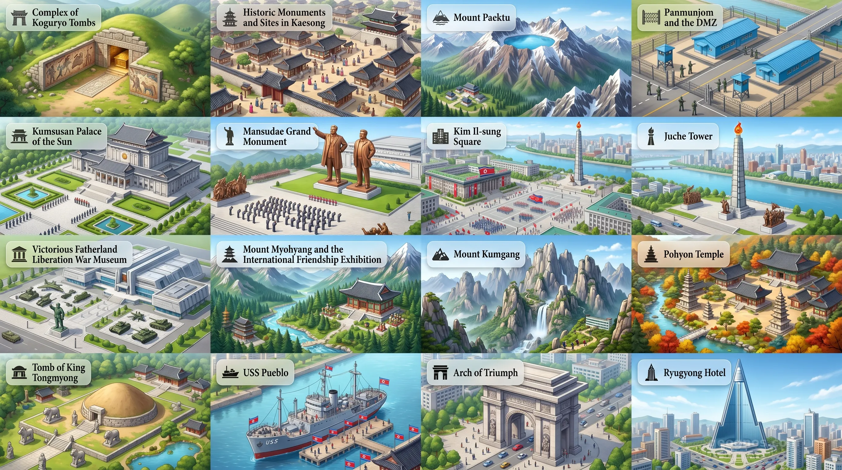
Beyond the pages of history books, the nation pulses with visual splendor. The northern reaches are characterized by the "Diamond Mountain" range, known locally as Kumgangsan, where sheer cliffs and crystal-clear waterfalls create a landscape that has inspired poets and painters for millennia. The architectural footprint is equally compelling, ranging from the dignified grandeur of historic shrines to the modernist, sprawling monumentalism that characterizes the heart of the capital city. If you wish to witness these sites as they appear today, our POI Cinematic Showcase allows you to journey through the country’s top points of interest via a dynamic carousel that captures the breathtaking scale of its mountainous majesty and its unique urban design.
Education is a core pillar of the GeoGnos mission, and we recognize that history is best understood when it is seen through the eyes of those who witnessed it. Our History Cinematic Showcase bridges the gap between static text and vibrant narrative, playing back top historical events through curated illustrations. This feature is specifically tailored for our K-12 and collegiate audience, providing a multimedia synthesis of the themes that have defined the northern Korean identity throughout the ages.
Topography as Destiny
The geography of the region acts as a natural fortress. The northern interior is primarily dominated by high, craggy mountains and deep, narrow valleys that have dictated human settlement patterns since the prehistoric era. These mountains serve as the "spine" of the nation, cooling the inland climate and providing the rich alluvial soil in the lower river basins that supports traditional agrarian life. For the student of geography, the study of the northern rivers—the Yalu, the Tumen, and the Taedong—is essential, as these waterways have historically served as both natural borders and the lifeblood of transport and agriculture. The intersection of these environmental factors has cultivated a culture that prizes self-sufficiency and deep harmony with the seasonal shifts of a temperate climate.
A Perspective of Preservation and Growth
Looking toward the future, the nation remains a fascinating subject for cultural geographers and environmental scientists alike. The environmental indicators show a diverse ecosystem, with extensive forest cover in the northern highlands and significant biodiversity within the national parks. Whether analyzing the strategic development of its infrastructure, the resilience of its population, or the potential for ecological tourism, the study of this nation offers a profound lesson in how a country carves out its place in a globalized world. As we continue to document the atlas of our shared globe, we maintain a commitment to presenting North Korea as it truly exists: a place of ancient traditions, evolving landscapes, and an unwavering, quiet, and deliberate spirit.
In this digital page, you will find detailed datasets regarding the people, the government, and the economy, providing a well-rounded overview of a country that remains one of the most enigmatic and intriguing corners of the earth. We invite you to utilize these resources as a foundational pillar for your own explorations of global culture, and we encourage you to engage with the data to gain a better appreciation for the diverse paths nations take as they move into the future.