🇲🇼

Malawi

Africa • Countries
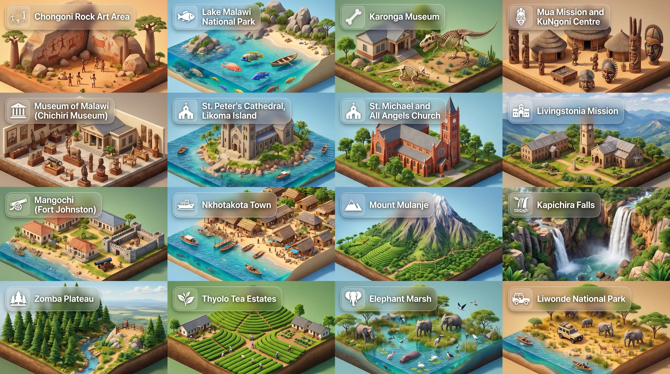
Malawi - Panoramic Places of Interest Atlas including Chongoni Rock Art Area, Lake Malawi National Park, Karonga Museum, Mua Mission and KuNgoni Centre of Culture & Art, Museum of Malawi (Chichiri Museum), St. Peter's Cathedral, Likoma Island, St. Michael and All Angels Church, Livingstonia Mission, Mangochi (Fort Johnston), Nkhotakota Town, Mount Mulanje, Kapichira Falls, Zomba Plateau, Thyolo Tea Estates, Elephant Marsh, Liwonde National Park

Top Sights & Landmarks

01

Chongoni Rock Art Area

Ancient Rock Art of the Chewa and BaTwa

02

Lake Malawi National Park

Evolutionary Marvel of the Rift Valley

03

Karonga Museum

From Dinosaurs to Democracy

04

Mua Mission and KuNgoni Centre of Culture & Art

Heart of Malawian Cultural Preservation

05

Museum of Malawi (Chichiri Museum)

The National Story of Malawi

06

St. Peter's Cathedral, Likoma Island

A Monumental Cathedral on Lake Malawi

07

St. Michael and All Angels Church

The Church Built Without Plans

08

Livingstonia Mission

A Scottish Village in the African Clouds

09

Mangochi (Fort Johnston)

Relics of the Arab Slave Trade and Colonial Rule

10

Nkhotakota Town

The Crossroads of the Slave Trade

11

Mount Mulanje

The Island in the Sky

12

Kapichira Falls

Livingstone's Impassable Barrier

13

Zomba Plateau

The Crown of the Colonial Capital

14

Thyolo Tea Estates

A Century of Malawian Agritourism

15

Elephant Marsh

Livingstone's Wetland Wilderness

16

Liwonde National Park

Malawi's Premier Wildlife Haven

The Warm Heart of Africa: An Introduction to Malawi

To speak of Malawi is to speak of a geography that defines its people. Often called the Warm Heart of Africa, this landlocked nation in southeastern Africa does not possess the vast coastlines of its neighbors, yet it holds a defining feature that has dictated the rhythm of life for millennia: Lake Malawi. As a country, Malawi is a sliver of land sculpted by the Great Rift Valley, a majestic geological tear that has created a tapestry of jagged mountains, rolling plateaus, and a crystalline inland sea that functions as the lifeblood of the nation.

Malawi is defined by a deep sense of communal connectivity and resilience. It is a place where the landscape, dominated by the shimmering expanse of the lake, invites contemplation. For those who study the intricate web of human migration, trade, and settlement, understanding this nation requires looking beyond the maps. To truly grasp the progression of the Malawian identity, one must explore the history of Malawi, a chronicle that stretches from early Iron Age settlements to the colonial era and the emergence of an independent nation built on agricultural heritage and social kinship.

A Geological Masterpiece: The Great Rift Valley

The topography of Malawi is a geological wonder. The country is essentially a long, narrow plateau bisected by the southern reach of the Great Rift Valley. To the west, the landscape rises into high, forested plateaus like the Nyika, a highland paradise that feels worlds away from the tropical climate of the lower elevations. To the south, the massive Mulanje Massif stands as a sentinel of granite, a breathtaking feature that dominates the horizon and represents the highest peak in the country.

However, it is the lake that dictates the soul of Malawi. Occupying about one-third of the nation’s total area, Lake Malawi is not merely a body of water but an evolutionary laboratory. Known for its incredible biodiversity, specifically its endemic cichlid fish populations, the lake serves as a sanctuary for wildlife and a crucial economic hub for the people living along its shores. For students and history buffs who wish to test their knowledge of the milestones that shaped this landscape, we invite you to solve our history puzzle, an interactive challenge that organizes the events defining the Malawian story into their rightful chronological order.

Culture at the Crossroads

Malawi sits at a cultural crossroads. Throughout its past, the land served as a corridor for migrating peoples and trade caravans, blending the traditions of diverse groups such as the Chewa, Yao, Tumbuka, and Lomwe. These distinct cultural threads have woven a society that prizes oral tradition, vibrant musical expressions, and an agrarian lifestyle that remains deeply connected to the seasons of the Rift Valley. Because Malawi is a society where interpersonal relationships are valued above all else, the genuine kindness often described by travelers is not just a polite social custom, but a core component of the national character.

The way in which these cultural forces have interacted with the physical environment can be witnessed through the artistic and photographic documentation of the nation’s growth. For a compelling look at the defining moments that turned this region into a melting pot of central African culture, view our history cinematic showcase, which synthesizes critical illustrations and narratives into an immersive visual experience for classrooms and curious learners alike.

Navigating the Landscapes of Discovery

Beyond the cultural centers and the historical narratives, Malawi offers a visual journey that few other nations can replicate. Whether it is the vast, undulating tea estates in the south, the misty forests of the central plateaus, or the sun-drenched beaches of Lake Malawi, the points of interest within the country are as diverse as the flora and fauna they protect. For the prospective traveler, academic researcher, or student seeking inspiration for their next geographical report, we have compiled an essential collection of the country's beauty. You may explore the POI cinematic showcase, which highlights the breathtaking biodiversity and iconic landmarks that mark the map of Malawi from north to south.

Education and the Future

At GeoGnos, we believe that understanding a nation like Malawi is a journey of active participation. By looking at how the environment restricts or enables human expansion, and how the people have responded with ingenuity and social solidarity, students can draw profound conclusions about the future of East African development. Malawi stands as a testament to the fact that size and resource access are only one part of the equation. It is the human element, the commitment to peace, and the stewardship of one of the world's most unique lake ecosystems that mark Malawi as a truly distinguished nation.

As we transition into deeper sections of our study, covering everything from the intricate government branches to the energy sectors and environmental statistics, keep in mind that Malawi remains a land defined by its unity. It is a nation that asks visitors and students alike to pause, listen, and learn the rhythm of a place that remains, quite literally and figuratively, the heart of its region.
Location

Latitude
-13.5° N
Longitude
34° E
N S W E
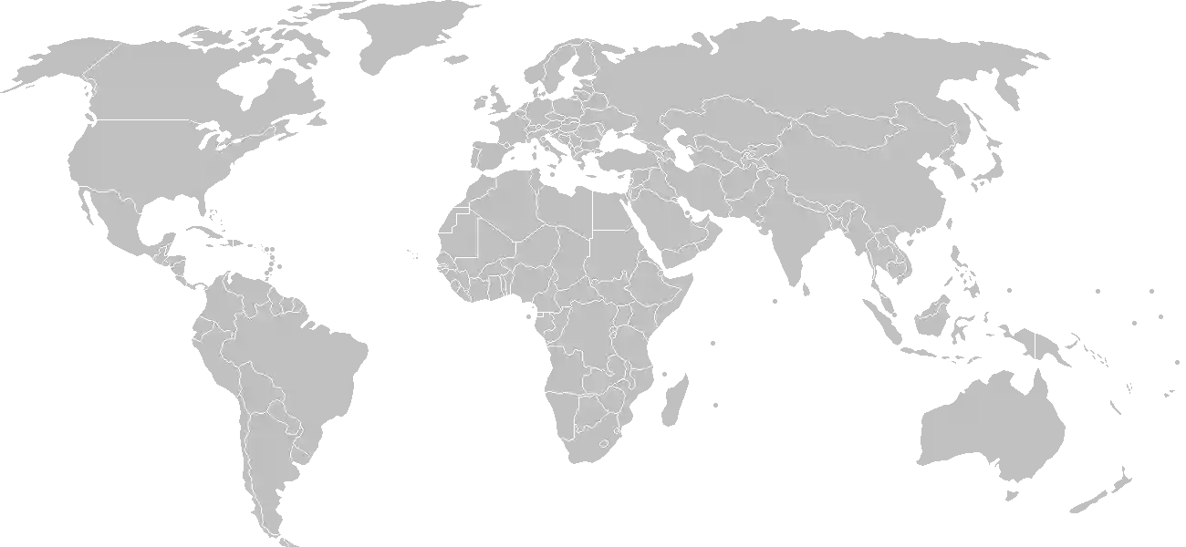
World Map Location
Geographic Location

Southern Africa, east of Zambia, west and north of Mozambique

Map Reference
Africa

Area

Total Area
118,484 sq km
Land (79%)
Water (21%)
Land: 94,080 sq km
Water: 24,404 sq km

Elevation

Highest Point
Sapitwa (Mount Mlanje)
Sapitwa (Mount Mlanje) 3,002 m
Lowest Point
junction of the Shire River and international boundary with Mozambique
junction of the Shire River and international boundary with Mozambique 37 m
Mean Elevation
779 m

Detailed Geography Information

Coastline

0 km (landlocked)

Geography - note

landlocked; Lake Nyasa, about 580 km (360 mi) long, is the country's most prominent physical feature; it contains more fish species than any other lake on earth

Irrigated land

740 sq km (2012)

Land boundaries

Total boundary: 2,857 km
Mozambique 1498 km
Tanzania 512 km
Zambia 847 km

Major lakes (area sq km)

fresh water lake(s): Lake Malawi (shared with Mozambique and Tanzania) - 22,490 salt water lake(s): Lake Chilwa - 1,040 sq km

Major rivers (by length in km)

Zambezi (shared with Zambia [s], Angola, Zimbabwe, Namibia, Tanzania, and Mozambique [m]) - 2,740 km note: [s] after country name indicates river source; [m] after country name indicates river mouth

Major watersheds (area sq km)

Atlantic Ocean drainage: Congo (3,730,881 sq km) Indian Ocean drainage: Zambezi (1,332,412 sq km)

Maritime claims

none (landlocked)

Natural hazards

flooding; droughts; earthquakes

Natural resources

limestonearable landhydropowerunexploited deposits of uraniumcoaland bauxite

Terrain

narrow elongated plateau with rolling plains, rounded hills, some mountains

Population & Growth

+2.20% Growth
20,550,954
Total inhabitants (2025 est.)
Male: 49.1% (10,097,082) Female: 50.9% (10,453,872)

Age Distribution

0-14 years
37.7%
~7,747,710
15-64 years
58.4%
~12,001,757
65 years
3.9%
~801,487
Note: 2024 est.

Demographic Longevity

Median Age
19.4 years
Male
20 yrs
Female
20.6 yrs
Life Expectancy
73 years
Male
69.9 yrs
Female
76.1 yrs

Vital Dynamics

Birth Rate
28.04
births per 1,000 people
Death Rate
3.57
deaths per 1,000 people
Net Migration
-2.9
migrants per 1,000 people
Fertility Rate
3.33
children born per woman

Detailed People & Society Information

Alcohol consumption per capita

2.04 liters of pure alcohol (2019 est.)

Children under the age of 5 years underweight

11.6% (2020 est.)

Currently married women (ages 15-49)

62.1% (2020 est.)

Dependency ratios

total dependency ratio: 74.3 (2025 est.) youth dependency ratio: 68.3 (2025 est.) elderly dependency ratio: 6 (2025 est.) potential support ratio: 16.6 (2025 est.)

Education expenditure

2.7%

2.7% of GDP (2022 est.) 16% national budget (2024 est.)

Ethnic groups

Chewa
34.3%
Lomwe
18.8%
Yao
13.2%
Ngoni
10.4%
Tumbuka
9.2%
Sena
3.8%
Mang'anja
3.2%
Tonga
1.8%
Nyanja
1.8%
Nkhonde
1%
other
2.2%
foreign
0.3%

Gross reproduction rate

1.65 (2025 est.)

Health expenditure

7.4%

7.4% of GDP (2021) 3.3% of national budget (2022 est.)

Infant mortality rate

total: 28.9 deaths/1,000 live births (2025 est.) male: 36.4 deaths/1,000 live births female: 27.4 deaths/1,000 live births

Languages

Literacy

total population: 70.2% (2020 est.) male: 78.6% (2020 est.) female: 62.7% (2020 est.)

Major urban areas - population

1.276 million LILONGWE (capital), 1.031 million Blantyre-Limbe (2023)

Maternal mortality ratio

225 deaths/100,000 live births (2023 est.)

Mother's mean age at first birth

19.1 years (2015/16 est.) note: data represents median age at first birth among women 20-49

Nationality

noun: Malawian(s) adjective: Malawian

Obesity - adult prevalence rate

5.8% (2016)

Physician density

0.05 physicians/1,000 population (2022)

Population distribution

population density is highest south of Lake Nyasa, as shown in this population distribution map

Refugees and internally displaced persons

Total Displaced & Vulnerable Persons
192,387 individuals
Refugees
29.5%
56,659
56,659 (2024 est.)
Internally Displaced Persons (IDPs)
70.5%
135,728
135,728 (2024 est.)

Religions

Protestant (includes Church of Central Africa Presbyterian
33.5%
Seventh Day Adventist/Baptist
9.4%
Pentecostal
7.6%
Anglican
2.3%
Roman Catholic
17.2%
other Christian
26.6%
Muslim
13.8%
traditionalist
1.1%
other
5.6%
none
2.1%

School life expectancy (primary to tertiary education)

total: 10 years (2021 est.) male: 10 years (2021 est.) female: 10 years (2021 est.)

Sex ratio

at birth: 1.01 male(s)/female 0-14 years: 0.99 male(s)/female 15-64 years: 0.96 male(s)/female 65 years and over: 0.8 male(s)/female total population: 0.96 male(s)/female (2024 est.)

Tobacco use

total: 6.3% (2025 est.) male: 11.7% (2025 est.) female: 1.4% (2025 est.)

Climate & Issues

Climate Profile

sub-tropical; rainy season (November to May); dry season (May to November)

Key Environmental Issues
deforestation land degradation water pollution from agricultural runoff, sewage, industrial wastes siltation of fish spawning grounds high temperatures and changing precipitation patterns

Land Cover

Coverage Distribution
Agri (64%)
Forest (22%)
Arable: 42.4%
Crops: 2.1%
Pasture: 19.6%
Forest: 22.4%

Air & Carbon Emissions

Annual CO2 Output 2023 est.
2.265 million
Coal (100%) Oil (0%) Gas (0%)
PM2.5 Exposure 18.5 µg/m³
0 5 (WHO Limit) 15 25 35+

Water Resources & Use

Renewable Water Resources 17.28 billion cubic meters (2022 est.)
Annual Water Withdrawal
municipal: 143.1 million cubic meters (2022 est.)
Municipal (11%) Ind (4%) Agri (86%)

Detailed Environmental Information

International environmental agreements

BiodiversityClimate ChangeClimate Change-Kyoto ProtocolClimate Change-Paris AgreementComprehensive Nuclear Test BanDesertificationEndangered SpeciesEnvironmental ModificationHazardous WastesLaw of the SeaMarine Life ConservationNuclear Test BanOzone Layer ProtectionShip PollutionWetlands

Urbanization

urban population: 18.3% of total population (2023) rate of urbanization: 4.41% annual rate of change (2020-25 est.)

Waste and recycling

municipal solid waste generated annually: 1.298 million tons (2024 est.) percent of municipal solid waste recycled: 9.6% (2022 est.)

Capital & State Profile

Capital City
Lilongwe
-13.9667° N, 33.7833° E
Timezone UTC+2
Government Type
presidential republic
Independence 1964-07-06
National Holiday 07-06

Executive Branch

Chief of State
President Peter MUTHARIKA (since 4 October 2025)
Head of Government
President Peter MUTHARIKA (since 4 October 2025)
Last Election September 2030
Next Election September 2030
Cabinet Cabinet named by the president

Legislative Branch

unicameral
Legislature Name National Assembly
Seats & Term
229 (all directly elected) seats / 5 years
Women in Chamber
21.4% Representation
Electoral System plurality/majority
Parties Composition
Democratic Progressive Party (DPP) 78Malawi Congress Party (MCP) 52Independents 73Other 21

National Identity & Symbols

National Flag Description

three equal horizontal bands of black (top), red, and green, with a rising red sun centered on the black band

Symbolic Meaning black stands for ethnic groups, red for the blood shed in the struggle for freedom, and green for nature; the sun represents the hope of freedom for the continent of Africa
National Symbol lion
National Colors black, red, green
National Anthem Mulungu dalitsa Malawi (O God, Bless Our Land of Malawi)

Detailed Government Information

Administrative divisions

28 districts; Balaka, Blantyre, Chikwawa, Chiradzulu, Chitipa, Dedza, Dowa, Karonga, Kasungu, Likoma, Lilongwe, Machinga, Mangochi, Mchinji, Mulanje, Mwanza, Mzimba, Neno, Ntcheu, Nkhata Bay, Nkhotakota, Nsanje, Ntchisi, Phalombe, Rumphi, Salima, Thyolo, Zomba

Citizenship

citizenship by birth: no citizenship by descent only: at least one parent must be a citizen of Malawi dual citizenship recognized: no residency requirement for naturalization: 7 years

Constitution

history: previous 1953 (pre-independence), 1964, 1966; latest drafted January to May 1994, approved 16 May 1994, entered into force 18 May 1995 amendment process: proposed by the National Assembly; passage of amendments affecting constitutional articles, including the sovereignty and territory of the state, fundamental constitutional principles, human rights, voting rights, and the judiciary, requires majority approval in a referendum and majority approval by the Assembly; passage of other amendments requires at least two-thirds majority vote of the Assembly

Country name

conventional long form: Republic of Malawi conventional short form: Malawi local long form: Dziko la Malawi local short form: Malawi former: British Central African Protectorate, Nyasaland Protectorate, Nyasaland etymology: named for the Maravi people who inhabited the area since the 14th century; the word maravi means "flames"

International law organization participation

accepts compulsory ICJ jurisdiction with reservations; accepts ICCt jurisdiction

International organization participation

Judicial branch

highest court(s): Supreme Court of Appeal (consists of the chief justice and at least 3 judges) judge selection and term of office: Supreme Court chief justice appointed by the president and confirmed by the National Assembly; other judges appointed by the president on the recommendation of the Judicial Service Commission, which regulates judicial officers; judges serve until age 65 subordinate courts: High Court; magistrate courts; Industrial Relations Court; district and city traditional or local courts

Legal system

mixed system of English common law and customary law; Supreme Court of Appeal reviews legislative acts

National heritage

total World Heritage Sites: 3 (2 cultural, 1 natural) selected World Heritage Site locales: Lake Malawi National Park (n); Chongoni Rock-Art Area (c); Mount Mulanje Cultural Landscape (c)

Political parties

Democratic Progressive Party or DPP Malawi Congress Party or MCP People's Party or PP United Democratic Front or UDF United Transformation Movement or UTM

Suffrage

18 years of age; universal

Economic Overview

low-income East African economy; primarily agrarian; investing in human capital; urban poverty increasing due to COVID-19; high public debt; endemic corruption and poor property rights; poor hydroelectric grid; localized pharmaceutical industry

Size & Performance

Real GDP (PPP)
$35.425 billion
Latest available estimate (2024)
2023: $34.789 billion2022: $34.143 billion
Real GDP Growth
1.8% (2024 est.)
+1.8%
GDP Per Capita (PPP)
$1,600
2023: $1,6002022: $1,700

GDP Sector Breakdown

Agriculture: 32.4%Industry: 16.0%Services: 44.9%
Origin GDP %
Agriculture 32.4%
Industry 16.0%
Services 44.9%

Trade Balance

Trade Position
Trade Deficit
$2.47 billion
Total Exports
$1.526 billion (2023 est.)
Total Imports
$3.995 billion (2023 est.)
Exports (28%) Imports (72%)

Budget Balance

Budget Position
Budget Deficit
-$1.31 billion
Revenues
$2.208 billion (2022 est.)
Expenditures
$3.523 billion (2022 est.)
Revenues (39%) Expenditures (61%)

Export Profile

Top Export Partners

Note: 2023; top five export partners based on percentage share of exports

Major Export Commodities

tobaccoteadried legumessoybean mealraw sugar

Import Profile

Top Import Partners

Note: 2023; top five import partners based on percentage share of imports

Major Import Commodities

refined petroleumfertilizersplasticsgarmentspostage stamps/documents

Labor & Employment

Total Labor Force 8.602 million (2024 est.)
General Unemployment Rate 5.1%
Youth Unemployment (Ages 15-24) 6.8%
Population Below Poverty Line 50.7% (2019 est.)

Income Inequality

Gini Coefficient (Family Income) 38.5
0 (Perfect Equality) Moderate Inequality 100 (Perfect Inequality)

Family Income / Consumption Share

Lowest 10%: 2.9% (2019 est.) Highest 10%: 31% (2019 est.)
Inequality Gap: Top 10% holds 10.7x the share of the bottom 10%.

Detailed Economic Data

Agricultural products

sweet potatoescassavamaizesugarcanemangoespotatoestomatoespigeon peaspumpkinsplantains

Current account balance

-$2.276 billion (2023 est.) -$2.218 billion (2022 est.) -$1.918 billion (2021 est.) note: balance of payments - net trade and primary/secondary income in current dollars

Debt - external

$2.269 billion (2023 est.) note: present value of external debt in current US dollars

Exchange rates

Malawian kwachas (MWK) per US dollar - Exchange rates: 1,161.094 (2023 est.) 949.039 (2022 est.) 805.9 (2021 est.) 749.527 (2020 est.) 745.541 (2019 est.)

Industrial production growth rate

2.1% (2024 est.) note: annual % change in industrial value added based on constant local currency

Industries

tobaccoteasugarsawmill productscementconsumer goods

Inflation rate (consumer prices)

32.2% (2024 est.) 28.8% (2023 est.) 21% (2022 est.) note: annual % change based on consumer prices

Public debt

55.6% of GDP (2022 est.) note: central government debt as a % of GDP

Remittances

1.4% of GDP (2023 est.) 2.1% of GDP (2022 est.) 2.6% of GDP (2021 est.) note: personal transfers and compensation between resident and non-resident individuals/households/entities

Reserves of foreign exchange and gold

$594.498 million (2020 est.) $846.84 million (2019 est.) $766.155 million (2018 est.) note: holdings of gold (year-end prices)/foreign exchange/special drawing rights in current dollars

Taxes and other revenues

13.5% (of GDP) (2022 est.) note: central government tax revenue as a % of GDP

Grid Infrastructure

Electricity Access 14%
Urban: 54% Rural: 5.6%
Capacity 731,000 kW (2023 est.)
Consumption 1.585 billion kWh (2023 est.)
Exports 19.938 million kWh (2023 est.)
Grid Losses: 231.785 million kWh (2023 est.)

Generation Mix

Percentage Share of Production
hydroelectricity 92.2%
fossil fuels 4.2%
biomass and waste 3%
solar 0.7%

Fossil Fuels Production

Petroleum
Consumption 15,000 bbl/day (2023 est.)
Coal
Production 3,000 metric tons (2023 est.)
Consumption 22,000 metric tons (2023 est.)
Imports 19,000 metric tons (2023 est.)
Proven Reserves 801.999 million metric tons (2023 est.)

Intensity & Nuclear

Energy Consumption Per Capita 1.792 million Btu/person (2023 est.)
No nuclear energy infrastructure or reactor operations reported in this country dossier.

Digital Access

.mw
Internet Usage 18%

Active internet users as a percentage of the total population.

Fixed Broadband

Penetration Rate 0 / 100
Total Subscriptions 17,000 (2023 est.)

Mobile Cellular

Penetration Rate 69 / 100
Total Subscriptions 15 million (2024 est.)

Broadcast Media

radio is the main broadcast medium; privately owned Zodiak radio has the widest national reach, followed by state-run radio; numerous private and community radio stations broadcast in cities and towns; the largest TV network is state-owned, but at least 4 private TV networks broadcast in urban areas; relays of multiple international broadcasters are available (2019)

Aviation

7Q
Airports
27
As of 2025

Railways

Total Track Length
767 km
National Network Data from 2014

Military Expenditures

GDP Allocation 0.8%
0.8% of GDP (2024 est.) 1% of GDP (2023 est.) 0.8% of GDP (2022 est.) 0.9% of GDP (2021 est.) 0.9% of GDP (2020 est.)

Active Duty Strengths

estimated 10,000 active Malawi Defense Forces (2025)

Refers to active military personnel.

Service & Defense Details

Military and security forces

Malawi Defense Force (MDF): Malawi Army (Land Forces), Malawi Maritime Force (MMF), Malawi Air Force (MAF), Malawi National Service (MNS) Ministry of Homeland Security: Malawi Police Service (2025) note: the MDF reports directly to the president as commander in chief

Military deployments

750 Democratic Republic of the Congo (MONUSCO) (2025)

Military equipment inventories and acquisitions

the MDF's inventory is comprised of mostly older or secondhand armaments originating from such countries as China, France, Israel, South Africa, and the UK (2025)

Military - note

the MDF’s primary responsibility is external security; it is also tasked as necessary with providing support to civilian authorities during emergencies, supporting the Police Service, protecting national forest reserves, and participating in regional peacekeeping missions, as well as assisting with infrastructure development; key areas of concern include border security, regional conflict, and international terrorism; the MDF participates in exercises with foreign partners and contributes regularly to African Union and UN peace support operations; Malawi contributes regularly to African Union and UN peace support operations the MDF was established in 1964 from elements of the Kings African Rifles (KAR), a British colonial regiment raised from Great Britain's various possessions in East Africa from 1902 until independence in the 1960s; the KAR conducted both military and internal security functions within the colonial territories, and served outside the territories during the World Wars (2025)

Military service age and obligation

18-24 years of age for men and women for voluntary military service (2025)