🇭🇳

Honduras

Central America and Caribbean • Countries
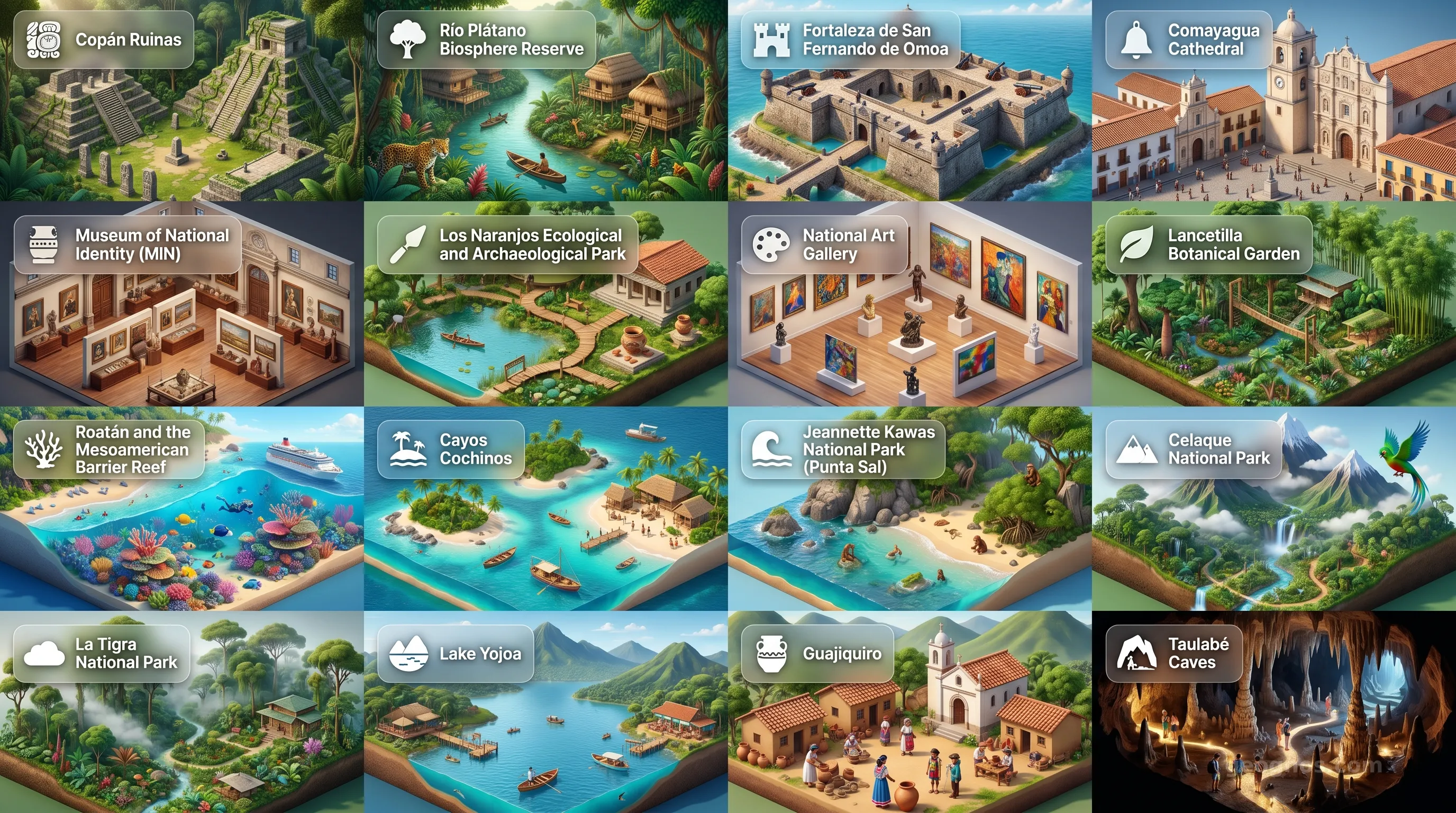
Honduras - Panoramic Places of Interest Atlas including Copán Ruinas, Río Plátano Biosphere Reserve, Fortaleza de San Fernando de Omoa, Comayagua Cathedral, Museum of National Identity (MIN), Los Naranjos Ecological and Archaeological Park, National Art Gallery, Lancetilla Botanical Garden, Roatán and the Mesoamerican Barrier Reef, Cayos Cochinos, Jeannette Kawas National Park (Punta Sal), Celaque National Park, La Tigra National Park, Lake Yojoa, Guajiquiro, Taulabé Caves

Top Sights & Landmarks

01

Copán Ruinas

The Paris of the Maya World

02

Río Plátano Biosphere Reserve

Pristine Jungle and Ancient Heritage

03

Fortaleza de San Fernando de Omoa

Colonial Caribbean Defense

04

Comayagua Cathedral

Colonial Epicenter with an Ancient Clock

05

Museum of National Identity (MIN)

The Heart of Honduran Heritage

06

Los Naranjos Ecological and Archaeological Park

Proto-Maya and Lenca Settlement

07

National Art Gallery

Chronicle of Honduran Artistic Evolution

08

Lancetilla Botanical Garden

A Legacy of the Banana Republic Era

09

Roatán and the Mesoamerican Barrier Reef

World-Class Diving and Afro-Caribbean History

10

Cayos Cochinos

Protected Marine Archipelago

11

Jeannette Kawas National Park (Punta Sal)

Coastal Biodiversity and Conservation

12

Celaque National Park

The Cloud Forest and the Lenca Heartland

13

La Tigra National Park

Honduras' First National Park and Mining History

14

Lake Yojoa

A Pre-Columbian Crossroads and Birding Mecca

15

Guajiquiro

Living Lenca Traditions in the Highlands

16

Taulabé Caves

An Underworld of Stalactites and History

The Heart of the Isthmus: An Introduction to Honduras

Honduras exists as a bridge of rugged beauty, a topographical masterpiece where the backbone of the Americas, the great mountain ranges of the North, dips into the Caribbean. It is a nation defined by its verticality and its vibrancy, an intersection of the ancient Mayan world and the sweeping horizons of the sea. To understand Honduras is to understand a land where the clouds cling to pine-covered highlands and the jungle whispers secrets of long-lost civilizations. This is not merely a country situated in the middle of Central America; it is a profound testament to resilience and the enduring spirit of the human connection to the land.

Geography here is destiny. With its long Caribbean coastline and its singular point of contact with the Pacific at the Gulf of Fonseca, the nation has functioned as a crossroads for trade, migration, and culture for millennia. From the bustling shores where the reef teems with life to the shadowed depths of the Copan ruins, Honduras presents a duality of accessibility and mystery. It is a place that invites the curious to dig deep, rewarding the observant traveler and student with a mosaic of colonial history, indigenous heritage, and a natural environment of staggering biodiversity.

The Echoes of Time and Stone

At the center of any journey through this nation lies the majestic city of Copán, an architectural crown jewel of the Maya civilization. Here, stone inscriptions rise like petrified stories from the forest floor. These monuments are silent sentinels of a scientific and artistic prowess that once dominated the region. If you seek to grasp how these events shaped the trajectory of Central American society, you are invited to explore the comprehensive history of Honduras. Through these accounts, we uncover how various epochs shaped the identity of this mountainous land.

History in Honduras is not a stagnant academic subject. It is a vibrant, unfolding tapestry that requires active participation to understand. For those who enjoy testing their grasp of time, we recommend you try our interactive history puzzle. This digital challenge invites you to align major milestones, from the era of indigenous empires to the transition toward a modern republic, allowing you to earn recognition as you sharpen your historical intuition.

Beyond the classroom, we understand that true knowledge of a landscape is best communicated through visual narrative. Because the physical evidence of the past often speaks louder than the written word, we have curated a history cinematic showcase. This feature utilizes immersive illustrations and archival narratives to breathe life into the moments that defined the nation. Whether it is the colonial architecture of Tegucigalpa or the remote island outposts in the Bay Islands, these visuals connect the student to the actual sensation of time passing over the soil of Honduras.

Geographic Splendor: From Peaks to Reefs

The spirit of Honduras is anchored in its extreme geological variance. In a relatively small span of land, one can travel from the misty peaks of the Celaque Mountains—where the climate mirrors that of a temperate zone—to the sun-drenched, turquoise waters of the Bay Islands. These islands, part of the Mesoamerican Barrier Reef System, provide a sanctuary for life beneath the waves that rivals any maritime ecosystem on the planet.

When you stand at the edge of the Pico Bonito National Park, you witness the convergence of lush rainforests and rushing waterfalls. The rivers, such as the UlĂşa and the Patuca, serve as the lifeblood of the nation, cutting through limestone ridges and rolling valleys to reach the sea. This landscape has fostered a unique environmental ethos, one that encourages sustainable exploration and scientific study. To gain a perspective on the varied landmarks that comprise this beautiful territory, we invite you to peruse our comprehensive points of interest cinematic showcase. It is a curated gallery of the soul-stirring vistas that make Honduras a sanctuary for nature enthusiasts and scholars alike.

A Cultural Crossroads

The soul of Honduras resides in its people, a tapestry woven from Lenca, Miskito, Pech, Tawahka, Garifuna, and Mestizo threads. Each group brings a unique lexicon of tradition, music, and culinary art to the national collective. The Garifuna culture, particularly prominent along the Caribbean coast, adds a rhythmic intensity to the nation through their distinct dance, language, and ancestral heritage. This diversity ensures that Honduras remains a living museum, where customs are not displayed behind glass, but lived daily in village squares and market stalls.

As you progress through the pages of this atlas, you will find that Honduras is a country that bridges the gap between the monumental and the intimate. From the sprawling urban growth of its capital to the quiet corners of the cloud forests, every hectare has a story. Whether you are a scholar researching the migrations of the Maya, a student analyzing the importance of biodiversity in tropical rainforests, or a visitor preparing to witness the sunrise over a Caribbean cay, GeoGnos serves as your gateway. Here, we offer not just information, but an invitation to witness the enduring legacy of a land that remains, quite literally, at the center of the world.

This page, designed for discovery, holds the keys to the logistical, scientific, and cultural framework of the nation. Beyond this introduction, you will find resources ranging from high-resolution diorama maps to economic profiles that quantify the industry and ambition of the Honduran people. We hope that your exploration of these data-rich pages inspires a deep and lasting appreciation for the history, the people, and the pristine wilderness that constitutes the heart of Honduras.
Location

Latitude
15° N
Longitude
-86.5° E
N S W E
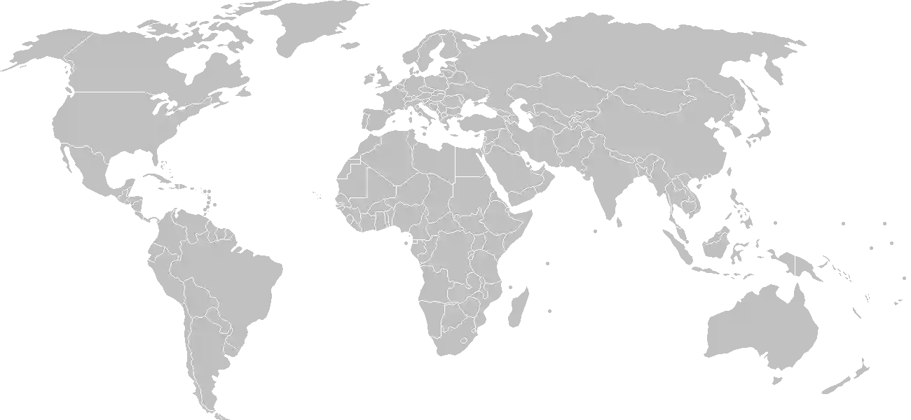
World Map Location
Geographic Location

Central America, bordering the Caribbean Sea, between Guatemala and Nicaragua and bordering the Gulf of Fonseca (North Pacific Ocean), between El Salvador and Nicaragua

Map Reference
Central America and the Caribbean

Area

Total Area
112,090 sq km
Land (100%)
Land: 111,890 sq km
Water: 200 sq km

Elevation

Highest Point
Cerro Las Minas
Cerro Las Minas 2,870 m
Lowest Point
Caribbean Sea
Caribbean Sea 0 m
Mean Elevation
684 m

Detailed Geography Information

Coastline

823 km (Caribbean Sea 669 km; Gulf of Fonseca 163 km)

Geography - note

has only a short Pacific coast but a long Caribbean shoreline, including the virtually uninhabited eastern Mosquito Coast

Irrigated land

900 sq km (2012)

Land boundaries

Total boundary: 1,575 km
Guatemala 244 km
Nicaragua 940 km

Major lakes (area sq km)

salt water lake(s): Laguna de Caratasca - 1,110 sq km

Maritime claims

territorial sea: 12 nm contiguous zone: 24 nm exclusive economic zone: 200 nm continental shelf: natural extension of territory or to 200 nm

Natural hazards

frequent, but generally mild, earthquakes; extremely susceptible to damaging hurricanes and floods along the Caribbean coast

Natural resources

timbergoldsilvercopperleadzinciron oreantimonycoalfishhydropower

Terrain

mostly mountains in interior, narrow coastal plains

Population & Growth

+1.30% Growth
9,652,170
Total inhabitants (2025 est.)
Male: 48.2% (4,649,294) Female: 51.8% (5,002,876)

Age Distribution

0-14 years
28.7%
~2,770,173
15-64 years
65.7%
~6,341,476
65 years
5.6%
~540,522
Note: 2024 est.

Demographic Longevity

Median Age
26.1 years
Male
24.8 yrs
Female
26.6 yrs
Life Expectancy
73.1 years
Male
69.6 yrs
Female
76.8 yrs

Vital Dynamics

Birth Rate
19.7
births per 1,000 people
Death Rate
4.9
deaths per 1,000 people
Net Migration
-2.02
migrants per 1,000 people
Fertility Rate
2.29
children born per woman

Detailed People & Society Information

Alcohol consumption per capita

2.73 liters of pure alcohol (2019 est.)

Children under the age of 5 years underweight

7.1% (2019 est.)

Currently married women (ages 15-49)

54.4% (2019 est.)

Dependency ratios

total dependency ratio: 51.5 (2025 est.) youth dependency ratio: 42.8 (2025 est.) elderly dependency ratio: 8.8 (2025 est.) potential support ratio: 11.4 (2025 est.)

Education expenditure

4.5%

4.5% of GDP (2023 est.) 23.2% national budget (2018 est.)

Ethnic groups

Mestizo
90%
Indigenous
7%
African descent
2%
White
1%

Gross reproduction rate

1.13 (2025 est.)

Health expenditure

9.2%

9.2% of GDP (2021) 14.2% of national budget (2022 est.)

Hospital bed density

0.7 beds/1,000 population (2021 est.)

Infant mortality rate

total: 15.4 deaths/1,000 live births (2025 est.) male: 17.5 deaths/1,000 live births female: 13.2 deaths/1,000 live births

Languages

Literacy

total population: 88.2% (2024 est.) male: 87.6% (2024 est.) female: 88.8% (2024 est.)

Major urban areas - population

1.568 million TEGUCIGALPA (capital), 982,000 San Pedro Sula (2023)

Maternal mortality ratio

47 deaths/100,000 live births (2023 est.)

Mother's mean age at first birth

20.3 years (2011/12 est.) note: data represents median age a first birth among women 25-49

Nationality

noun: Honduran(s) adjective: Honduran

Obesity - adult prevalence rate

21.4% (2016)

Physician density

0.49 physicians/1,000 population (2020)

Population distribution

most residents live in the mountainous western half of the country; Honduras is the only Central American nation with an urban population that is distributed between two large centers, the capital of Tegucigalpa and the city of San Pedro Sula; the Rio Ulua valley in the north is the only densely populated lowland area

Refugees and internally displaced persons

Total Displaced & Vulnerable Persons
100,978 individuals
Refugees
0.3%
341
341 (2024 est.)
Internally Displaced Persons (IDPs)
99.7%
100,637
100,637 (2024 est.)

Religions

Evangelical
55%
Roman Catholic
33.4%
none
10.1%
unspecified
1.5%

School life expectancy (primary to tertiary education)

total: 10 years (2019 est.) male: 9 years (2019 est.) female: 10 years (2019 est.)

Sex ratio

at birth: 1.03 male(s)/female 0-14 years: 1.02 male(s)/female 15-64 years: 0.91 male(s)/female 65 years and over: 0.77 male(s)/female total population: 0.93 male(s)/female (2024 est.)

Tobacco use

total: 11.9% (2025 est.) male: 22.2% (2025 est.) female: 1.6% (2025 est.)

Climate & Issues

Climate Profile

subtropical in lowlands, temperate in mountains

Key Environmental Issues
deforestation from logging and agricultural clearing land degradation and soil erosion from overdevelopment and improper land use practices mining activities polluting Lago de Yojoa (the country's largest source of fresh water) and other rivers and streams

Land Cover

Coverage Distribution
Agri (32%)
Forest (53%)
Arable: 9.1%
Crops: 5.4%
Pasture: 17.5%
Forest: 53.3%

Air & Carbon Emissions

Annual CO2 Output 2023 est.
10.534 million
Coal (100%) Oil (0%) Gas (0%)
PM2.5 Exposure 19.1 µg/m³
0 5 (WHO Limit) 15 25 35+

Water Resources & Use

Renewable Water Resources 92.164 billion cubic meters (2022 est.)
Annual Water Withdrawal
municipal: 315 million cubic meters (2022 est.)
Municipal (20%) Ind (7%) Agri (73%)

Detailed Environmental Information

International environmental agreements

BiodiversityClimate ChangeClimate Change-Kyoto ProtocolClimate Change-Paris AgreementComprehensive Nuclear Test BanDesertificationEndangered SpeciesEnvironmental ModificationHazardous WastesLaw of the SeaMarine Dumping-London ConventionNuclear Test BanOzone Layer ProtectionShip PollutionTropical Timber 2006Wetlands

Urbanization

urban population: 60.2% of total population (2023) rate of urbanization: 2.48% annual rate of change (2020-25 est.)

Waste and recycling

municipal solid waste generated annually: 2.162 million tons (2024 est.) percent of municipal solid waste recycled: 10.3% (2022 est.)

Capital & State Profile

Capital City
Tegucigalpa
14.1° N, -87.2167° E
Timezone UTC-6
Government Type
presidential republic
Independence 1821-09-15
National Holiday 09-15

Executive Branch

Chief of State
President Iris Xiomara CASTRO de Zelaya (since 27 January 2022)
Head of Government
President Iris Xiomara CASTRO de Zelaya (since 27 January 2022)
Last Election 30 November 2025
Next Election 25 November 2029
Cabinet Cabinet appointed by president

Legislative Branch

unicameral
Legislature Name National Congress (Congreso Nacional)
Seats & Term
128 (all directly elected) seats / 4 years
Women in Chamber
27.3% Representation
Electoral System proportional representation
Parties Composition
Liberty and Refoundation Party (LIBRE) 50National Party (PN) 44Liberal Party (PL) 22Salvador de Honduras Party (PSH) 10Other 2

National Identity & Symbols

National Flag Description

three equal horizontal bands of cerulean blue (top), white, and cerulean blue, with five five-pointed cerulean stars arranged in an "X" pattern and centered in the white band

Symbolic Meaning the stars represent the members of the former Federal Republic of Central America: Costa Rica, El Salvador, Guatemala, Honduras, and Nicaragua; blue stands for the Pacific Ocean and the Caribbean Sea, and white for the land and the people's peace and prosperity
National Symbol scarlet macaw, white-tailed deer
National Colors blue, white
National Anthem Himno Nacional de Honduras (National Anthem of Honduras)

Detailed Government Information

Administrative divisions

18 departments (departamentos, singular - departamento); Atlántida, Choluteca, Colon, Comayagua, Copan, Cortes, El Paraiso, Francisco Morazán, Gracias a Dios, Intibucá, Islas de la Bahia, La Paz, Lempira, Ocotepeque, Olancho, Santa Barbara, Valle, Yoro

Citizenship

citizenship by birth: yes citizenship by descent only: yes dual citizenship recognized: yes residency requirement for naturalization: 1 to 3 years

Constitution

history: several previous; latest approved 11 January 1982, effective 20 January 1982 amendment process: proposed by the National Congress with at least two-thirds majority vote of the membership; passage requires at least two-thirds majority vote of Congress in its next annual session; constitutional articles, such as the form of government, national sovereignty, the presidential term, and the procedure for amending the constitution, cannot be amended

Country name

conventional long form: Republic of Honduras conventional short form: Honduras local long form: República de Honduras local short form: Honduras etymology: the name means "depths" in Spanish and refers to the deep anchorage in the northern Bay of Trujillo

International law organization participation

accepts compulsory ICJ jurisdiction with reservations; accepts ICCt jurisdiction

International organization participation

Judicial branch

highest court(s): Supreme Court of Justice or Corte Suprema de Justicia (15 principal judges, including the court president, and 6 alternates; court organized into civil, criminal, constitutional, and labor chambers) judge selection and term of office: court president elected by his peers; judges elected by the National Congress from candidates proposed by the Nominating Board, a diverse 7-member group of judicial officials and other government and non-government officials nominated by each of their organizations; judges elected by Congress for renewable, 7-year terms subordinate courts: courts of appeal; courts of first instance; justices of the peace note: the Supreme Court has both judicial and constitutional jurisdiction

Legal system

civil law system

National heritage

total World Heritage Sites: 2 (1 cultural, 1 natural) selected World Heritage Site locales: Maya Site of Copan (c); Río Plátano Biosphere Reserve (n)

Political parties

Anti-Corruption Party or PAC Christian Democratic Party or DC Democratic Liberation of Honduras or Liderh Democratic Unification Party or UD The Front or El Frente Honduran Patriotic Alliance or AP Innovation and Unity Party or PINU Liberal Party or PL Liberty and Refoundation Party or LIBRE National Party of Honduras or PNH New Route or NR Opposition Alliance against the Dictatorship or Alianza de Oposicion contra la Dictadura (electoral coalition) Savior Party of Honduras or PSH Vamos or Let’s Go We Are All Honduras (Todos Somos Honduras) or TSH

Suffrage

18 years of age; universal and compulsory

Economic Overview

second-fastest-growing Central American economy; COVID-19 and two hurricanes crippled activity; high poverty and inequality; declining-but-still-high violent crime disruption; systemic corruption; coffee and banana exporter; enormous remittances

Size & Performance

Real GDP (PPP)
$71.297 billion
Latest available estimate (2024)
2023: $68.85 billion2022: $66.473 billion
Real GDP Growth
3.6% (2024 est.)
+3.6%
GDP Per Capita (PPP)
$6,600
2023: $6,5002022: $6,400

GDP Sector Breakdown

Agriculture: 11.2%Industry: 26.1%Services: 58.4%
Origin GDP %
Agriculture 11.2%
Industry 26.1%
Services 58.4%

Trade Balance

Trade Position
Trade Deficit
$8.88 billion
Total Exports
$9.352 billion (2024 est.)
Total Imports
$18.235 billion (2024 est.)
Exports (34%) Imports (66%)

Budget Balance

Budget Position
Budget Deficit
-$1.06 billion
Revenues
$5.333 billion (2020 est.)
Expenditures
$6.391 billion (2020 est.)
Revenues (45%) Expenditures (55%)

Export Profile

Top Export Partners

Note: 2023; top five export partners based on percentage share of exports

Major Export Commodities

garmentscoffeeinsulated wirepalm oilshellfish

Import Profile

Top Import Partners

Note: 2023; top five import partners based on percentage share of imports

Major Import Commodities

refined petroleumcotton yarngarmentstruckspackaged medicine

Labor & Employment

Total Labor Force 4.296 million (2024 est.)
General Unemployment Rate 6.1%
Youth Unemployment (Ages 15-24) 10.5%
Population Below Poverty Line 64.1% (2023 est.)

Income Inequality

Gini Coefficient (Family Income) 46.8
0 (Perfect Equality) High Inequality 100 (Perfect Inequality)

Family Income / Consumption Share

Lowest 10%: 1.1% (2023 est.) Highest 10%: 33% (2023 est.)
Inequality Gap: Top 10% holds 30.0x the share of the bottom 10%.

Detailed Economic Data

Agricultural products

sugarcaneoil palm fruitmaizemilkbananascoffeemelonsorangeschickenbeans

Current account balance

-$1.711 billion (2024 est.) -$1.368 billion (2023 est.) -$2.157 billion (2022 est.) note: balance of payments - net trade and primary/secondary income in current dollars

Debt - external

$7.785 billion (2023 est.) note: present value of external debt in current US dollars

Exchange rates

lempiras (HNL) per US dollar - Exchange rates: 24.799 (2024 est.) 24.602 (2023 est.) 24.486 (2022 est.) 24.017 (2021 est.) 24.582 (2020 est.)

GDP - composition, by end use

Industrial production growth rate

0.8% (2024 est.) note: annual % change in industrial value added based on constant local currency

Industries

sugar processingcoffeewoven and knit apparelwood productscigars

Inflation rate (consumer prices)

4.6% (2024 est.) 6.7% (2023 est.) 9.1% (2022 est.) note: annual % change based on consumer prices

Remittances

25.7% of GDP (2024 est.) 26.1% of GDP (2023 est.) 27% of GDP (2022 est.) note: personal transfers and compensation between resident and non-resident individuals/households/entities

Reserves of foreign exchange and gold

$8.036 billion (2024 est.) $7.543 billion (2023 est.) $8.41 billion (2022 est.) note: holdings of gold (year-end prices)/foreign exchange/special drawing rights in current dollars

Taxes and other revenues

15.1% (of GDP) (2020 est.) note: central government tax revenue as a % of GDP

Grid Infrastructure

Electricity Access 94.4%
Urban: 100% Rural: 86.8%
Capacity 3.334 million kW (2023 est.)
Consumption 8.303 billion kWh (2023 est.)
Exports 4 million kWh (2023 est.)
Imports 214.601 million kWh (2023 est.)
Grid Losses: 3.617 billion kWh (2023 est.)

Generation Mix

Percentage Share of Production
fossil fuels 38.4%
hydroelectricity 33.2%
biomass and waste 10.7%
solar 8.9%
wind 5.9%
geothermal 3%

Fossil Fuels Production

Petroleum
Production 20 bbl/day (2023 est.)
Consumption 71,000 bbl/day (2023 est.)
Coal
Consumption 144,000 metric tons (2023 est.)
Imports 148,000 metric tons (2023 est.)

Intensity & Nuclear

Energy Consumption Per Capita 16.642 million Btu/person (2023 est.)
No nuclear energy infrastructure or reactor operations reported in this country dossier.

Digital Access

.hn
Internet Usage 58%

Active internet users as a percentage of the total population.

Fixed Broadband

Penetration Rate 4 / 100
Total Subscriptions 476,000 (2023 est.)

Mobile Cellular

Penetration Rate 71 / 100
Total Subscriptions 7.68 million (2024 est.)

Broadcast Media

multiple privately owned terrestrial TV networks, supplemented by multiple cable TV networks; Radio Honduras is the state-owned radio network; roughly 300 privately owned radio stations (2019)

Aviation

HR
Airports
129
As of 2025
Heliports
6
As of 2025

Railways

Total Track Length
699 km
National Network Data from 2014

Ports & Harbors

Ports Count 8
Hover for breakdown & key ports As of 2024

Merchant Marine

Commercial Fleet
489 ships
Hover for vessel types breakdown As of 2023

Military Expenditures

GDP Allocation 1.5%
1.5% of GDP (2024 est.) 1.5% of GDP (2023 est.) 1.4% of GDP (2022 est.) 1.5% of GDP (2021 est.) 1.6% of GDP (2020 est.)

Active Duty Strengths

approximately 15,000 active Honduran Armed Forces (2025)

Refers to active military personnel.

Service & Defense Details

Military and security forces

Honduran Armed Forces (Fuerzas Armadas de Honduras, FFAA): Army (Ejercito), Honduran Naval Force (Fuerza Naval Hondurena, FNH; includes marines), Honduran Air Force (Fuerza Aerea Hondurena, FAH), Honduran Military Police of Public Order (Policía Militar del Orden Público or PMOP) (2025) note 1: the National Police of Honduras (Policía Nacional de Honduras, PNH) are under the Secretariat of Security and responsible for internal security; some larger cities have police forces that operate independently of the national police and report to municipal authorities note 2: the PMOP supports the PNH against narcotics trafficking and organized crime; it is subordinate to the Secretariat of Defense/FFAA, but conducts operations sanctioned by civilian security officials as well as by military leaders note 3: the National Interinstitutional Security Force is an interagency command that coordinates the overlapping responsibilities of the HNP, PMOP, and other security organizations such as the National Intelligence Directorate and the Public Ministry (public prosecutor), but exercises coordination, command, and control responsibilities only during interagency operations involving those forces

Military equipment inventories and acquisitions

the FFAA's inventory is comprised of a mix of older or secondhand and limited amounts of more modern equipment; its main supplier is the US; other suppliers include Colombia, Israel, the Netherlands, and the UK (2025)

Military - note

the Honduran Armed Forces (FFAA) are responsible for maintaining the country’s territory, defending its sovereignty, providing emergency/humanitarian assistance, and supporting the National Police (PNH); the FFAA’s primary focus is internal and border security, and since 2011 a considerable portion of it has been deployed to support the PNH in combating narcotics trafficking and organized crime; military support to domestic security included the creation of the Military Police of Public Order (PMOP) in 2013 to provide security in areas controlled by street gangs to combat crime and make arrests; the FFAA, including the PMOP, cooperates with the militaries of El Salvador, Guatemala, and Nicaragua on border security the FFAA has received military equipment, training, humanitarian, and technical assistance from the US military; the US military maintains a joint service task force co-located with the FFAA at Soto Cano Air Base (2025)

Military service age and obligation

18-22 years of age for voluntary military service for men and women; 24–36 month service obligation; no conscription (2026)