🇸🇿

Eswatini

Africa • Countries
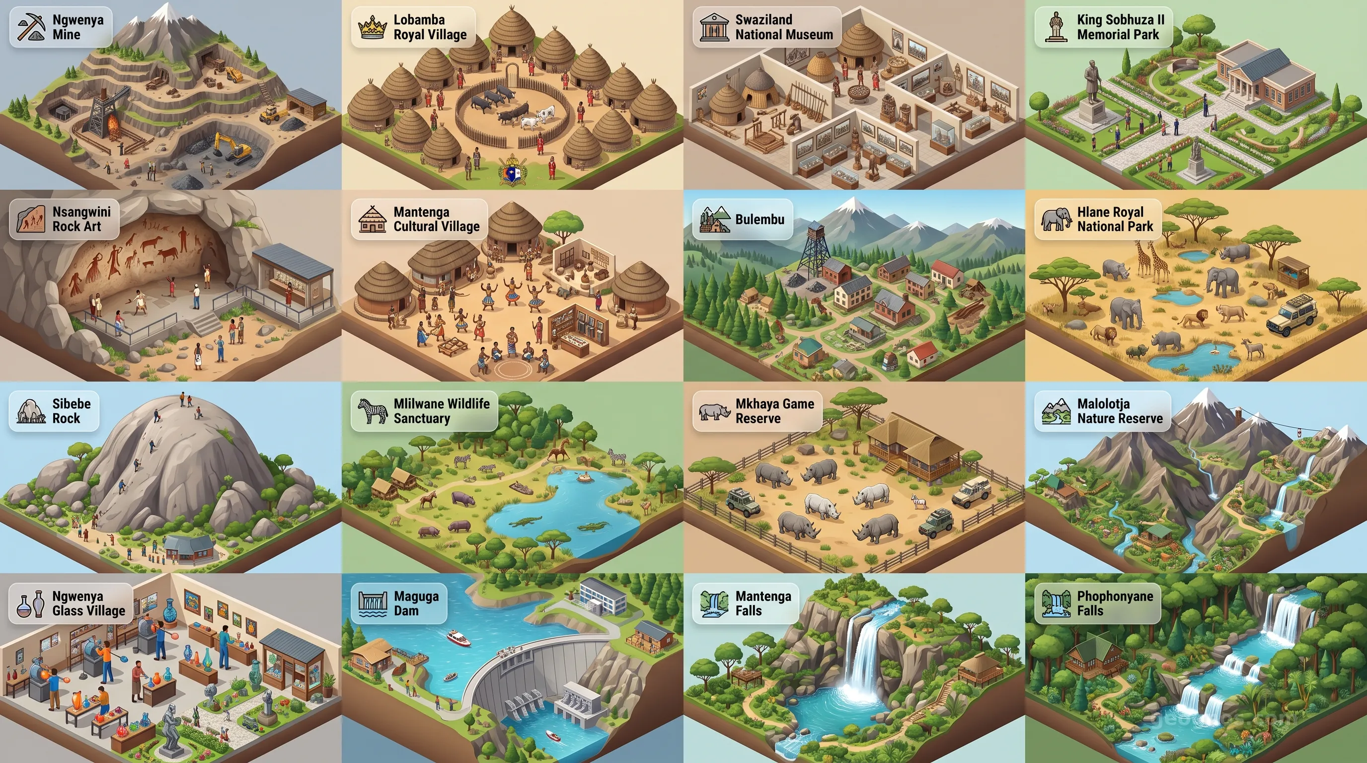
Eswatini - Panoramic Places of Interest Atlas including Ngwenya Mine, Lobamba Royal Village, Swaziland National Museum, King Sobhuza II Memorial Park, Nsangwini Rock Art, Mantenga Cultural Village, Bulembu, Hlane Royal National Park, Sibebe Rock, Mlilwane Wildlife Sanctuary, Mkhaya Game Reserve, Malolotja Nature Reserve, Ngwenya Glass Village, Maguga Dam, Mantenga Falls, Phophonyane Falls

Top Sights & Landmarks

01

Ngwenya Mine

The World's Oldest Mine

02

Lobamba Royal Village

Spiritual and Political Capital

03

Swaziland National Museum

Custodian of Swazi Heritage

04

King Sobhuza II Memorial Park

Tribute to a Legendary Monarch

05

Nsangwini Rock Art

Ancient Bushmen Canvases

06

Mantenga Cultural Village

A Living Museum of Swazi Life

07

Bulembu

Revitalized 1930s Mining Town

08

Hlane Royal National Park

The King's Royal Hunting Grounds

09

Sibebe Rock

The World's Second Largest Monolith

10

Mlilwane Wildlife Sanctuary

The Pioneer of Swazi Conservation

11

Mkhaya Game Reserve

Refuge for the Endangered Rhino

12

Malolotja Nature Reserve

Pristine Mountain Wilderness

13

Ngwenya Glass Village

Eco-friendly Artisanal Glassblowing

14

Maguga Dam

Award-Winning Engineering Marvel

15

Mantenga Falls

Eswatini's Most Famous Waterfall

16

Phophonyane Falls

Cascades of Ancient Gneiss

The Kingdom of the Sky and Savannah

To cross the border into Eswatini is to enter a world where time adopts a rhythm dictated by the sun and the rugged contours of the Lebombo Mountains. Often called the last absolute monarchy on the African continent, this landlocked jewel, formerly known as Swaziland, is more than its headlines. It is a tapestry of cultural continuity, where modern life and deeply rooted tradition dance in a balance that remains rare in our rapidly digitizing world. While its neighbors, South Africa and Mozambique, stretch out with vast, expansive plains and sweeping coastlines, Eswatini remains intimate and intentional, cradling a dense variety of ecosystems within its modest borders.

The soul of Eswatini is found in its geography. It is a nation of high-veld rolling grasslands, precipitous mountain corridors, and low-veld scrublands that teem with some of the continent's most majestic wildlife. As you journey through this terrain, you are not merely moving across space; you are walking through a living archive. If you wish to immerse yourself in the timeline of this sovereign people, we invite you to explore the history of Eswatini, where the legacy of the Dlamini dynasty and the resilient spirit of the Emaswati people are chronicled in depth, providing the context necessary to appreciate the quiet dignity of the kingdom today.

A Crucible of Tradition and Transformation

In the quiet valleys of the Ezulwini and the rugged slopes of the high veld, the history of this region is felt as a pulse. It is not a stagnant story of the past but an active, vibrant participation in rituals that have survived for centuries. From the Incwala ceremony to the Umhlanga Reed Dance, the nation exhibits a commitment to heritage that serves as an anchor for its youth. To test your knowledge and see if you can correctly map these monumental developments, engage with our interactive history puzzle. It is a challenge designed for scholars and curious minds alike, tasking you to arrange the key shifts of the Eswatini narrative in their proper sequence to earn your place among our expert historians.

The visual language of Eswatini is just as compelling as its spoken traditions. For those who want to see the passage of time reflected in art and archive, our history cinematic showcase provides an immersive, multi-sensory experience. Through this carousel of illustrations and period summaries, you can visualize the strategic alliances and peaceful navigations that have defined Eswatini as a unique enclave in Southern Africa. This is history made tactile, bringing the stories of ancestral kingdoms to your classroom or your living room.

The Landscape as a Living Canvas

Beyond the borders of history books and administrative archives lies the physical kingdom. Eswatini offers a sensory experience that defines the southern African experience in a compact, accessible scale. Whether it is the thundering roar of the Mkhondo River or the mist clinging to the crags of the northern mountains, the terrain invites contemplation. The flora and fauna of the region reflect a successful conservation model that brings human development and nature into a rare, cooperative proximity.

While the statistics of our economy and government sections describe the machinery of the nation, the spirit of Eswatini is captured in its horizons. We recommend that you spend time with our POI cinematic showcase to view the landmarks that anchor this landscape. From the rock art in the wilderness to the bustling markets of Mbabane, these locations highlight the aesthetic, ecological, and cultural landmarks that make the nation a premier destination for those who seek to understand the intersection of ancient mountains and the modern spirit.

The Eswatini Promise

Eswatini stands as a testament to the idea that a nation can move forward while holding tightly to the essence of its origins. It is a place that rewards the observer. To travel through its lands is to witness the resilience of a small nation that knows itself deeply. For the student of geography, it provides a masterclass in regional influence. For the traveler, it offers a sanctuary of peace and a perspective on community life that is increasingly hard to find.

As you delve into the technical sections that follow, remember that these numbers and maps are merely the skeleton of the country. The flesh and blood, the heartbeat and the melody of Eswatini, are found in its mountains, its people, and its commitment to the continuity of its crown. We hope this guide serves as your compass as you begin your journey of learning about this singular African kingdom, where the landscape shapes the soul and every horizon invites a deeper exploration of the world around us.
Location

Latitude
-26.5° N
Longitude
31.5° E
N S W E
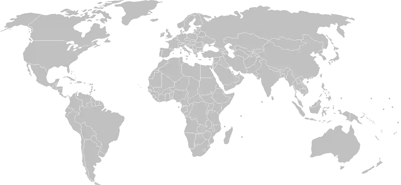
World Map Location
Geographic Location

Southern Africa, between Mozambique and South Africa

Map Reference
Africa

Area

Total Area
17,364 sq km
Land (99%)
Land: 17,204 sq km
Water: 160 sq km

Elevation

Highest Point
Emlembe
Emlembe 1,862 m
Lowest Point
Great Usutu River
Great Usutu River 21 m
Mean Elevation
305 m

Detailed Geography Information

Coastline

0 km (landlocked)

Geography - note

landlocked; almost completely surrounded by South Africa

Irrigated land

500 sq km (2012)

Land boundaries

Total boundary: 546 km

Maritime claims

none (landlocked)

Natural hazards

drought

Natural resources

asbestoscoalclaycassiteritehydropowerforestssmall gold and diamond depositsquarry stoneand talc

Terrain

mostly mountains and hills; some moderately sloping plains

Population & Growth

+0.90% Growth
1,137,268
Total inhabitants (2025 est.)
Male: 49.0% (557,204) Female: 51.0% (580,064)

Age Distribution

0-14 years
31.6%
~359,377
15-64 years
64.3%
~731,263
65 years
4.0%
~45,491
Note: 2024 est.

Demographic Longevity

Median Age
24.8 years
Male
23.4 yrs
Female
25.8 yrs
Life Expectancy
60.7 years
Male
58.7 yrs
Female
62.8 yrs

Vital Dynamics

Birth Rate
20.66
births per 1,000 people
Death Rate
8.3
deaths per 1,000 people
Net Migration
-3.68
migrants per 1,000 people
Fertility Rate
2.64
children born per woman

Detailed People & Society Information

Alcohol consumption per capita

7.68 liters of pure alcohol (2019 est.)

Children under the age of 5 years underweight

5% (2021 est.)

Currently married women (ages 15-49)

36.4% (2022 est.)

Dependency ratios

total dependency ratio: 52.2 (2025 est.) youth dependency ratio: 44.7 (2025 est.) elderly dependency ratio: 7.5 (2025 est.) potential support ratio: 13.3 (2025 est.)

Education expenditure

6%

6% of GDP (2024 est.) 19.2% national budget (2025 est.)

Ethnic groups

Gross reproduction rate

1.3 (2025 est.)

Health expenditure

7%

7% of GDP (2021) 11.3% of national budget (2022 est.)

Infant mortality rate

total: 38 deaths/1,000 live births (2025 est.) male: 40.7 deaths/1,000 live births female: 32.5 deaths/1,000 live births

Languages

Literacy

total population: 90.8% (2022 est.) male: 91.1% (2022 est.) female: 90.4% (2022 est.)

Major urban areas - population

68,000 MBABANE (capital) (2018)

Maternal mortality ratio

118 deaths/100,000 live births (2023 est.)

Nationality

noun: liSwati (singular), emaSwati (plural); note - former term, Swazi(s), still used among English speakers adjective: Swati; note - former term, Swazi, still used among English speakers

Obesity - adult prevalence rate

16.5% (2016)

Physician density

0.56 physicians/1,000 population (2023)

Population distribution

because of its mountainous terrain, the population distribution is uneven throughout the country, concentrating primarily in valleys and plains as shown in this population distribution map

Refugees and internally displaced persons

Total Displaced & Vulnerable Persons
4,515 individuals
Refugees
98.8%
4,459
4,459 (2024 est.)
Internally Displaced Persons (IDPs)
1.2%
56
56 (2024 est.)

Religions

Christian (Zionist - a blend of Christianity and traditional African religions
90%
Roman Catholic
20%
other Christian - includes Anglican
30%
Muslim
2%
other (includes Baha'i
8%

Sex ratio

at birth: 1.03 male(s)/female 0-14 years: 1 male(s)/female 15-64 years: 0.87 male(s)/female 65 years and over: 0.59 male(s)/female total population: 0.9 male(s)/female (2024 est.)

Tobacco use

total: 8.5% (2025 est.) male: 16.1% (2025 est.) female: 1.2% (2025 est.)

Climate & Issues

Climate Profile

varies from tropical to near temperate

Key Environmental Issues
limited supplies of potable water overhunting depleting wildlife population growth, deforestation, and overgrazing lead to soil erosion and soil degradation

Land Cover

Coverage Distribution
Agri (70%)
Forest (25%)
Arable: 10.3%
Crops: 1.0%
Pasture: 58.1%
Forest: 25.4%

Air & Carbon Emissions

Annual CO2 Output 2023 est.
1.326 million
Coal (31%) Oil (69%) Gas (0%)
PM2.5 Exposure 16.4 µg/m³
0 5 (WHO Limit) 15 25 35+

Water Resources & Use

Renewable Water Resources 4.51 billion cubic meters (2022 est.)
Annual Water Withdrawal
municipal: 41.3 million cubic meters (2022 est.)
Municipal (4%) Ind (2%) Agri (94%)

Detailed Environmental Information

International environmental agreements

BiodiversityClimate ChangeClimate Change-Kyoto ProtocolClimate Change-Paris AgreementComprehensive Nuclear Test BanDesertificationEndangered SpeciesHazardous WastesLaw of the SeaNuclear Test BanOzone Layer ProtectionWetlands

Urbanization

urban population: 24.8% of total population (2023) rate of urbanization: 2.42% annual rate of change (2020-25 est.)

Waste and recycling

municipal solid waste generated annually: 218,200 tons (2024 est.) percent of municipal solid waste recycled: 17.3% (2022 est.)

Capital & State Profile

Capital City
Mbabane
-26.3167° N, 31.1333° E
Timezone UTC+2
Government Type
absolute monarchy
Independence 1968-09-06
National Holiday 09-06

Executive Branch

Chief of State
King MSWATI III (since 25 April 1986)
Head of Government
Prime Minister Russell DLAMINI (since 6 November 2023)
Cabinet Cabinet recommended by the prime minister, confirmed by the monarch; at least one-half of the cabinet membership must be appointed from among elected members of the House of Assembly

Legislative Branch

bicameral
Legislature Name Parliament (Libandla)
Lower Chamber House of Assembly
Seats 74 (59 directly elected; 4 indirectly elected; 10 appointed)
Term 5 years
% Women 21.6%
Upper Chamber Senate
Seats 30 (10 indirectly elected; 20 appointed)
Term 5 years
% Women 46.7%

National Identity & Symbols

National Flag Description

three horizontal bands of blue (top), red (triple-width), and blue; the red band is edged in yellow, with a large black-and-white shield in the center that covers two horizontal spears and a staff with feather tassels

Symbolic Meaning blue stands for peace and stability, red for past struggles, and yellow for the mineral resources of the country; the shield, spears, and staff symbolize protection from enemies, and the shield colors stand for ethnic groups living in peaceful coexistence
National Symbol lion, elephant
National Colors blue, yellow, red
National Anthem Nkulunkulu Mnikati wetibusiso temaSwati (O God, Bestower of the Blessings of the Swazi)

Detailed Government Information

Administrative divisions

4 regions; Hhohho, Lubombo, Manzini, Shiselweni

Citizenship

citizenship by birth: no citizenship by descent only: both parents must be citizens of Eswatini dual citizenship recognized: no residency requirement for naturalization: 5 years

Constitution

history: previous 1968, 1978; latest signed by the king 26 July 2005, effective 8 February 2006 amendment process: proposed at a joint sitting of both houses of Parliament; passage requires majority vote by both houses and/or majority vote in a referendum, and assent of the king; passage of amendments affecting "specially entrenched" constitutional provisions requires at least three-fourths majority vote by both houses, passage by simple majority vote in a referendum, and assent of the king; passage of "entrenched" provisions requires at least two-thirds majority vote of both houses, passage in a referendum, and assent of the king

Country name

conventional long form: Kingdom of Eswatini conventional short form: Eswatini local long form: Umbuso weSwatini local short form: eSwatini former: Swaziland etymology: the country name derives from 19th century King MSWATI II, under whose rule Swati territory was expanded and unified note: pronounced ay-swatini or eh-swatini

International law organization participation

accepts compulsory ICJ jurisdiction with reservations; non-party state to the ICCt

International organization participation

Judicial branch

highest court(s): Supreme Court (consists of the chief justice and at least 4 justices) and the High Court (consists of the chief justice ex officio and 4 justices) judge selection and term of office: justices of the Supreme Court and High Court appointed by the monarch on the advice of the Judicial Service Commission (JSC), a judicial advisory body consisting of the Supreme Court Chief Justice, 4 members appointed by the monarch, and the chairman of the Civil Service Commission; justices of both courts eligible for retirement at age 65 with mandatory retirement at age 75 subordinate courts: magistrates' courts; National Swazi Courts for administering customary/traditional laws (jurisdiction restricted to customary law for Swazi citizens) note: the Supreme Court has jurisdiction in all constitutional matters

Legal system

mixed system of civil, common, and customary law

Political parties

political parties exist but conditions for their operations, particularly in elections, are undefined, legally unclear, or culturally restricted; the following are considered political associations: African United Democratic Party or AUDP Ngwane National Liberatory Congress or NNLC People's United Democratic Movement or PUDEMO Swazi Democratic Party or SWADEPA

Suffrage

18 years of age

Economic Overview

landlocked southern African economy; South African trade dependent and currency pegging; CMA and SACU member state; COVID-19 economic slowdown; growing utilities inflation; persistent poverty and unemployment; HIV/AIDS labor force disruptions

Size & Performance

Real GDP (PPP)
$12.885 billion
Latest available estimate (2024)
2023: $12.553 billion2022: $12.135 billion
Real GDP Growth
2.6% (2024 est.)
+2.6%
GDP Per Capita (PPP)
$10,400
2023: $10,2002022: $10,000

GDP Sector Breakdown

Agriculture: 6.8%Industry: 34.7%Services: 51.7%
Origin GDP %
Agriculture 6.8%
Industry 34.7%
Services 51.7%

Trade Balance

Trade Position
Trade Deficit
$177.00 million
Total Exports
$2.174 billion (2023 est.)
Total Imports
$2.351 billion (2023 est.)
Exports (48%) Imports (52%)

Budget Balance

Budget Position
Budget Deficit
-$222.00 million
Revenues
$1.217 billion (2021 est.)
Expenditures
$1.439 billion (2021 est.)
Revenues (46%) Expenditures (54%)

Export Profile

Top Export Partners

Note: 2023; top five export partners based on percentage share of exports

Major Export Commodities

scented mixturesraw sugarindustrial acids/oils/alcoholsgarmentswood

Import Profile

Top Import Partners

Note: 2023; top five import partners based on percentage share of imports

Major Import Commodities

refined petroleumelectricityplastic productscotton fabricgarments

Labor & Employment

Total Labor Force 390,600 (2024 est.)
General Unemployment Rate 34.4%
Youth Unemployment (Ages 15-24) 58.2%
Population Below Poverty Line 58.9% (2016 est.)

Income Inequality

Gini Coefficient (Family Income) 54.6
0 (Perfect Equality) High Inequality 100 (Perfect Inequality)

Family Income / Consumption Share

Lowest 10%: 1.4% (2016 est.) Highest 10%: 42.7% (2016 est.)
Inequality Gap: Top 10% holds 30.5x the share of the bottom 10%.

Detailed Economic Data

Agricultural products

sugarcanemaizeroot vegetablesgrapefruitsorangesmilkpineapplesbananasbeefsweet potatoes

Current account balance

$107.534 million (2023 est.) -$140.972 million (2022 est.) $125.318 million (2021 est.) note: balance of payments - net trade and primary/secondary income in current dollars

Debt - external

$923.266 million (2023 est.) note: present value of external debt in current US dollars

Exchange rates

emalangeni per US dollar - Exchange rates: 18.318 (2024 est.) 18.454 (2023 est.) 16.362 (2022 est.) 14.783 (2021 est.) 16.47 (2020 est.)

GDP - composition, by end use

Industrial production growth rate

0.5% (2023 est.) note: annual % change in industrial value added based on constant local currency

Industries

soft drink concentratescoalforestrysugar processingtextilesand apparel

Inflation rate (consumer prices)

2.6% (2019 est.) 4.8% (2018 est.) 6.2% (2017 est.) note: annual % change based on consumer prices

Public debt

35.9% of GDP (2021 est.) note: central government debt as a % of GDP

Remittances

1.7% of GDP (2023 est.) 2.7% of GDP (2022 est.) 2.8% of GDP (2021 est.) note: personal transfers and compensation between resident and non-resident individuals/households/entities

Reserves of foreign exchange and gold

$479.261 million (2023 est.) $452.352 million (2022 est.) $572.282 million (2021 est.) note: holdings of gold (year-end prices)/foreign exchange/special drawing rights in current dollars

Taxes and other revenues

24.5% (of GDP) (2021 est.) note: central government tax revenue as a % of GDP

Grid Infrastructure

Electricity Access 82.3%
Urban: 86.1% Rural: 81.6%
Capacity 285,000 kW (2023 est.)
Consumption 1.308 billion kWh (2023 est.)
Imports 928.237 million kWh (2023 est.)
Grid Losses: 167.476 million kWh (2023 est.)

Generation Mix

Percentage Share of Production
hydroelectricity 54.4%
biomass and waste 37.6%
solar 4.9%
fossil fuels 3.1%

Fossil Fuels Production

Petroleum
Consumption 6,000 bbl/day (2023 est.)
Coal
Production 253,000 metric tons (2023 est.)
Consumption 202,000 metric tons (2023 est.)
Exports 4,000 metric tons (2023 est.)
Imports 201,000 metric tons (2023 est.)
Proven Reserves 4.644 billion metric tons (2023 est.)

Intensity & Nuclear

Energy Consumption Per Capita 18.823 million Btu/person (2023 est.)
No nuclear energy infrastructure or reactor operations reported in this country dossier.

Digital Access

.sz
Internet Usage 58%

Active internet users as a percentage of the total population.

Fixed Broadband

Penetration Rate 3 / 100
Total Subscriptions 34,000 (2023 est.)

Mobile Cellular

Penetration Rate 140 / 100
Total Subscriptions 1.74 million (2024 est.)

Broadcast Media

1 state-owned TV station; satellite dishes can access South African providers; state-owned radio network with 3 channels; 1 private radio station (2019)

Aviation

3DC
Airports
16
As of 2025
Heliports
1
As of 2025

Railways

Total Track Length
301 km
National Network Data from 2014

Military Expenditures

GDP Allocation 1.4%
1.4% of GDP (2024 est.) 1.4% of GDP (2023 est.) 1.6% of GDP (2022 est.) 1.7% of GDP (2021 est.) 1.8% of GDP (2020 est.)

Active Duty Strengths

estimated 3,000 active-duty Defense Force (2025)

Refers to active military personnel.

Service & Defense Details

Military and security forces

Umbutfo Eswatini Defense Force (UEDF): Army (includes a small air wing); the Royal Eswatini Police Service (REPS) (2025)

Military equipment inventories and acquisitions

the UEDF has a small inventory of mostly older light weapons and equipment originating from Europe, South Africa, Taiwan, and the US (2025)

Military - note

the UEDF’s primary mission is external defense, which includes mostly securing the borders; it also has domestic security responsibilities, including protecting members of the royal family; the king is the UEDF commander in chief and holds the position of minister of defense, although the UEDF reports to the Army commander and principal undersecretary of defense for day-to-day operations; the Royal Eswatini Police Service (REPS) is responsible for maintaining internal security as well as migration and border crossing enforcement; it is under the prime minister, although the king is the force’s titular commissioner in chief; the UEDF was originally created in 1973 as the Royal Swaziland Defense Force (2025)

Military service age and obligation

18-35 years of age for voluntary military service for men and women; no conscription (2025)