🇬🇲

Gambia, The

Africa • Countries
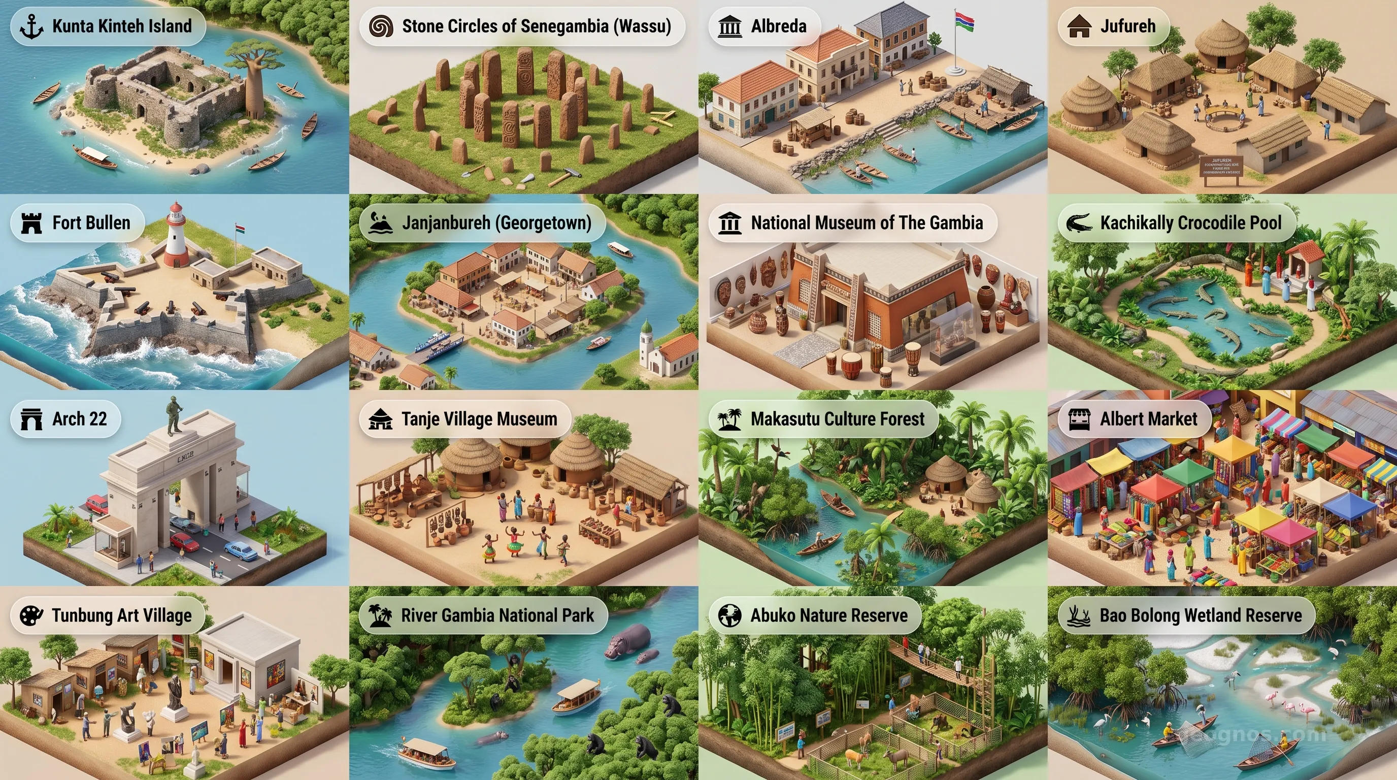
Gambia, The - Panoramic Places of Interest Atlas including Kunta Kinteh Island, Stone Circles of Senegambia (Wassu), Albreda, Jufureh, Fort Bullen, Janjanbureh (Georgetown), National Museum of The Gambia, Kachikally Crocodile Pool, Arch 22, Tanje Village Museum, Makasutu Culture Forest, Albert Market, Tunbung Art Village, River Gambia National Park, Abuko Nature Reserve, Bao Bolong Wetland Reserve

Top Sights & Landmarks

01

Kunta Kinteh Island

Historic Slave Trade Fortress

02

Stone Circles of Senegambia (Wassu)

Ancient Megalithic Wonders

03

Albreda

Former French Trading Post

04

Jufureh

Ancestral Home of Kunta Kinte

05

Fort Bullen

Anti-Slavery Fortification

06

Janjanbureh (Georgetown)

Colonial Island Settlement

07

National Museum of The Gambia

Repository of Gambian Heritage

08

Kachikally Crocodile Pool

Sacred Healing Waters

09

Arch 22

Monument of Independence

10

Tanje Village Museum

Living Cultural Village

11

Makasutu Culture Forest

Eco-Tourism Haven

12

Albert Market

Bustling Urban Bazaar

13

Tunbung Art Village

Contemporary Art Retreat

14

River Gambia National Park

Baboon Island Chimpanzee Sanctuary

15

Abuko Nature Reserve

First Wildlife Reserve

16

Bao Bolong Wetland Reserve

Ramsar Protected Wetlands

The River That Defines a Nation

To look at a map of Africa is to observe the grand strokes of cartographic history, yet within the western crook of the continent lies a curiosity that defies standard geometric logic. The Gambia, The, is a sliver of sovereign land tracing the winding, silt-rich path of the Gambia River. It is a nation defined not by mountain ranges or vast plateaus, but by the arterial flow of water that has sustained civilizations for millennia. Here, the river is more than a geographic feature. It is the lifeblood, the highway, and the soul of a nation that sits like a green ribbon amidst the expansive Sahelian landscape of its larger neighbor, Senegal.

For the traveler, the historian, or the student of geography, The Gambia offers a unique case study in how nature dictates destiny. This is a place where the mangrove-fringed banks have witnessed the rise and fall of empires, the echoes of maritime explorers, and the enduring resilience of communities living in harmony with the tides. To truly understand this West African gem, one must peel back the layers of its colonial emergence and appreciate the deep, ancestral roots that stretch far deeper than the modern borders drawn on paper.

A Crossroads of Time and Memory

The history of this region is as profound as the river itself. From the early Neolithic settlements to the flourishing of the Mali and Kaabu Empires, the river provided a safe corridor for trade, agriculture, and cultural exchange. It served as a gateway, inviting the world in while nurturing the traditions of the Mandinka, Fula, Wolof, and Jola peoples. When European maritime powers arrived in the 15th century, the Gambia River became one of the most contested waterways in West Africa, transforming the landscape into a crucible of global shifts. We invite you to explore the history of Gambia, The to gain a comprehensive understanding of the events and socio-political movements that shaped the nation into its current form.

History, however, is not merely a collection of dates. It is a living, breathing sequence of moments that define identity. To test your knowledge of how these moments interlink, we encourage you to challenge yourself with our history puzzle. This interactive timeline invites students and scholars alike to sequence key milestones, transforming the dry facts of textbooks into a dynamic narrative challenge that earns you digital honors within our community platform.

The Living Landscape

If you stand upon the banks of the Gambia River near Banjul or travel inland toward the stone circles of Senegambia, you are stepping into a vibrant environmental theater. The ecology of the country shifts from the brackish marshes of the Atlantic coast to the verdant interior floodplains. Birdwatchers from every corner of the globe flock to the Kiang West National Park, where the convergence of African and European migratory paths creates a spectacle of avian diversity unparalleled in the region.

To capture the visual splendor of these environments and the architectural markers of the nation, take a moment to enjoy our POI cinematic showcase. This visual narrative takes you on a tour of the country's most iconic locations, from the historic forts that stand as monuments to past eras to the tranquil, sun-drenched bolongs where silence is interrupted only by the rhythmic call of the African fish eagle.

An Enduring Cultural Identity

What strikes the observer most about The Gambia is its infectious sense of warmth. Often referred to as the Smiling Coast of Africa, the nation holds a hospitality that is deeply woven into the fabric of daily existence. Whether you are navigating the bustling markets of Serrekunda or sharing a quiet moment in a river-side village, the encounter is almost always defined by a welcoming curiosity. This culture has been preserved across generations, articulated through the Griot tradition where poets and musicians act as the oral historians of the nation.

The continuity of this history is something we strive to keep vivid and accessible for every visitor to our Atlas. Through our history cinematic showcase, you can witness the evolution of the nation through curated illustrations and immersive storytelling. It provides an essential bridge between the past and present, helping students and educators visualize the major historical events that have crafted the Gambian identity today.

A Sustainable Future

Today, The Gambia stands as a testament to the idea that size does not limit a nation's influence or its capacity for development. With the river as its constant guide, the country is actively forging a path that balances the protection of its fragile riparian ecosystems with the needs of a growing population. It is a land of quiet innovation, where the lessons of the past serve as a blueprint for sustainable growth in the agricultural and tourism sectors.

As we examine The Gambia through the lens of GeoGnos, we see more than just a line on a map. We see a landscape of stories, a biodiversity hotspot, and a vibrant community that occupies a unique and irreplaceable position on the world stage. We invite you to traverse these pages, engage with the data, and appreciate the singular beauty of a country that proves, more than any other, that it is the river that makes the nation.
Location

Latitude
13.4667° N
Longitude
-16.5667° E
N S W E
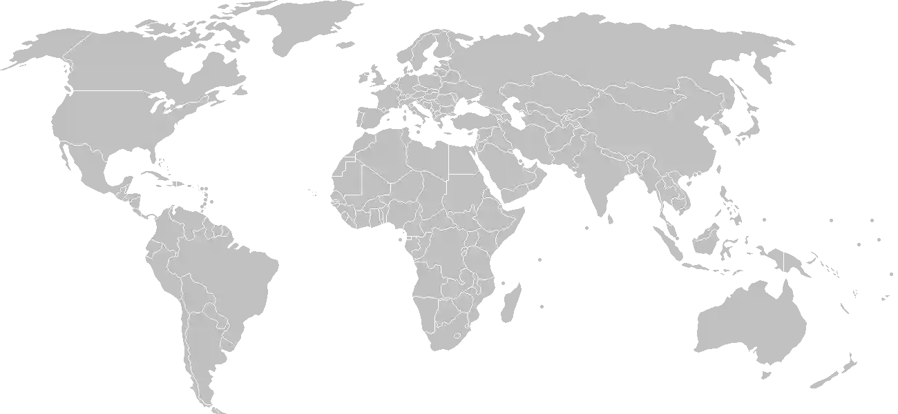
World Map Location
Geographic Location

Western Africa, bordering the North Atlantic Ocean and Senegal

Map Reference
Africa

Area

Total Area
11,300 sq km
Land (90%)
Land: 10,120 sq km
Water: 1,180 sq km

Elevation

Highest Point
unnamed elevation
unnamed elevation 63 m; 3 km southeast of the town of Sabi
Lowest Point
Atlantic Ocean
Atlantic Ocean 0 m
Mean Elevation
34 m

Detailed Geography Information

Coastline

80 km

Geography - note

almost an enclave of Senegal; smallest country on the African mainland

Irrigated land

50 sq km (2012)

Land boundaries

Total boundary: 749 km
Senegal 749 km

Major aquifers

Senegalo-Mauritanian Basin

Major rivers (by length in km)

Gambia river mouth (shared with Senegal and Guinea [s]) - 1,094 km note: [s] after country name indicates river source; [m] after country name indicates river mouth

Maritime claims

territorial sea: 12 nm contiguous zone: 18 nm continental shelf: extent not specified exclusive fishing zone: 200 nm

Natural hazards

droughts

Natural resources

fishclaysilica sandtitaniumtinzircon

Terrain

flood plain of the Gambia River flanked by some low hills

Population & Growth

+2.10% Growth
2,577,553
Total inhabitants (2025 est.)
Male: 49.6% (1,277,624) Female: 50.4% (1,299,929)

Age Distribution

0-14 years
38.2%
~984,625
15-64 years
58.1%
~1,497,558
65 years
3.7%
~95,369
Note: 2024 est.

Demographic Longevity

Median Age
20.5 years
Male
19.8 yrs
Female
20.6 yrs
Life Expectancy
68.4 years
Male
66.7 yrs
Female
70.1 yrs

Vital Dynamics

Birth Rate
26.49
births per 1,000 people
Death Rate
5.53
deaths per 1,000 people
Net Migration
-0.04
migrants per 1,000 people
Fertility Rate
3.39
children born per woman

Detailed People & Society Information

Alcohol consumption per capita

2.67 liters of pure alcohol (2019 est.)

Children under the age of 5 years underweight

11.6% (2020 est.)

Currently married women (ages 15-49)

63% (2020 est.)

Dependency ratios

total dependency ratio: 70.4 (2025 est.) youth dependency ratio: 63.9 (2025 est.) elderly dependency ratio: 6.5 (2025 est.) potential support ratio: 15.4 (2025 est.)

Education expenditure

2.8%

2.8% of GDP (2023 est.) 14.2% national budget (2025 est.)

Ethnic groups

Mandinka/Jahanka
33.3%
Fulani/Tukulur/Lorobo
18.2%
Wolof
12.9%
Jola/Karoninka
11%
Serahuleh
7.2%
Serer
3.5%
other
4%
non-Gambian
9.9%

Gross reproduction rate

1.67 (2025 est.)

Health expenditure

3.2%

3.2% of GDP (2021) 7.5% of national budget (2022 est.)

Hospital bed density

1.2 beds/1,000 population (2021 est.)

Infant mortality rate

total: 35 deaths/1,000 live births (2025 est.) male: 39.1 deaths/1,000 live births female: 32.2 deaths/1,000 live births

Languages

Literacy

total population: 51.6% (2021 est.) male: 65.3% (2021 est.) female: 40.5% (2021 est.)

Major urban areas - population

481,000 BANJUL (capital) (2023) note: includes the local government areas of Banjul and Kanifing

Maternal mortality ratio

354 deaths/100,000 live births (2023 est.)

Mother's mean age at first birth

20.7 years (2019/20 est.) note: data represents median age at first birth among women 25-49

Nationality

noun: Gambian(s) adjective: Gambian

Obesity - adult prevalence rate

10.3% (2016)

Physician density

0.09 physicians/1,000 population (2023)

Population distribution

settlements are found scattered along the Gambia River; the largest communities, including the capital of Banjul and the country's largest city, Serekunda, are found at the mouth of the Gambia River along the Atlantic coast, as shown in this population distribution map

Refugees and internally displaced persons

Total Displaced & Vulnerable Persons
11,873 individuals
Refugees
37.2%
4,411
4,411 (2024 est.)
Internally Displaced Persons (IDPs)
62.8%
7,462
7,462 (2024 est.)

Religions

Muslim
96.4%
Christian
3.5%
other or none
0.1%

Sex ratio

at birth: 1.03 male(s)/female 0-14 years: 1.02 male(s)/female 15-64 years: 0.97 male(s)/female 65 years and over: 0.78 male(s)/female total population: 0.98 male(s)/female (2024 est.)

Tobacco use

total: 8.6% (2025 est.) male: 17% (2025 est.) female: 0.5% (2025 est.)

Climate & Issues

Climate Profile

tropical; hot, rainy season (June to November); cooler, dry season (November to May)

Key Environmental Issues
deforestation due to slash-and-burn agriculture desertification water pollution water-borne diseases

Land Cover

Coverage Distribution
Agri (63%)
Forest (22%)
Other (15%)
Arable: 43.5%
Crops: 0.7%
Pasture: 18.5%
Forest: 22.0%

Air & Carbon Emissions

Annual CO2 Output 2023 est.
537,000
Coal (0%) Oil (100%) Gas (0%)
PM2.5 Exposure 34.9 µg/m³
0 5 (WHO Limit) 15 25 35+

Water Resources & Use

Renewable Water Resources 8 billion cubic meters (2022 est.)
Annual Water Withdrawal
municipal: 41.2 million cubic meters (2022 est.)
Municipal (41%) Ind (21%) Agri (39%)

Detailed Environmental Information

International environmental agreements

BiodiversityClimate ChangeClimate Change-Kyoto ProtocolClimate Change-Paris AgreementDesertificationEndangered SpeciesHazardous WastesLaw of the SeaNuclear Test BanOzone Layer ProtectionShip PollutionWetlandsWhaling

Urbanization

urban population: 64.5% of total population (2023) rate of urbanization: 3.75% annual rate of change (2020-25 est.)

Waste and recycling

municipal solid waste generated annually: 193,400 tons (2024 est.) percent of municipal solid waste recycled: 13% (2022 est.)

Capital & State Profile

Capital City
Banjul
13.45° N, -16.5667° E
Timezone UTC 0
Government Type
presidential republic
Independence 1965-02-18
National Holiday 02-18

Executive Branch

Chief of State
President Adama BARROW (since 19 January 2022)
Head of Government
Vice President Mohammed JALLOW (since 23 February 2024)
Last Election 4 December 2021
Next Election 2026
Cabinet Cabinet appointed by the president

Legislative Branch

unicameral
Legislature Name National Assembly
Seats & Term
58 (53 directly elected; 5 appointed) seats / 5 years
Women in Chamber
8.6% Representation
Electoral System plurality/majority
Parties Composition
National People's Party (NPP) 18United Democratic Party (UDP) 15National Reconciliation Party (NRP) 4Independents 12Other 4

National Identity & Symbols

National Flag Description

three equal horizontal bands of red (top), blue with white edges, and green

Symbolic Meaning red stands for the sun and the savannah, blue for the Gambia River, and green for forests and agriculture; the white stripes denote unity and peace
National Symbol lion
National Colors red, blue, green, white
National Anthem For The Gambia, Our Homeland

Detailed Government Information

Administrative divisions

5 regions, 1 city*, and 1 municipality**; Banjul*, Central River, Kanifing**, Lower River, North Bank, Upper River, West Coast

Citizenship

citizenship by birth: yes citizenship by descent only: yes dual citizenship recognized: no residency requirement for naturalization: 5 years

Constitution

history: previous 1965 (Independence Act), 1970; latest adopted 8 April 1996, approved by referendum 8 August 1996, effective 16 January 1997 amendment process: proposed by the National Assembly; passage requires at least three-fourths majority vote by the Assembly membership in each of several readings and approval by the president of the republic; a referendum is required for amendments affecting national sovereignty, fundamental rights and freedoms, government structures and authorities, taxation, and public funding; passage by referendum requires participation of at least 50% of eligible voters and approval by at least 75% of votes cast note: in 2024, The Gambian government announced its commitment to adopting a new constitution

Country name

conventional long form: Republic of The Gambia conventional short form: The Gambia etymology: named for the Gambia River that flows through the country; Portuguese explorers in the 15th century derived the name for the river from its local name, Ba-Dimma, meaning "the river"

International law organization participation

accepts compulsory ICJ jurisdiction with reservations; accepts ICCt jurisdiction

International organization participation

Judicial branch

highest court(s): Supreme Court of The Gambia (consists of the chief justice and 6 justices; court sessions held with 5 justices) judge selection and term of office: justices appointed by the president after consultation with the Judicial Service Commission, a 6-member independent body of high-level judicial officials, a presidential appointee, and a National Assembly appointee; justices appointed for life or until mandatory retirement at age 75 subordinate courts: Court of Appeal; High Court; Special Criminal Court; Khadis or Muslim courts; district tribunals; magistrates courts; cadi courts

Legal system

mixed system of English common law, Islamic law, and customary law

National heritage

total World Heritage Sites: 2 (both cultural) selected World Heritage Site locales: Kunta Kinteh Island and Related Sites; Stone Circles of Senegambia

Political parties

Alliance for Patriotic Reorientation and Construction or APRC Gambia Democratic Congress or GDC Gambia Moral Congress or GMC National People's Party or NPP People's Progressive Party or PPP United Democratic Party or UDP

Suffrage

18 years of age; universal

Economic Overview

low-income West African economy; agriculture-dominant; high poverty rate; heightened inflation; dependent on foreign assistance and remittances; structural reforms conditioned by IMF Extended Credit Facility program

Size & Performance

Real GDP (PPP)
$8.365 billion
Latest available estimate (2024)
2023: $7.911 billion2022: $7.549 billion
Real GDP Growth
5.7% (2024 est.)
+5.7%
GDP Per Capita (PPP)
$3,000
2023: $2,9002022: $2,900

GDP Sector Breakdown

Agriculture: 24.1%Industry: 14.7%Services: 53.9%
Origin GDP %
Agriculture 24.1%
Industry 14.7%
Services 53.9%

Trade Balance

Trade Position
Trade Deficit
$710.59 million
Total Exports
$838.409 million (2024 est.)
Total Imports
$1.549 billion (2024 est.)
Exports (35%) Imports (65%)

Budget Balance

Budget Position
Budget Surplus
+$87.75 million
Revenues
$308.887 million (2018 est.)
Expenditures
$221.137 million (2018 est.)
Revenues (58%) Expenditures (42%)

Export Profile

Top Export Partners

Note: 2023; top five export partners based on percentage share of exports

Major Export Commodities

packaged medicinecarsharvesting machineryrefined petroleumtrailers

Import Profile

Top Import Partners

Note: 2023; top five import partners based on percentage share of imports

Major Import Commodities

crude petroleumrefined petroleumcotton fabriciron alloysrice

Labor & Employment

Total Labor Force 783,100 (2024 est.)
General Unemployment Rate 6.5%
Youth Unemployment (Ages 15-24) 10.9%
Population Below Poverty Line 53.4% (2020 est.)

Income Inequality

Gini Coefficient (Family Income) 38.8
0 (Perfect Equality) Moderate Inequality 100 (Perfect Inequality)

Family Income / Consumption Share

Lowest 10%: 2.6% (2020 est.) Highest 10%: 30.5% (2020 est.)
Inequality Gap: Top 10% holds 11.7x the share of the bottom 10%.

Detailed Economic Data

Agricultural products

ricegroundnutsmilkmilletoil palm fruitmaizevegetablescassavafruitssorghum

Current account balance

-$74.374 million (2024 est.) -$120.064 million (2023 est.) -$90.251 million (2022 est.) note: balance of payments - net trade and primary/secondary income in current dollars

Debt - external

$902.421 million (2023 est.) note: present value of external debt in current US dollars

Exchange rates

dalasis (GMD) per US dollar - Exchange rates: 61.096 (2023 est.) 54.923 (2022 est.) 51.484 (2021 est.) 51.502 (2020 est.) 50.062 (2019 est.)

GDP - composition, by end use

Industrial production growth rate

2.4% (2024 est.) note: annual % change in industrial value added based on constant local currency

Industries

peanutsfishhidestourismbeveragesagricultural machinery assemblywoodworkingmetalworkingclothing

Inflation rate (consumer prices)

11.6% (2024 est.) 17% (2023 est.) 11.5% (2022 est.) note: annual % change based on consumer prices

Remittances

21.1% of GDP (2024 est.) 21.5% of GDP (2023 est.) 22.8% of GDP (2022 est.) note: personal transfers and compensation between resident and non-resident individuals/households/entities

Reserves of foreign exchange and gold

$577.028 million (2023 est.) $568.244 million (2022 est.) $652.671 million (2021 est.) note: holdings of gold (year-end prices)/foreign exchange/special drawing rights in current dollars

Grid Infrastructure

Electricity Access 65.4%
Urban: 82.8% Rural: 31.2%
Capacity 162,000 kW (2023 est.)
Consumption 410.824 million kWh (2023 est.)
Grid Losses: 104.176 million kWh (2023 est.)

Generation Mix

Percentage Share of Production
fossil fuels 99%
solar 0.6%
wind 0.4%

Fossil Fuels Production

Petroleum
Consumption 3,000 bbl/day (2023 est.)

Intensity & Nuclear

Energy Consumption Per Capita 2.731 million Btu/person (2023 est.)
No nuclear energy infrastructure or reactor operations reported in this country dossier.

Digital Access

.gm
Internet Usage 46%

Active internet users as a percentage of the total population.

Fixed Broadband

Penetration Rate 0 / 100
Total Subscriptions 6,000 (2022 est.)

Mobile Cellular

Penetration Rate 126 / 100
Total Subscriptions 3.48 million (2024 est.)

Broadcast Media

1 state-run TV-channel; one privately owned TV station; 1 online TV station; 3 state-owned and 31 privately owned radio stations; 8 community radio stations; transmissions of multiple international broadcasters are available; cable and satellite TV subscription services in some parts of the country (2019)

Aviation

C5
Airports
1
As of 2025

Ports & Harbors

Ports Count 1
Hover for breakdown & key ports As of 2024

Merchant Marine

Commercial Fleet
15 ships
Hover for vessel types breakdown As of 2023

Military Expenditures

GDP Allocation 0.6%
0.6% of GDP (2024 est.) 0.6% of GDP (2023 est.) 0.7% of GDP (2022 est.) 0.8% of GDP (2021 est.) 0.8% of GDP (2020 est.)

Active Duty Strengths

estimated 3,000-4,000 active Gambian Armed Forces (2025)

Refers to active military personnel.

Service & Defense Details

Military and security forces

Gambian Armed Forces (GAF; aka Armed Forces of the Gambia): the Gambian National Army (GNA), Gambia Navy, Gambia Air Force, Republican National Guard (RNG) Ministry of Interior: Gambia Police Force (GPF) (2025) note: the RNG is responsible for VIP protection, riot control, and presidential security, while the GPF maintains internal security

Military equipment inventories and acquisitions

the military of Gambia has a limited inventory of mostly older, obsolescent, or donated equipment originating from several suppliers, including Taiwan, Turkey, the UK, and the US (2025)

Military - note

the Gambian Armed Forces (GAF) are responsible for external defense and aiding civil authorities in internal emergencies and natural disaster relief; they participate in multinational peacekeeping missions, as well as domestic support activities such as agricultural development, construction, education, and health services; the Gambian security forces have a history of involvement in domestic politics, including multiple coup attempts and mutinies, with the latest being an attempted coup in 2022 since January 2017, several members of the Economic Community of West African States (ECOWAS) have provided security forces for Gambia's stability, plus assistance and training for the GAF and other Gambian security forces through the ECOWAS Mission in the Gambia (ECOMIG); as of 2025, Ghana, Nigeria, and Senegal were providing military and gendarmerie personnel for ECOMIG (2025)

Military service age and obligation

18-28 years of age for men and women depending on enlisted, officer, or specialized positions (2025)