🇰🇮

Kiribati

Australia-Oceania • Countries
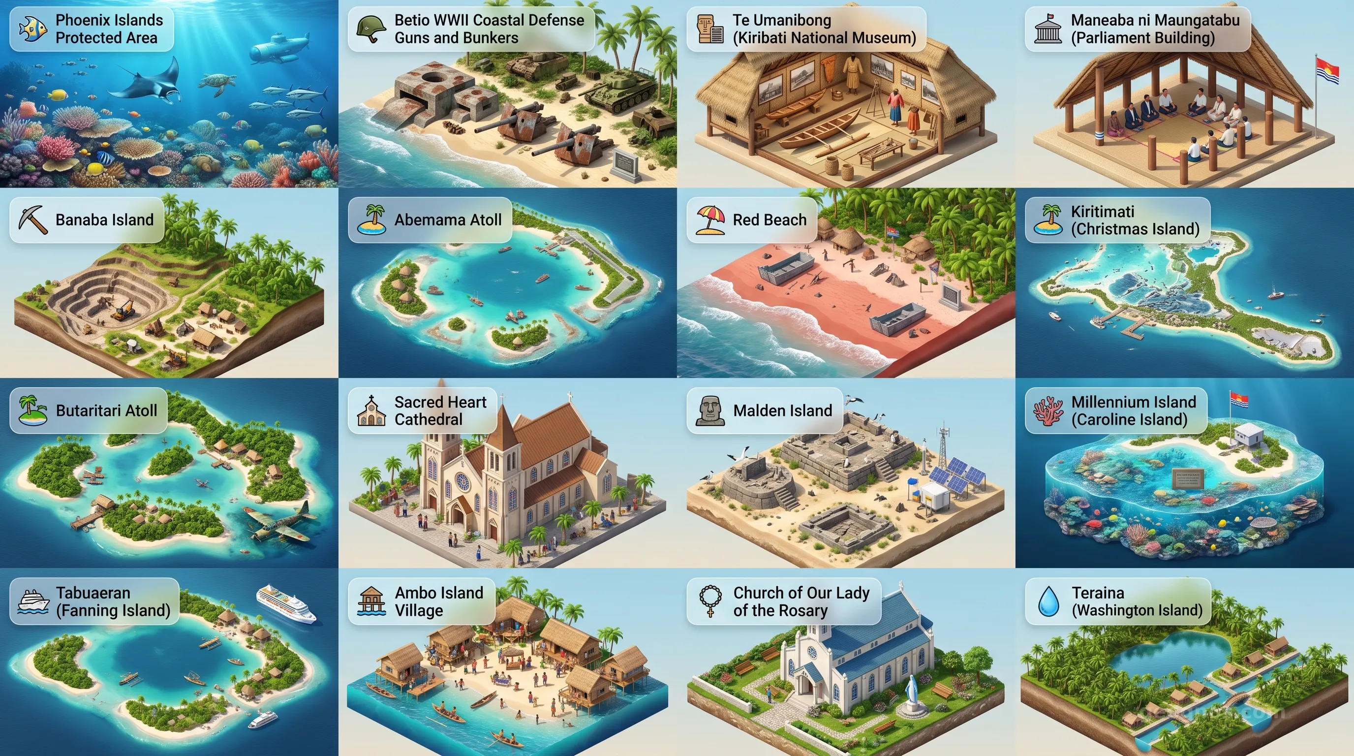
Kiribati - Panoramic Places of Interest Atlas including Phoenix Islands Protected Area (PIPA), Betio WWII Coastal Defense Guns and Bunkers, Te Umanibong (Kiribati National Museum), Maneaba ni Maungatabu (Parliament Building), Banaba Island, Abemama Atoll, Red Beach, Kiritimati (Christmas Island), Butaritari Atoll, Sacred Heart Cathedral, Malden Island, Millennium Island (Caroline Island), Tabuaeran (Fanning Island), Ambo Island Village, Church of Our Lady of the Rosary, Teraina (Washington Island)

Top Sights & Landmarks

01

Phoenix Islands Protected Area (PIPA)

Vast Marine Wilderness

02

Betio WWII Coastal Defense Guns and Bunkers

Relics of the Pacific War

03

Te Umanibong (Kiribati National Museum)

Heart of Gilbertese Heritage

04

Maneaba ni Maungatabu (Parliament Building)

Modern Gilbertese Governance

05

Banaba Island

The Phosphate Island

06

Abemama Atoll

Isle of Stevenson and Kings

07

Red Beach

Site of the Tarawa Landings

08

Kiritimati (Christmas Island)

World's Largest Coral Atoll

09

Butaritari Atoll

The Lush Atoll and Makin Raid

10

Sacred Heart Cathedral

Catholic Center of Kiribati

11

Malden Island

Mysterious Polynesian Marae

12

Millennium Island (Caroline Island)

First Sunrise of the Millennium

13

Tabuaeran (Fanning Island)

The Footprint Lagoon

14

Ambo Island Village

Ground Zero for Climate Change

15

Church of Our Lady of the Rosary

Coral Stone Mission

16

Teraina (Washington Island)

Freshwater Lake on an Atoll

The Saltwater Horizon: An Odyssey Through the Heart of Kiribati

To arrive in Kiribati is to redefine one’s understanding of geography. Scattered across three and a half million square kilometers of the deep blue Pacific, this nation does not simply exist on a map; it exists as a breath between the sky and the sea. Comprising thirty-three coral atolls and islands, Kiribati is the only country on Earth to straddle both the equator and the International Date Line. It is a place where the sun rises upon the world, offering humanity its first glimpse of each new day. Here, the boundary between the firmament and the ocean feels permeable, and the life of the I-Kiribati people is woven tightly into the shifting tides of the vast Pacific.

For the traveler or the scholar, Kiribati is a study in grace and resilience. It is a nation that asks us to contemplate the delicate equilibrium of life on islands that rise only a few meters above sea level. This is not merely a collection of islands, but a sophisticated maritime civilization with a deep cultural heritage, a rhythmic history, and a future that challenges the global imagination. To truly comprehend this nation, one must dive deep into the layers of its existence, starting with the formative experiences that have shaped its identity. For those seeking a deeper dive into the foundations of this unique Pacific jewel, we invite you to explore the comprehensive history of Kiribati, a curated narrative that traces the archipelago from ancestral settlement to the present day.

A Maritime Sovereignty Defined by Distance

Kiribati is often misunderstood by those who measure power by land mass alone. Across its sprawling maritime territory, which includes the Gilbert, Phoenix, and Line Islands, the country possesses a spirit that defies its small terrestrial footprint. Its isolation has preserved a language, te taetae ni Kiribati, and a vibrant set of social customs that remain steadfastly oriented toward community, collective responsibility, and ancestral wisdom. Life here is dictated by the coconut palm, the outrigger canoe, and the bountiful lagoon, providing a lifestyle that reflects the essential virtues of harmony with the natural environment.

As you traverse this vast, watery realm, you encounter landscapes that seem carved from dreams—pristine lagoons, phosphate-rich soils, and narrow strips of land fringed with brilliant white sand. To better understand how the islanders have negotiated their space within the immense Pacific, it is helpful to visualize the progression of their journey through the ages. We recommend that students and researchers challenge themselves with our interactive history puzzle, which organizes the pivotal turning points of the nation into a cohesive chronology, earning rewards as you master the timeline.

The Living Heritage: Between Memory and Horizon

History in Kiribati is not trapped in dusty ledgers. It lives in the chants of the maneaba (the traditional communal meeting house), the intricacies of traditional dance, and the oral traditions that connect the current generations to the first navigators who navigated by the stars to settle these remote atolls. It is a history of profound discovery, colonial encounters, and the steadfast assertion of a proud Pacific identity. Seeing this heritage captured visually offers a unique lens through which to understand the soul of the islands. To experience these stories in a more dynamic way, you can access our immersive history cinematic showcase, which weaves together archival illustrations and expert commentary to narrate the chronicles of this nation.

The geography of Kiribati is as much a subject of artistic wonder as it is of scientific fascination. The sheer variety of atoll structures, from the heavily populated urban centers of Tarawa to the desolate, protected beauty of the Phoenix Islands Protected Area, creates a canvas of stunning visual depth. Whether you are planning a journey to visit these distant shores or researching the environmental and cultural diversity of the islands, witnessing these vistas firsthand is an essential step. We encourage you to discover the splendor of the nation by viewing our POI cinematic showcase, a gallery of high-definition imagery that highlights the most significant geographical and cultural landmarks across the archipelago.

The Moral Geography of the Twenty-First Century

The contemporary narrative of Kiribati is inextricably linked to the environment. As a nation located at the frontline of global sea-level changes, it has become a central point of global discourse regarding climate adaptation and human agency. Yet, the people of Kiribati are far from passive observers. They are leading, innovating, and teaching the rest of the world about resilience. Their approach to sustainable living, land stewardship, and community migration patterns offers a blueprint for how a culture can maintain its dignity and integrity in the face of shifting environmental paradigms.

Understanding Kiribati requires a departure from traditional geopolitical maps. One must look instead at the "blue economy" and the immense exclusive economic zone that gives Kiribati significant influence in international maritime waters. It is a country that thrives on a philosophy of te mauri, te raoi, ao te tabomoa (health, peace, and prosperity). By embracing these values, the I-Kiribati have maintained a society that prioritizes human connection and sustainable harmony with the sea. As GeoGnos.com guides you through the geography, economy, and societal structures of this fascinating country, keep in mind that the map you see is always changing, shifting, and growing with the tides.

As you read through the subsequent sections of this country page—from the 3d diorama of our island structures to the nuances of our national government and energy strategies—remember that every piece of data is part of a larger story. It is a story of a resilient people who have anchored their identity not just to the coral beneath their feet, but to the endless horizons of the vast, life-giving ocean. Kiribati invites us all to broaden our perspective, look toward the horizon, and appreciate the immense complexity held within the small, shimmering jewels of the Pacific.
Location

Latitude
1.4167° N
Longitude
173° E
N S W E
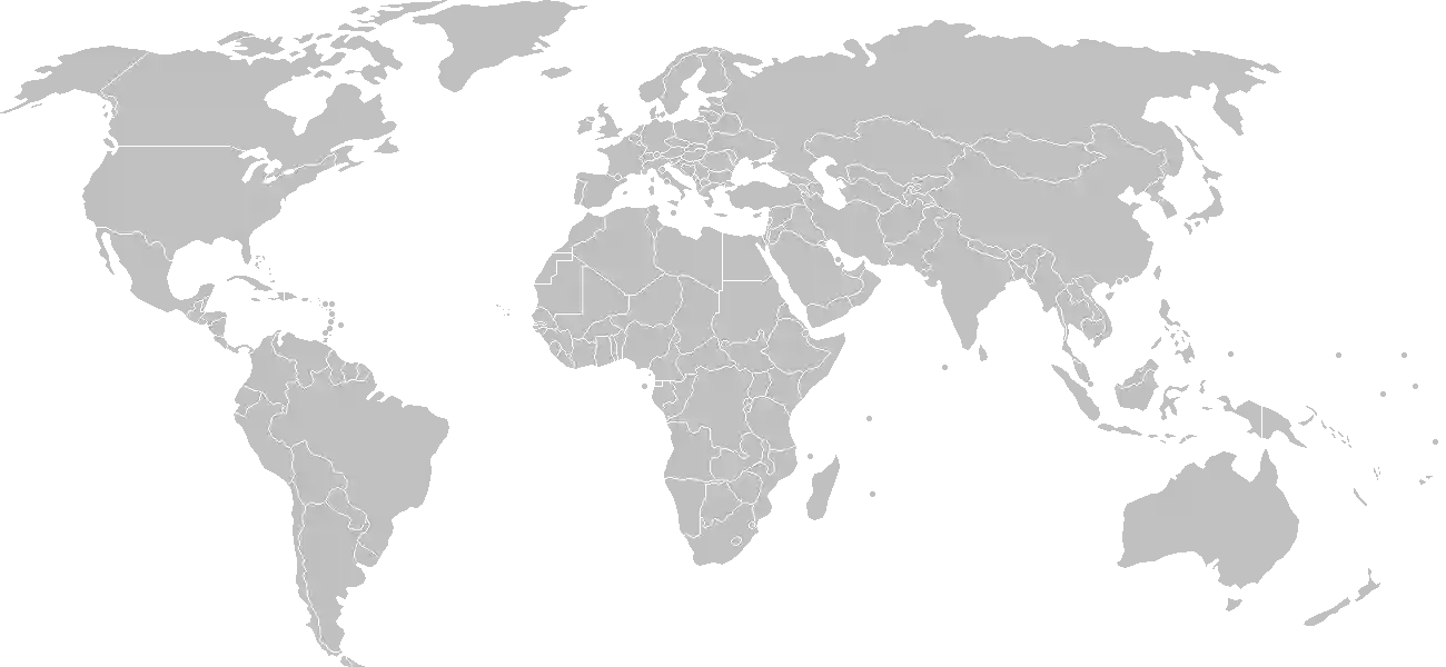
World Map Location
Geographic Location

Oceania, group of 32 coral atolls and one raised coral island in the Pacific Ocean, straddling the Equator; the capital Tarawa is about halfway between Hawaii and Australia

Map Reference
Oceania

Area

Total Area
811 sq km
Land (100%)
Land: 811 sq km
Water: 0 sq km

Elevation

Highest Point
unnamed elevation on Banaba
unnamed elevation on Banaba 81 m
Lowest Point
Pacific Ocean
Pacific Ocean 0 m
Mean Elevation
2 m

Detailed Geography Information

Coastline

1,143 km

Geography - note

21 of the 33 islands are inhabited; Banaba (Ocean Island) in Kiribati is one of the three great phosphate rock islands in the Pacific Ocean -- the others are Makatea in French Polynesia, and Nauru; Kiribati is the only country in the world to fall into all four hemispheres (northern, southern, eastern, and western)

Irrigated land

0 sq km (2022)

Land boundaries

total: 0 km

Maritime claims

territorial sea: 12 nm exclusive economic zone: 200 nm

Natural hazards

typhoons can occur any time, but usually November to March; occasional tornadoes; low level of some of the islands make them sensitive to changes in sea level

Natural resources

phosphatecoconutsfish

Terrain

mostly low-lying coral atolls surrounded by extensive reefs

Population & Growth

+1.00% Growth
117,702
Total inhabitants (2025 est.)
Male: 48.3% (56,866) Female: 51.7% (60,836)

Age Distribution

0-14 years
26.8%
~31,544
15-64 years
67.9%
~79,920
65 years
5.4%
~6,356
Note: 2024 est.

Demographic Longevity

Median Age
27.7 years
Male
26.4 yrs
Female
28.2 yrs
Life Expectancy
68.5 years
Male
65.9 yrs
Female
71.3 yrs

Vital Dynamics

Birth Rate
19.4
births per 1,000 people
Death Rate
6.88
deaths per 1,000 people
Net Migration
-2.75
migrants per 1,000 people
Fertility Rate
2.13
children born per woman

Detailed People & Society Information

Alcohol consumption per capita

0.43 liters of pure alcohol (2019 est.)

Children under the age of 5 years underweight

6.9% (2018 est.)

Currently married women (ages 15-49)

67.4% (2020 est.)

Dependency ratios

total dependency ratio: 47.2 (2025 est.) youth dependency ratio: 39.1 (2025 est.) elderly dependency ratio: 8.2 (2025 est.) potential support ratio: 12.2 (2025 est.)

Education expenditure

16.4%

16.4% of GDP (2023 est.) 20.1% national budget (2024 est.)

Ethnic groups

I-Kiribati
95.78%
I-Kiribati/mixed
3.8%
Tuvaluan
0.2%
other
1.7%

Gross reproduction rate

1.04 (2025 est.)

Health expenditure

14.8%

14.8% of GDP (2021) 9.7% of national budget (2022 est.)

Hospital bed density

1.9 beds/1,000 population (2016 est.)

Infant mortality rate

total: 30.8 deaths/1,000 live births (2025 est.) male: 33.5 deaths/1,000 live births female: 29.4 deaths/1,000 live births

Languages

Literacy

total population: 98.6% (2020 est.) male: 98.6% (2020 est.) female: 98.9% (2020 est.)

Major urban areas - population

64,000 TARAWA (capital) (2018)

Maternal mortality ratio

80 deaths/100,000 live births (2023 est.)

Mother's mean age at first birth

23.1 years (2009 est.) note: data represents median age at first birth among women 25-29

Nationality

noun: I-Kiribati (singular and plural) adjective: Kiribati

Obesity - adult prevalence rate

46% (2016)

Physician density

0.2 physicians/1,000 population (2013)

Population distribution

consists of three archipelagos spread out over an area roughly the size of India; the eastern Line Islands and central Phoenix Islands are sparsely populated, but the western Gilbert Islands are some of the most densely settled places on earth, with the main island of South Tarawa boasting a population density similar to Tokyo or Hong Kong

Religions

Roman Catholic
58.9%
Kiribati Uniting Church
21.2%
Kiribati Protestant Church
8.4%
Church of Jesus Christ
5.6%
Seventh Day Adventist
2.1%
Baha'i
2.1%
other
1.7%

Sex ratio

at birth: 1.05 male(s)/female 0-14 years: 1.04 male(s)/female 15-64 years: 0.93 male(s)/female 65 years and over: 0.63 male(s)/female total population: 0.94 male(s)/female (2024 est.)

Tobacco use

total: 35.4% (2025 est.) male: 48.4% (2025 est.) female: 23.6% (2025 est.)

Climate & Issues

Climate Profile

tropical; marine, hot and humid, moderated by trade winds

Key Environmental Issues
heavy pollution in lagoon of south Tarawa atoll due to overcrowding mixed with traditional practices such as lagoon latrines and open-pit dumping coastal erosion

Land Cover

Coverage Distribution
Agri (42%)
Other (57%)
Arable: 2.5%
Crops: 39.5%
Pasture: 0.0%
Forest: 1.3%

Air & Carbon Emissions

Annual CO2 Output 2023 est.
81,000
Coal (0%) Oil (100%) Gas (0%)
PM2.5 Exposure 8 µg/m³
0 5 (WHO Limit) 15 25 35+

Detailed Environmental Information

International environmental agreements

BiodiversityClimate ChangeClimate Change-Kyoto ProtocolClimate Change-Paris AgreementComprehensive Nuclear Test BanDesertificationHazardous WastesLaw of the SeaMarine Dumping-London ConventionOzone Layer ProtectionShip PollutionWetlandsWhaling

Urbanization

urban population: 57.8% of total population (2023) rate of urbanization: 2.77% annual rate of change (2020-25 est.)

Waste and recycling

municipal solid waste generated annually: 35,700 tons (2024 est.) percent of municipal solid waste recycled: 15.4% (2022 est.)

Capital & State Profile

Capital City
Tarawa
1.35° N, 173.0333° E
Timezone UTC+12
Government Type
presidential republic
Independence 1979-07-12
National Holiday 07-12

Executive Branch

Chief of State
President Taneti MAAMAU (since 11 March 2016)
Head of Government
President Taneti MAAMAU (since 11 March 2016)
Last Election 25 October 2024
Next Election 2028
Cabinet Cabinet appointed by the president from among House of Assembly members

Legislative Branch

unicameral
Legislature Name House of Assembly (Maneaba Ni Maungatabu)
Seats & Term
45 (44 directly elected; 1 appointed) seats / 4 years
Women in Chamber
11.1% Representation
Electoral System plurality/majority

National Identity & Symbols

National Flag Description

the upper half is red with a yellow frigatebird flying over a yellow rising sun, and the lower half is blue with three wavy horizontal white stripes to represent the Pacific Ocean

Symbolic Meaning the white stripes represent the Gilbert, Line, and Phoenix island groups; the 17 rays of the sun represent the 16 Gilbert Islands and Banaba (formerly Ocean Island); the frigatebird symbolizes authority and freedom
National Symbol frigatebird
National Colors red, white, blue, yellow
National Anthem Teirake kaini Kiribati (Stand Up, Kiribati)

Detailed Government Information

Administrative divisions

3 geographical units: Gilbert Islands, Line Islands, Phoenix Islands; there are no first-order administrative divisions, but the 6 districts are Banaba, Central Gilberts, Line Islands, Northern Gilberts, Southern Gilberts, Tarawa, with 21 island councils on Abaiang, Abemama, Aranuka, Arorae, Banaba, Beru, Butaritari, Kanton, Kiritimati, Kuria, Maiana, Makin, Marakei, Nikunau, Nonouti, Onotoa, Tabiteuea, Tabuaeran, Tamana, Tarawa, Teraina

Citizenship

citizenship by birth: no citizenship by descent only: at least one parent must be a native-born citizen of Kiribati dual citizenship recognized: no residency requirement for naturalization: 7 years

Constitution

history: The Gilbert and Ellice Islands Order in Council 1915, The Gilbert Islands Order in Council 1975 (pre-independence); latest promulgated 12 July 1979 (at independence) amendment process: proposed by the House of Assembly; passage requires two-thirds majority vote by the Assembly membership; passage of amendments affecting the constitutional section on amendment procedures and parts of the constitutional chapter on citizenship requires deferral of the proposal to the next Assembly meeting where approval is required by at least two-thirds majority vote of the Assembly membership and support of the nominated or elected Banaban member of the Assembly; amendments affecting the protection of fundamental rights and freedoms also requires approval by at least two-thirds majority in a referendum

Country name

conventional long form: Republic of Kiribati conventional short form: Kiribati local long form: Republic of Kiribati local short form: Kiribati former: Gilbert Islands etymology: the name is the local pronunciation of "Gilbert," the former designation of the islands; originally named after explorer Thomas GILBERT, who mapped many of the islands in 1788 note: pronounced keer-ree-bahss

International law organization participation

has not submitted an ICJ jurisdiction declaration; non-party state to the ICCt

International organization participation

Judicial branch

highest court(s): High Court (consists of a chief justice and other judges as prescribed by the president) judge selection and term of office: chief justice appointed by the president on the advice of the cabinet in consultation with the Public Service Commission (PSC); other judges appointed by the president on the advice of the chief justice along with the PSC subordinate courts: Court of Appeal; magistrates' courts

Legal system

English common law supplemented by customary law

National heritage

total World Heritage Sites: 1 (natural) selected World Heritage Site locales: Phoenix Islands Protected Area

Political parties

Boutokaan Kiribati Moa Party or BKM Kiribati Moa Party or KMP Kamanoan Kiribati Party or KKP Tobwaan Kiribati Party or TKP

Suffrage

18 years of age; universal

Economic Overview

lower-middle income, Pacific island economy; environmentally fragile; sizable remittances; key phosphate mining fund; tourism and fishing industries; public sector-dominated economy; recent withdrawal from Pacific Islands Forum; ongoing constitutional crisis

Size & Performance

Real GDP (PPP)
$438.143 million
Latest available estimate (2024)
2023: $416.221 million2022: $405.468 million
Real GDP Growth
5.3% (2024 est.)
+5.3%
GDP Per Capita (PPP)
$3,300
2023: $3,1002022: $3,100

GDP Sector Breakdown

Agriculture: 27.8%Industry: 9.9%Services: 65.7%
Origin GDP %
Agriculture 27.8%
Industry 9.9%
Services 65.7%

Trade Balance

Trade Position
Trade Deficit
$276.52 million
Total Exports
$17.099 million (2023 est.)
Total Imports
$293.624 million (2023 est.)
Exports (6%) Imports (94%)

Budget Balance

Budget Position
Budget Deficit
-$4.18 million
Revenues
$260.557 million (2023 est.)
Expenditures
$264.736 million (2023 est.)
Revenues (50%) Expenditures (50%)

Export Profile

Top Export Partners

Note: 2023; top five export partners based on percentage share of exports

Major Export Commodities

fishcoconut oil

Import Profile

Top Import Partners

24.0%
15.0%
7.0%
6.0%
Note: 2023; top five import partners based on percentage share of imports

Major Import Commodities

shipscentrifugesrefined petroleumriceraw sugar

Labor & Employment

Population Below Poverty Line 21.9% (2019 est.)

Income Inequality

Gini Coefficient (Family Income) 27.8
0 (Perfect Equality) Low Inequality 100 (Perfect Inequality)

Family Income / Consumption Share

Lowest 10%: 4% (2019 est.) Highest 10%: 22.8% (2019 est.)
Inequality Gap: Top 10% holds 5.7x the share of the bottom 10%.

Detailed Economic Data

Agricultural products

coconutsbananasvegetablestarotropical fruitsporkchickennutseggspork offal

Current account balance

-$5.117 million (2023 est.) -$32.523 million (2022 est.) $20.251 million (2021 est.) note: balance of payments - net trade and primary/secondary income in current dollars

Exchange rates

Australian dollars (AUD) per US dollar - Exchange rates: 1.515 (2024 est.) 1.505 (2023 est.) 1.442 (2022 est.) 1.331 (2021 est.) 1.453 (2020 est.) note: the Australian dollar circulates as legal tender

GDP - composition, by end use

Industrial production growth rate

-6.2% (2022 est.) note: annual % change in industrial value added based on constant local currency

Industries

fishinghandicrafts

Inflation rate (consumer prices)

9.3% (2023 est.) 5.3% (2022 est.) 2.1% (2021 est.) note: annual % change based on consumer prices

Remittances

4% of GDP (2023 est.) 10.4% of GDP (2022 est.) 4.7% of GDP (2021 est.) note: personal transfers and compensation between resident and non-resident individuals/households/entities

Taxes and other revenues

17.7% (of GDP) (2023 est.) note: central government tax revenue as a % of GDP

Grid Infrastructure

Electricity Access 94.4%
Urban: 86% Rural: 94.3%
Capacity 12,000 kW (2023 est.)
Consumption 27.388 million kWh (2023 est.)
Grid Losses: 5 million kWh (2023 est.)

Generation Mix

Percentage Share of Production
fossil fuels 81.5%
solar 18.5%

Fossil Fuels Production

Petroleum
Consumption 500 bbl/day (2023 est.)

Intensity & Nuclear

Energy Consumption Per Capita 8.578 million Btu/person (2023 est.)
No nuclear energy infrastructure or reactor operations reported in this country dossier.

Digital Access

.ki
Internet Usage 88%

Active internet users as a percentage of the total population.

Fixed Broadband

Penetration Rate 0 / 100
Total Subscriptions 0 (2023 est.)

Mobile Cellular

Penetration Rate 54 / 100
Total Subscriptions 72,000 (2024 est.)

Broadcast Media

multi-channel TV packages provide access to Australian and US stations; 1 government-operated radio station broadcasts on AM, FM, and shortwave (2017)

Aviation

T3
Airports
21
As of 2025

Ports & Harbors

Ports Count 3
Hover for breakdown & key ports As of 2024

Merchant Marine

Commercial Fleet
74 ships
Hover for vessel types breakdown As of 2023

Service & Defense Details

Military and security forces

Kiribati Police Service (includes Maritime Police) (2025)

Military - note

Australia, NZ, and the US have provided security assistance; Kiribati has a "ship rider" agreement with the US, which allows local maritime law enforcement officers to embark on US Coast Guard (USCG) and US Navy (USN) vessels, including to board and search vessels suspected of violating laws or regulations within Kiribati's designated exclusive economic zone (EEZ) or on the high seas; ship rider agreements also enable USCG personnel and USN vessels with embarked USCG law enforcement personnel to work with host nations to protect critical regional resources (2025)