🇱🇸

Lesotho

Africa • Countries
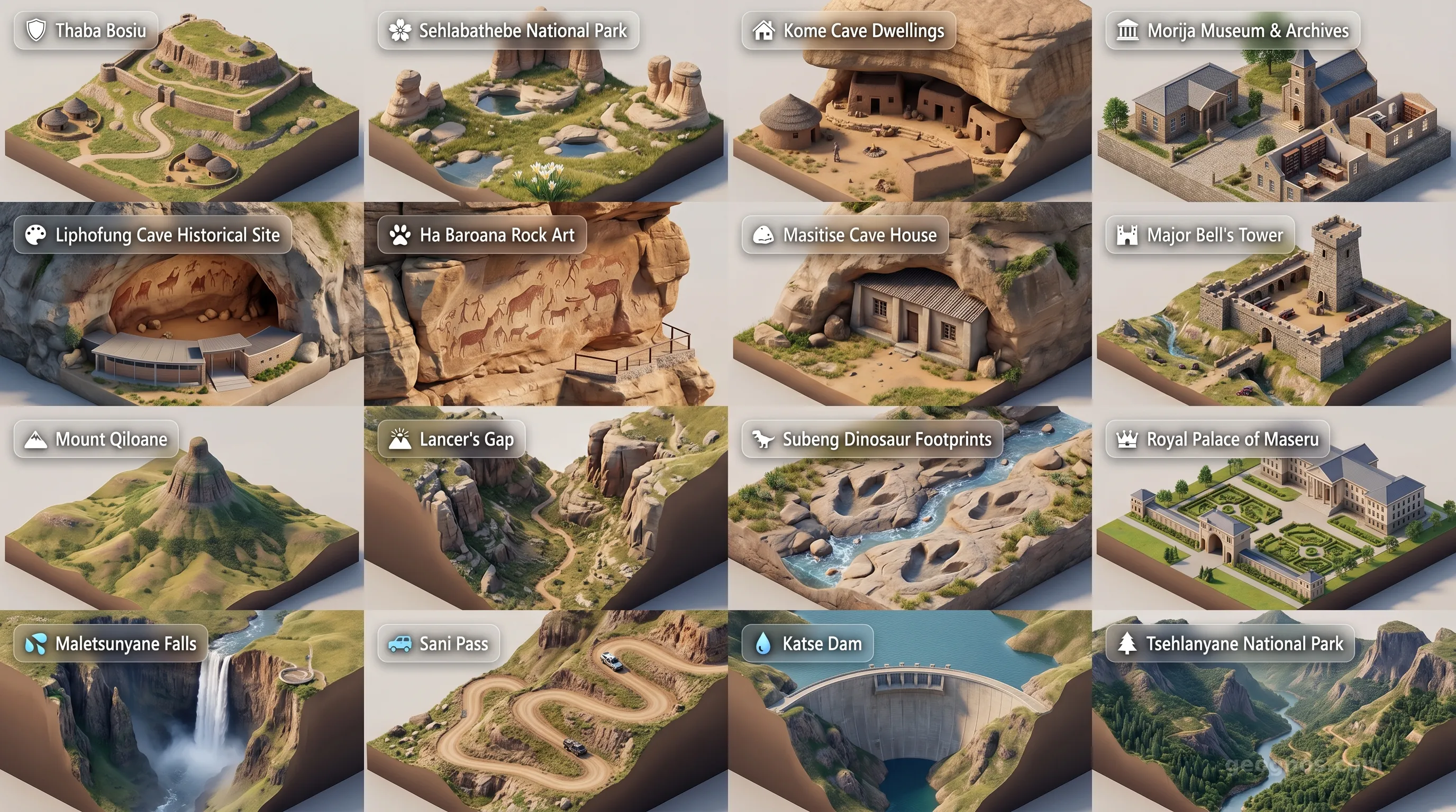
Lesotho - Panoramic Places of Interest Atlas including Thaba Bosiu, Sehlabathebe National Park, Kome Cave Dwellings, Morija Museum & Archives, Liphofung Cave Historical Site, Ha Baroana Rock Art, Masitise Cave House, Major Bell's Tower, Mount Qiloane, Lancer's Gap, Subeng Dinosaur Footprints, Royal Palace of Maseru, Maletsunyane Falls, Sani Pass, Katse Dam, Tsehlanyane National Park

Top Sights & Landmarks

01

Thaba Bosiu

Birthplace of the Basotho Nation

02

Sehlabathebe National Park

Lesotho's Transboundary Wilderness

03

Kome Cave Dwellings

Living History Built into Rock

04

Morija Museum & Archives

The Memory of a Nation

05

Liphofung Cave Historical Site

Ancient Rock Art and Royal Refuge

06

Ha Baroana Rock Art

Home of the Bushmen

07

Masitise Cave House

A 19th-Century Missionary Marvel

08

Major Bell's Tower

A Relic of the Gun War

09

Mount Qiloane

The Mountain that Inspired a Nation

10

Lancer's Gap

Historic Battlefield and Scenic Pass

11

Subeng Dinosaur Footprints

Walk in Prehistoric Footsteps

12

Royal Palace of Maseru

Seat of the Basotho Monarchy

13

Maletsunyane Falls

A Plunge into the Abyss

14

Sani Pass

The Mother of All Mountain Passes

15

Katse Dam

An Engineering Marvel in the Highlands

16

Tsehlanyane National Park

Lesotho's Largest Nature Reserve

The Kingdom in the Clouds

To stand in Lesotho is to stand closer to the heavens than anywhere else in southern Africa. While most nations define themselves by their coastal frontiers or their flat, accessible plains, Lesotho claims its identity through verticality. It is a nation of extremes, a high-altitude bastion where the earth rises to meet the sky in a series of jagged, windswept peaks. Often referred to as the Kingdom in the Clouds, this landlocked nation is completely encircled by its much larger neighbor, South Africa. Yet, do not mistake its internal position for a lack of autonomy. Lesotho’s geography has served as a formidable fortress, shaping a culture of resilience, independence, and a unique way of life that defies the gravitational pull of the lowlands surrounding it.

The soul of Lesotho is not found in cities or infrastructure, but in the silence of the Maloti Mountains and the persistent rhythm of Basotho life. Here, the air is thin, the light is piercingly clear, and the culture is inextricably woven into the rugged terrain. To understand how this small kingdom maintained its distinct identity against the tide of regional change, one must explore the history of Lesotho, a narrative defined by diplomacy, mountain warfare, and the visionary leadership of King Moshoeshoe I.

A Fortress Built of Granite and History

The story of the Basotho people is one of strategic geography. In the early 19th century, amid the turbulence of the Lifaqane wars, King Moshoeshoe I recognized the defensive potential of the Thaba Bosiu plateau. By retreating to this "mountain of night," he was able to consolidate his people, offer refuge to displaced clans, and build a nation from a singular, elevated stronghold. The terrain itself acted as an ally, frustrating invaders and providing the space for a unique cultural synthesis to emerge.

For students and history enthusiasts looking to test their knowledge of this resilience, we invite you to participate in our history puzzle. This interactive challenge allows you to arrange the defining moments of Basotho history in chronological order. Beyond the academic exercise, if you wish to see these milestones brought to life, you can view our history cinematic showcase, which blends period illustrations with vivid accounts of how this mountain kingdom navigated the complexities of the 19th and 20th centuries to preserve its sovereignty.

Life Among the Peaks

Living at an average elevation higher than any other country in the world dictates the rhythms of existence in Lesotho. Winters are harsh, bringing blankets of snow to the Sani Pass, while summers ignite the valleys with lush, verdant pastures. The Basotho people are master equestrians, and in many remote regions, the iconic Basotho pony is still the most reliable form of transport through the winding, craggy mountain paths. This deep-seated connection to the land is a vital part of the Basotho heritage, which remains proudly preserved in local textiles, specifically the intricately patterned Sotho blankets that serve as both protection against the mountain chill and as vital symbols of status and cultural identity.

As you plan your journey—be it a physical trek across the Highlands or a digital exploration from your classroom—there is no better way to familiarize yourself with the topography and wonder of this landscape than to watch our POI cinematic showcase. This visual tour guides you through the highlights of the nation, from the awe-inspiring Maletsunyane Falls, which plummet into a sheer gorge, to the ancient petrified footprints left by prehistoric dinosaurs etched into the sedimentary rock of the highlands.

The Sustainable Highland Future

Today, the Kingdom in the Clouds finds itself in a pivotal position regarding regional resources. Because of its extreme elevation, Lesotho acts as the primary water tower for southern Africa. Through the ambitious Lesotho Highlands Water Project, the country captures the crystalline runoff of its mountain peaks to supply the thirsty industrial and residential centers of neighboring South Africa. This act of geography—a high-altitude fountain feeding a thirsty continent—highlights how Lesotho’s unique environmental profile serves as its most precious asset.

As visitors or students study the map, it becomes clear that Lesotho is not merely a high-altitude island. It is a vital, living component of the global ecosystem. Whether one is investigating the geological wonders of the Drakensberg range or analyzing the socioeconomic impacts of life in a landlocked mountain state, Lesotho offers a lesson in adaptation. It demonstrates that being surrounded by borders does not imply enclosure. For the Basotho, the mountains do not wall the nation off from the world; rather, they provide the vantage point from which the world can be viewed with clarity. We hope this exploration serves as your first step toward mastering the complexities and the undeniable beauty of this extraordinary nation.
Location

Latitude
-29.5° N
Longitude
28.5° E
N S W E
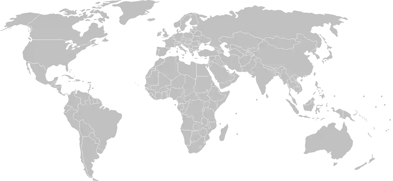
World Map Location
Geographic Location

Southern Africa, an enclave of South Africa

Map Reference
Africa

Area

Total Area
30,355 sq km
Land (100%)
Land: 30,355 sq km
Water: 0 sq km

Elevation

Highest Point
Thabana Ntlenyana
Thabana Ntlenyana 3,482 m
Lowest Point
junction of the Orange and Makhaleng Rivers
junction of the Orange and Makhaleng Rivers 1,400 m
Mean Elevation
2,161 m

Detailed Geography Information

Coastline

0 km (landlocked)

Geography - note

landlocked, surrounded by South Africa; mountainous, more than 80% of the country is 1,800 m (5,900 ft) above sea level

Irrigated land

12 sq km (2013)

Land boundaries

Total boundary: 1,106 km
South Africa 1106 km

Major rivers (by length in km)

Orange river source (shared with South Africa and Namibia [m]) - 2,092 km note: [s] after country name indicates river source; [m] after country name indicates river mouth

Major watersheds (area sq km)

Atlantic Ocean drainage: Orange (941,351 sq km)

Maritime claims

none (landlocked)

Natural hazards

periodic droughts

Natural resources

wateragricultural and grazing landdiamondssandclaybuilding stone

Terrain

mostly highland with plateaus, hills, and mountains

Population & Growth

+0.70% Growth
2,222,962
Total inhabitants (2025 est.)
Male: 49.5% (1,099,314) Female: 50.5% (1,123,648)

Age Distribution

0-14 years
32.0%
~711,348
15-64 years
62.7%
~1,393,797
65 years
5.4%
~120,040
Note: 2024 est.

Demographic Longevity

Median Age
24 years
Male
23.4 yrs
Female
24.3 yrs
Life Expectancy
60.2 years
Male
58.1 yrs
Female
62.3 yrs

Vital Dynamics

Birth Rate
21.68
births per 1,000 people
Death Rate
10.2
deaths per 1,000 people
Net Migration
-4.21
migrants per 1,000 people
Fertility Rate
2.49
children born per woman

Detailed People & Society Information

Alcohol consumption per capita

3.56 liters of pure alcohol (2019 est.)

Children under the age of 5 years underweight

12.5% (2024 est.)

Currently married women (ages 15-49)

46.9% (2021 est.)

Dependency ratios

total dependency ratio: 56.8 (2025 est.) youth dependency ratio: 48.2 (2025 est.) elderly dependency ratio: 8.6 (2025 est.) potential support ratio: 11.6 (2025 est.)

Education expenditure

6.6%

6.6% of GDP (2024 est.) 10.4% national budget (2024 est.)

Ethnic groups

Sotho
99.7%
other (includes Kwena
0.3%

Gross reproduction rate

1.23 (2025 est.)

Health expenditure

10.2%

10.2% of GDP (2021) 13.1% of national budget (2022 est.)

Infant mortality rate

total: 52.2 deaths/1,000 live births (2025 est.) male: 51 deaths/1,000 live births female: 40.2 deaths/1,000 live births

Languages

Literacy

total population: 90.4% (2024 est.) male: 83.2% (2024 est.) female: 96.6% (2024 est.)

Major urban areas - population

202,000 MASERU (capital) (2018)

Maternal mortality ratio

478 deaths/100,000 live births (2023 est.)

Mother's mean age at first birth

20.9 years (2014 est.) note: data represents median age at first birth among women 25-49

Nationality

noun: Mosotho (singular), Basotho (plural) adjective: Basotho

Obesity - adult prevalence rate

16.6% (2016)

Physician density

0.24 physicians/1,000 population (2022)

Population distribution

relatively higher population density in the western half of the nation, with the capital of Maseru and the smaller cities of Mafeteng, Teyateyaneng, and Leribe attracting the most people, as shown in this population distribution map

Refugees and internally displaced persons

Total Displaced & Vulnerable Persons
610 individuals
Refugees
100.0%
610
610 (2024 est.)

Religions

Protestant (Pentecostal
47.8%
Lesotho Evangelical
17.3%
Anglican
7.4%
Roman Catholic
39.3%
other Christian
9.1%
non-Christian
1.4%
none
2.3%

School life expectancy (primary to tertiary education)

total: 11 years (2017 est.) male: 11 years (2017 est.) female: 11 years (2017 est.)

Sex ratio

at birth: 1.03 male(s)/female 0-14 years: 1.01 male(s)/female 15-64 years: 1 male(s)/female 65 years and over: 0.59 male(s)/female total population: 0.98 male(s)/female (2024 est.)

Tobacco use

total: 22.8% (2025 est.) male: 42.4% (2025 est.) female: 4.1% (2025 est.)

Climate & Issues

Climate Profile

temperate; cool to cold, dry winters; hot, wet summers

Key Environmental Issues
overgrazing severe soil erosion soil exhaustion desertification Highlands Water Project controls, stores, and redirects water to South Africa

Land Cover

Coverage Distribution
Agri (78%)
Other (21%)
Arable: 11.8%
Crops: 0.1%
Pasture: 65.9%
Forest: 1.1%

Air & Carbon Emissions

Annual CO2 Output 2023 est.
1.148 million
Coal (15%) Oil (85%) Gas (0%)
PM2.5 Exposure 17.4 µg/m³
0 5 (WHO Limit) 15 25 35+

Water Resources & Use

Renewable Water Resources 3.022 billion cubic meters (2022 est.)
Annual Water Withdrawal
municipal: 20 million cubic meters (2022 est.)
Municipal (46%) Ind (46%) Agri (9%)

Detailed Environmental Information

International environmental agreements

BiodiversityClimate ChangeClimate Change-Kyoto ProtocolClimate Change-Paris AgreementComprehensive Nuclear Test BanDesertificationEndangered SpeciesHazardous WastesLaw of the SeaMarine Life ConservationOzone Layer ProtectionWetlands

Urbanization

urban population: 30.4% of total population (2023) rate of urbanization: 2.77% annual rate of change (2020-25 est.)

Waste and recycling

municipal solid waste generated annually: 73,500 tons (2024 est.) percent of municipal solid waste recycled: 11.9% (2022 est.)

Capital & State Profile

Capital City
Maseru
-29.3167° N, 27.4833° E
Timezone UTC+2
Government Type
parliamentary constitutional monarchy
Independence 1966-10-04
National Holiday 10-04

Executive Branch

Chief of State
King LETSIE III (since 7 February 1996)
Head of Government
Prime Minister Ntsokoane Samuel MATEKANE (28 October 2022)
Cabinet consists of the prime minister (appointed by the King on the advice of the Council of State), the deputy prime minister, and 18 other ministers; the prime minister is the leader of the majority party or majority coalition in the National Assembly

Legislative Branch

bicameral
Legislature Name Parliament
Lower Chamber National Assembly
Seats 122 (all directly elected)
Term 5 years
% Women 25%
Parties Composition
Revolution for Prosperity (RFP) 56Democratic Congress (DC) 29All Basotho Convention (ABC) 8Basotho Action Party (BAP) 6Other 20
Upper Chamber Senate
Seats 33 (11 appointed)
Term 5 years
% Women 21.2%

National Identity & Symbols

National Flag Description

three horizontal stripes of blue (top), white, and green; centered on the white stripe is a black mokorotlo, a traditional Basotho straw hat and national symbol

Symbolic Meaning blue stands for rain, white for peace, and green for prosperity
National Symbol mokorotio (Basotho hat)
National Colors blue, white, green, black
National Anthem Lesotho fatse la bo ntata rona (Lesotho, Land of Our Fathers)

Detailed Government Information

Administrative divisions

10 districts; Berea, Butha-Buthe, Leribe, Mafeteng, Maseru, Mohale's Hoek, Mokhotlong, Qacha's Nek, Quthing, Thaba-Tseka

Citizenship

citizenship by birth: yes citizenship by descent only: yes dual citizenship recognized: no residency requirement for naturalization: 5 years

Constitution

history: previous 1959, 1967; latest adopted 2 April 1993 (effectively restoring the 1967 version) amendment process: proposed by Parliament; passage of amendments affecting constitutional provisions, including fundamental rights and freedoms, sovereignty of the kingdom, the office of the king, and powers of Parliament, requires a majority vote by the National Assembly, approval by the Senate, approval in a referendum by a majority of qualified voters, and assent of the king; passage of amendments other than those specified provisions requires at least a two-thirds majority vote in both houses of Parliament

Country name

conventional long form: Kingdom of Lesotho conventional short form: Lesotho local long form: Kingdom of Lesotho local short form: Lesotho former: Basutoland etymology: the name comes from the Sotho people, whose name means "dark-skinned;" Le- is a singular noun prefix; the former name, Basutoland, uses the plural noun prefix, Ba-

International law organization participation

accepts compulsory ICJ jurisdiction with reservations; accepts ICCt jurisdiction

International organization participation

Judicial branch

highest court(s): Court of Appeal (consists of the court president, such number of justices of appeal as set by Parliament, and the Chief Justice and the puisne judges of the High Court ex officio); High Court (consists of the chief justice and such number of puisne judges as set by Parliament) judge selection and term of office: Court of Appeal president and High Court chief justice appointed by the monarch on the advice of the prime minister; puisne judges appointed by the monarch on advice of the Judicial Service Commission, an independent body of judicial officers and officials designated by the monarch; judges of both courts can serve until age 75 subordinate courts: Magistrate Courts; customary or traditional courts; military courts note: both the Court of Appeal and the High Court have jurisdiction in constitutional issues

Legal system

mixed system of English common law and Roman-Dutch law; High Court and Court of Appeal review legislative acts

National heritage

total World Heritage Sites: 1 (mixed) selected World Heritage Site locales: Maloti-Drakensberg Park

Political parties

All Basotho Convention or ABC Alliance of Democrats or AD Basotho Action Party or BAP Basotho National Party or BNP Democratic Congress or DC Democratic Party of Lesotho or DPL Lesotho People's Congress or LPC Movement of Economic Change or MEC National Independent Party or NIP Popular Front for Democracy of PFD Reformed Congress of Lesotho or RCL

Suffrage

18 years of age; universal

Economic Overview

lower middle-income economy surrounded by South Africa; environmentally fragile and politically unstable; key infrastructure and renewable energy investments; dire poverty; urban job and income losses due to COVID-19; systemic corruption

Size & Performance

Real GDP (PPP)
$6.166 billion
Latest available estimate (2024)
2023: $6 billion2022: $5.893 billion
Real GDP Growth
2.8% (2024 est.)
+2.8%
GDP Per Capita (PPP)
$2,600
2023: $2,6002022: $2,600

GDP Sector Breakdown

Agriculture: 6.5%Industry: 31.0%Services: 48.0%
Origin GDP %
Agriculture 6.5%
Industry 31.0%
Services 48.0%

Trade Balance

Trade Position
Trade Deficit
$1.10 billion
Total Exports
$983.027 million (2024 est.)
Total Imports
$2.083 billion (2024 est.)
Exports (32%) Imports (68%)

Budget Balance

Budget Position
Budget Deficit
-$126.00 million
Revenues
$1.13 billion (2022 est.)
Expenditures
$1.256 billion (2022 est.)
Revenues (47%) Expenditures (53%)

Export Profile

Top Export Partners

Note: 2023; top five export partners based on percentage share of exports

Major Export Commodities

diamondsgarmentswoolpower equipmentbedding

Import Profile

Top Import Partners

Note: 2023; top five import partners based on percentage share of imports

Major Import Commodities

refined petroleumfabrictrucksgarmentscotton fabric

Labor & Employment

Total Labor Force 884,200 (2024 est.)
General Unemployment Rate 16.2%
Youth Unemployment (Ages 15-24) 24.2%
Population Below Poverty Line 49.7% (2017 est.)

Income Inequality

Gini Coefficient (Family Income) 44.9
0 (Perfect Equality) High Inequality 100 (Perfect Inequality)

Family Income / Consumption Share

Lowest 10%: 1.7% (2017 est.) Highest 10%: 32.9% (2017 est.)
Inequality Gap: Top 10% holds 19.4x the share of the bottom 10%.

Detailed Economic Data

Agricultural products

milkpotatoesmaizevegetablesfruitssorghumwheatgame meatbeanswool

Current account balance

$84.393 million (2024 est.) -$151.577 million (2023 est.) -$268.876 million (2022 est.) note: balance of payments - net trade and primary/secondary income in current dollars

Debt - external

$928.019 million (2023 est.) note: present value of external debt in current US dollars

Exchange rates

maloti (LSL) per US dollar - Exchange rates: 18.329 (2024 est.) 18.45 (2023 est.) 16.356 (2022 est.) 14.779 (2021 est.) 16.459 (2020 est.)

GDP - composition, by end use

Industrial production growth rate

2.6% (2024 est.) note: annual % change in industrial value added based on constant local currency

Industries

foodbeveragestextilesapparel assemblyhandicraftsconstructiontourism

Inflation rate (consumer prices)

6.1% (2024 est.) 6.3% (2023 est.) 8.3% (2022 est.) note: annual % change based on consumer prices

Public debt

3% of GDP (2020 est.) note: central government debt as a % of GDP

Remittances

22% of GDP (2024 est.) 22.9% of GDP (2023 est.) 22.6% of GDP (2022 est.) note: personal transfers and compensation between resident and non-resident individuals/households/entities

Reserves of foreign exchange and gold

$1.008 billion (2024 est.) $854.089 million (2023 est.) $771.278 million (2022 est.) note: holdings of gold (year-end prices)/foreign exchange/special drawing rights in current dollars

Taxes and other revenues

30.4% (of GDP) (2022 est.) note: central government tax revenue as a % of GDP

Grid Infrastructure

Electricity Access 50%
Urban: 83.6% Rural: 37.7%
Capacity 104,000 kW (2023 est.)
Consumption 833.009 million kWh (2023 est.)
Imports 453.992 million kWh (2023 est.)
Grid Losses: 102.88 million kWh (2023 est.)

Generation Mix

Percentage Share of Production
hydroelectricity 99.6%
solar 0.3%
fossil fuels 0.1%

Fossil Fuels Production

Petroleum
Consumption 7,000 bbl/day (2023 est.)
Coal
Production 57,000 metric tons (2023 est.)
Consumption 81,000 metric tons (2023 est.)
Exports 1 metric tons (2023 est.)
Imports 24,000 metric tons (2023 est.)

Intensity & Nuclear

Energy Consumption Per Capita 8.117 million Btu/person (2023 est.)
No nuclear energy infrastructure or reactor operations reported in this country dossier.

Digital Access

.ls
Internet Usage 48%

Active internet users as a percentage of the total population.

Fixed Broadband

Penetration Rate 0 / 100
Total Subscriptions 9,000 (2023 est.)

Mobile Cellular

Penetration Rate 70 / 100
Total Subscriptions 1.64 million (2024 est.)

Broadcast Media

1 state-owned TV station and 2 state-owned radio stations; most private broadcast media transmitters are connected to government radio signal towers; satellite TV subscription service available; transmissions of multiple international broadcasters obtainable (2019)

Aviation

7P
Airports
34
As of 2025

Military Expenditures

GDP Allocation 1.5%
1.5% of GDP (2024 est.) 1.6% of GDP (2023 est.) 1.6% of GDP (2022 est.) 1.5% of GDP (2021 est.) 1.6% of GDP (2020 est.)

Active Duty Strengths

approximately 2,000 active Defense Forces (2025)

Refers to active military personnel.

Service & Defense Details

Military and security forces

Lesotho Defense Force (LDF) (2025) note: the Lesotho Mounted Police Service is responsible for internal security and reports to the Minister of Local Government, Chieftainship, Home Affairs and Police

Military equipment inventories and acquisitions

the LDF is lightly armed and has a small inventory of mostly older or secondhand equipment of European, South African, and US origin (2025)

Military - note

the Lesotho Defense Force (LDF) is responsible for the maintenance of the country's sovereignty and the preservation of internal security; in practice, external security is guaranteed by South Africa; the LDF is a small force that began in 1964 as the Police Mobile Unit (PMU); the PMU was designated as the Lesotho Paramilitary Force in 1980 and became the Royal Lesotho Defense Force in 1986; it was renamed the Lesotho Defense Force in 1993 (2025)

Military service age and obligation

20-30 years of age for voluntary military service for both men and women (2026)