🇲🇭

Marshall Islands

Australia-Oceania • Countries
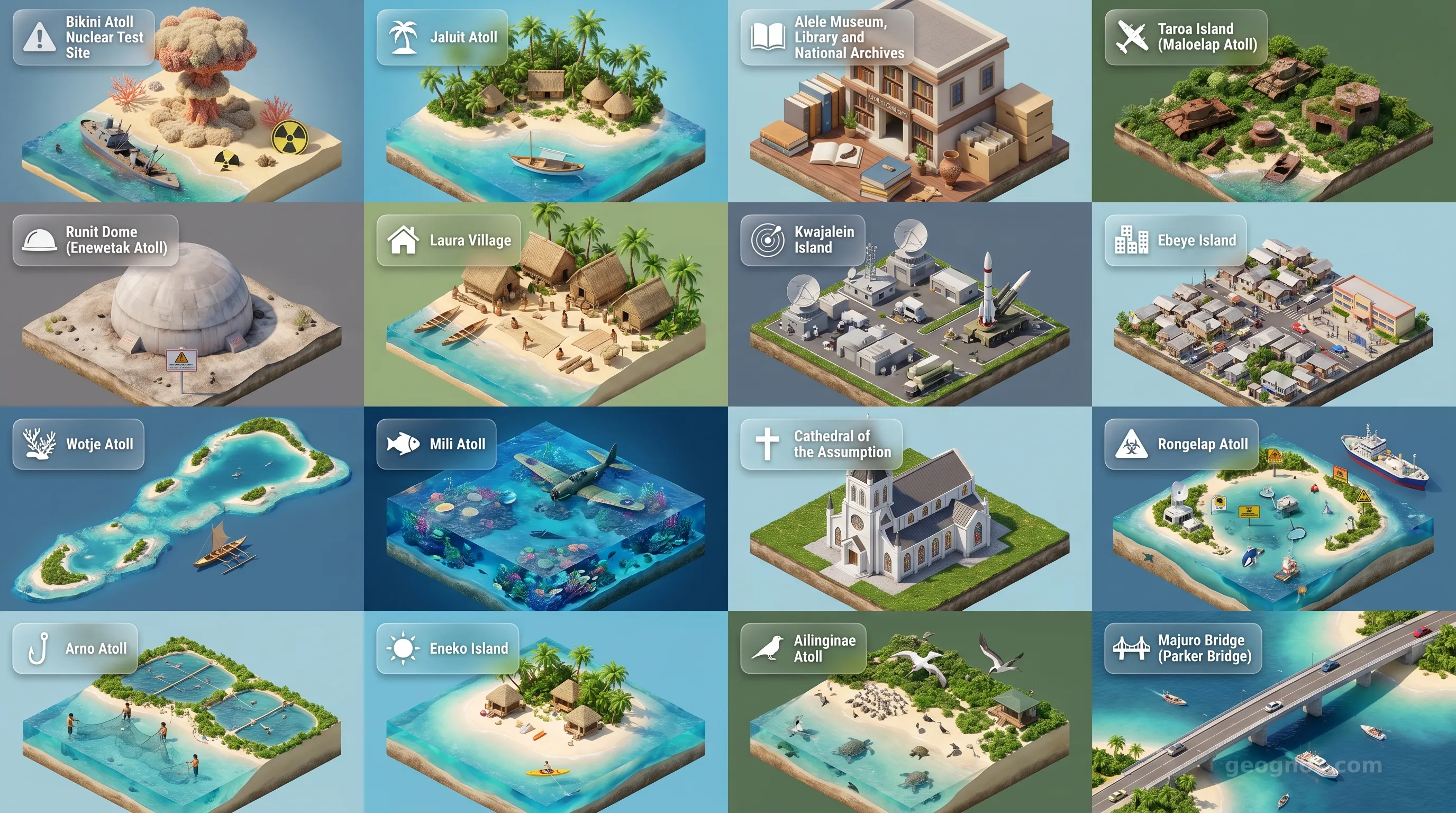
Marshall Islands - Panoramic Places of Interest Atlas including Bikini Atoll Nuclear Test Site, Jaluit Atoll, Alele Museum, Library and National Archives, Taroa Island (Maloelap Atoll), Runit Dome (Enewetak Atoll), Laura Village, Kwajalein Island, Ebeye Island, Wotje Atoll, Mili Atoll, Cathedral of the Assumption, Rongelap Atoll, Arno Atoll, Eneko Island, Ailinginae Atoll, Majuro Bridge (Parker Bridge)

Top Sights & Landmarks

01

Bikini Atoll Nuclear Test Site

Ground Zero of the Nuclear Age

02

Jaluit Atoll

Former Colonial Capital

03

Alele Museum, Library and National Archives

Heart of Marshallese Culture

04

Taroa Island (Maloelap Atoll)

WWII Japanese Airbase Ruins

05

Runit Dome (Enewetak Atoll)

The Tomb of Nuclear Waste

06

Laura Village

Ancient Settlement and Pristine Beach

07

Kwajalein Island

Strategic Military Hub

08

Ebeye Island

The Pacific's Most Densely Populated Island

09

Wotje Atoll

Relics of the Japanese Pacific Fleet

10

Mili Atoll

Site of the WWII Mili Mutiny

11

Cathedral of the Assumption

Spiritual Center of Majuro

12

Rongelap Atoll

A Pristine Shark Sanctuary

13

Arno Atoll

The 'Love School' Atoll

14

Eneko Island

Majuro's Tropical Escape

15

Ailinginae Atoll

Untouched Marine Wilderness

16

Majuro Bridge (Parker Bridge)

The Highest Point in Majuro

The Sovereignty of the Infinite Blue

To stand upon an atoll of the Republic of the Marshall Islands is to lose the traditional terrestrial definition of a nation. Here, the earth does not exist in towering ranges or sprawling continents. Instead, the nation is a delicate lace of coral, a scattering of emerald-fringed necklaces cast upon the deepest velvet of the Pacific Ocean. Comprising twenty-nine coral atolls and five solitary islands, the Marshall Islands span an immense aquatic territory, yet their dry land barely registers above the tide. It is a place where the horizon is not a distant line but a constant companion, and where the culture has been forged by the resilience required to navigate the vast, unpredictable pulses of the sea.

For those who wish to understand the resilience and profound heritage of this nation, it is essential to first explore the history of Marshall Islands. The past here is not measured by monuments of stone, but by the currents that brought the first navigators to these reefs and the resilience that has defined the people through eras of immense transition.

Masters of the Wave: A Heritage of Navigation

Long before the arrival of outsiders, the Marshallese people had mastered a science of navigation that remains one of the most remarkable intellectual achievements in human history. With an intimate knowledge of swell patterns, star paths, and bird migrations, they traversed the Pacific in intricate outrigger canoes. Their primary tool was the "stick chart," a complex, poetic mapping system made of palm fronds and shells that visualized wave refraction and intersection.

This navigation tradition represents more than just seafaring capability. It represents a way of seeing the world. For a culture confined to thin slivers of land, the ocean was never a barrier to be crossed, but a connective highway to be understood. To visualize how these legendary voyages shaped the development of their identity, you can interact with our history puzzle to sequence the eras that transformed these islands from solitary dots into a hub of maritime civilization.

The Architecture of Atolls

Geographically, the Marshall Islands are part of the vast Micronesian region, yet they occupy a unique niche. Each atoll is a geological marvel, formed from the volcanic remains of sunken seamounts, eventually crowned by layers of calcium carbonate secreted by trillions of tiny polyps. These structures provide the bedrock for a fragile, vibrant ecosystem. While the islands appear serene, they are dynamic, shifting environments where the presence of the ocean is felt in every breath of the salt-thickened air.

To grasp the scale of this maritime nation, consider the beauty of its landscape through our POI cinematic showcase. These vignettes provide a window into the crystalline lagoons and the white-sand coastlines that define the visual splendor of Majuro, Ebeye, and the outer islands. It is a reminder that in this corner of the globe, the environment is not merely the setting; it is the fundamental identity of the population.

Resilience in the Modern Era

The twentieth century brought profound changes to the Marshall Islands, thrusting these quiet lagoons into the center of international attention. The trajectory of the islands from a remote, ancestral home to a strategic point of focus for global powers is a narrative of profound transformation. For a deeper, more immersive look into how these centuries of events unfolded on the global stage, we invite you to view our history cinematic showcase, which weaves the threads of local heritage and external interaction into a visual chronicle of perseverance.

Today, the Republic of the Marshall Islands stands as an independent nation with a vibrant, democratic spirit. The Marshallese people maintain a deep commitment to their cultural roots, expressed through intricate hand-woven handicrafts, the revival of traditional celestial navigation, and an unwavering respect for the sanctity of their ancestral lagoons. Their government, education system, and daily life are all imbued with the philosophy that while the land is narrow, the influence of the culture is as broad as the Pacific.

Looking Toward the Horizon

Educators, students, and travelers find the Marshall Islands to be a place of endless discovery. It is a laboratory for climate studies, a cradle for Pacific anthropology, and a sanctuary for those who seek to understand the very definition of a homeland in the middle of a vast, uncontained sea. Whether you are investigating the scientific mysteries of atoll formation or seeking the tranquility of an untouched shore, this nation challenges our conventional maps and invites us to recognize the wisdom of those who live in partnership with the waves.

At GeoGnos, we hope this introduction serves as a portal to your journey through the history, geography, and enduring spirit of this remarkable maritime republic. The Marshall Islands do not shout their history in tall, imposing buildings; they whisper it in the steady rhythm of the tide. We invite you to listen.
Location

Latitude
9° N
Longitude
168° E
N S W E
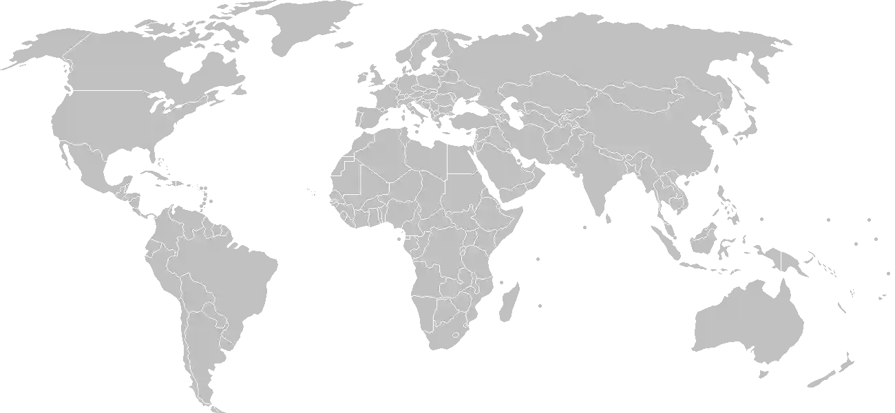
World Map Location
Geographic Location

Oceania, consists of 29 atolls and five isolated islands in the North Pacific Ocean, about halfway between Hawaii and Australia; the atolls and islands are situated in two, almost-parallel island chains - the Ratak (Sunrise) group and the Ralik (Sunset) group; the total number of islands and islets is about 1,225; 22 of the atolls and four of the islands are uninhabited

Map Reference
Oceania

Area

Total Area
181 sq km
Land (100%)
Land: 181 sq km
Water: 0 sq km

Elevation

Highest Point
East-central Airik Island, Maloelap Atoll
East-central Airik Island, Maloelap Atoll 14 m
Lowest Point
Pacific Ocean
Pacific Ocean 0 m
Mean Elevation
2 m

Detailed Geography Information

Coastline

370.4 km

Geography - note

Kwajalein atoll surrounds the world's largest lagoon; the island city of Ebeye is the second largest settlement in the Marshall Islands, after the capital of Majuro, and one of the most densely populated locations in the Pacific

Irrigated land

0 sq km (2022)

Land boundaries

total: 0 km

Maritime claims

territorial sea: 12 nm contiguous zone: 24 nm exclusive economic zone: 200 nm

Natural hazards

infrequent typhoons

Natural resources

coconut productsmarine productsdeep seabed minerals

Terrain

low coral limestone and sand islands

Population & Growth

+1.20% Growth
83,037
Total inhabitants (2025 est.)
Male: 50.7% (42,086) Female: 49.3% (40,951)

Age Distribution

0-14 years
30.0%
~24,911
15-64 years
64.3%
~53,393
65 years
5.7%
~4,733
Note: 2024 est.

Demographic Longevity

Median Age
25.9 years
Male
25.4 yrs
Female
25.6 yrs
Life Expectancy
75.2 years
Male
73 yrs
Female
77.5 yrs

Vital Dynamics

Birth Rate
20.81
births per 1,000 people
Death Rate
4.37
deaths per 1,000 people
Net Migration
-4.2
migrants per 1,000 people
Fertility Rate
2.62
children born per woman

Detailed People & Society Information

Children under the age of 5 years underweight

11.9% (2017 est.)

Currently married women (ages 15-49)

68.3% (2022 est.)

Dependency ratios

total dependency ratio: 54.7 (2025 est.) youth dependency ratio: 45.5 (2025 est.) elderly dependency ratio: 9.2 (2025 est.) potential support ratio: 10.9 (2025 est.)

Education expenditure

7.7%

7.7% of GDP (2022 est.) 11.3% national budget (2022 est.)

Ethnic groups

Marshallese
95.6%
Filipino
1.1%
other
3.3%

Gross reproduction rate

1.28 (2025 est.)

Health expenditure

12.5%

12.5% of GDP (2021) 6.7% of national budget (2022 est.)

Infant mortality rate

total: 20.1 deaths/1,000 live births (2025 est.) male: 24 deaths/1,000 live births female: 17.1 deaths/1,000 live births

Languages

Marshallese
98.2%
other languages
1.8%

Literacy

total population: 95.8% (2021 est.) male: 95.7% (2021 est.) female: 96.4% (2021 est.)

Major urban areas - population

31,000 MAJURO (capital) (2018)

Maternal mortality ratio

155 deaths/100,000 live births (2023 est.)

Nationality

noun: Marshallese (singular and plural) adjective: Marshallese

Obesity - adult prevalence rate

52.9% (2016)

Physician density

0.47 physicians/1,000 population (2012)

Population distribution

most people live in urban clusters on many of the country's islands; more than two thirds of the population lives on the atolls of Majuro and Ebeye

Refugees and internally displaced persons

Total Displaced & Vulnerable Persons
35 individuals
Internally Displaced Persons (IDPs)
100.0%
35
35 (2024 est.)

Religions

Protestant (United Church of Christ
79.3%
Assembly of God
14.1%
Full Gospel
5%
Bukot Nan Jesus
3%
Salvation Army
2.3%
Reformed Congressional Church
2.2%
Seventh Day Adventist
1.7%
New Beginning Church
1.4%
other Protestant
1.6%
Roman Catholic
9.3%
Church of Jesus Christ
5.7%
Jehovah's Witness
1.3%
other
3.3%
none
1.1%

School life expectancy (primary to tertiary education)

total: 14 years (2022 est.) male: 14 years (2022 est.) female: 15 years (2022 est.)

Sex ratio

at birth: 1.05 male(s)/female 0-14 years: 1.04 male(s)/female 15-64 years: 1.03 male(s)/female 65 years and over: 0.95 male(s)/female total population: 1.03 male(s)/female (2024 est.)

Tobacco use

total: 30.9% (2025 est.) male: 52.9% (2025 est.) female: 8.5% (2025 est.)

Climate & Issues

Climate Profile

tropical; hot and humid; wet season May to November; islands border typhoon belt

Key Environmental Issues
inadequate potable water pollution of Majuro lagoon from household waste and discharges from fishing vessels sea-level rise

Land Cover

Coverage Distribution
Agri (39%)
Forest (54%)
Arable: 2.8%
Crops: 36.1%
Pasture: 0.0%
Forest: 53.9%

Air & Carbon Emissions

Annual CO2 Output 2023 est.
293,700
PM2.5 Exposure 7.2 µg/m³
0 5 (WHO Limit) 15 25 35+

Detailed Environmental Information

International environmental agreements

BiodiversityClimate ChangeClimate Change-Kyoto ProtocolClimate Change-Paris AgreementComprehensive Nuclear Test BanDesertificationHazardous WastesLaw of the SeaMarine Dumping-London ProtocolOzone Layer ProtectionShip PollutionWetlandsWhaling

Urbanization

urban population: 78.9% of total population (2023) rate of urbanization: 0.61% annual rate of change (2020-25 est.)

Waste and recycling

municipal solid waste generated annually: 8,600 tons (2024 est.) percent of municipal solid waste recycled: 39.7% (2022 est.)

Capital & State Profile

Capital City
Majuro
7.1° N, 171.3833° E
Timezone UTC+12
Government Type
mixed presidential-parliamentary system in free association with the US
Independence 1986-10-21
National Holiday 05-01

Executive Branch

Chief of State
President Hilda C. HEINE (since 3 January 2023)
Head of Government
President Hilda C. HEINE (since 3 January 2023)
Last Election 2 January 2023
Next Election 2027
Cabinet Cabinet nominated by the president from among members of the Nitijela, appointed by Nitijela speaker

Legislative Branch

unicameral
Legislature Name Parliament (Nitijela)
Seats & Term
33 (all directly elected) seats / 4 years
Women in Chamber
12.1% Representation
Electoral System plurality/majority

National Identity & Symbols

National Flag Description

blue with an orange stripe and a white stripe radiating from the lower-left corner to the upper-right corner; a white star with four large rays and 20 small rays appears on the left side above the two stripes

Symbolic Meaning blue stands for the Pacific Ocean, orange for the Ralik Chain (or sunset and courage), and white for the Ratak Chain (or sunrise and peace); the star symbolizes the Christian cross, with a small ray for each electoral district and a larger ray for the principal cultural centers of Majuro, Jaluit, Wotje, and Ebeye; the diagonal stripes can also be interpreted as representing the equator, with the star showing the archipelago's position
National Symbol a 24-rayed star
National Colors blue, white, orange
National Anthem Forever Marshall Islands

Detailed Government Information

Administrative divisions

24 municipalities; Ailinglaplap, Ailuk, Arno, Aur, Bikini & Kili, Ebon, Enewetak & Ujelang, Jabat, Jaluit, Kwajalein, Lae, Lib, Likiep, Majuro, Maloelap, Mejit, Mili, Namorik, Namu, Rongelap, Ujae, Utrik, Wotho, Wotje

Citizenship

citizenship by birth: no citizenship by descent only: at least one parent must be a citizen of the Marshall Islands dual citizenship recognized: no residency requirement for naturalization: 5 years

Constitution

history: effective 1 May 1979 amendment process: proposed by the National Parliament or by a constitutional convention; passage by Parliament requires at least two-thirds majority vote of the total membership in each of two readings and approval by a majority of votes in a referendum; amendments submitted by a constitutional convention require approval of at least two thirds of votes in a referendum

Country name

conventional long form: Republic of the Marshall Islands conventional short form: Marshall Islands local long form: Republic of the Marshall Islands local short form: Marshall Islands former: Trust Territory of the Pacific Islands, Marshall Islands District abbreviation: RMI etymology: named after British Captain John MARSHALL, who charted many of the islands in 1788

International law organization participation

accepts compulsory ICJ jurisdiction with reservations; accepts ICCt jurisdiction

International organization participation

Judicial branch

highest court(s): Supreme Court (consists of the chief justice and 2 associate justices) judge selection and term of office: judges appointed by the Cabinet on the recommendation of the Judicial Service Commission (consists of the chief justice of the High Court, the attorney general and a private citizen selected by the Cabinet) and upon approval of the Nitijela; the current chief justice, appointed in 2013, serves for 10 years; Marshallese citizens appointed as justices serve until retirement at age 72 subordinate courts: High Court; District Courts; Traditional Rights Court; Community Courts

Legal system

mixed system of US and English common law, customary law, and local statutes

National heritage

total World Heritage Sites: 1 (cultural) selected World Heritage Site locales: Bikini Atoll Nuclear Test Site

Political parties

traditionally there have been no formally organized political parties; what has existed more closely resembles factions or interest groups because they do not have party headquarters, formal platforms, or party structures

Suffrage

18 years of age; universal

Economic Overview

upper middle-income Pacific island economy; US aid reliance; large public sector; coconut oil production as diesel fuel substitute; growing offshore banking locale; fishing rights seller; import-dependent

Size & Performance

Real GDP (PPP)
$270.809 million
Latest available estimate (2024)
2023: $263.507 million2022: $274.3 million
Real GDP Growth
2.8% (2024 est.)
+2.8%
GDP Per Capita (PPP)
$7,200
2023: $6,8002022: $6,800

GDP Sector Breakdown

Agriculture: 19.5%Industry: 11.1%Services: 70.5%
Origin GDP %
Agriculture 19.5%
Industry 11.1%
Services 70.5%

Trade Balance

Trade Position
Trade Deficit
$76.01 million
Total Exports
$130.016 million (2021 est.)
Total Imports
$206.025 million (2021 est.)
Exports (39%) Imports (61%)

Budget Balance

Budget Position
Budget Surplus
+$12.17 million
Revenues
$171.267 million (2020 est.)
Expenditures
$159.095 million (2020 est.)
Revenues (52%) Expenditures (48%)

Export Profile

Top Export Partners

16.0%
9.0%
Note: 2023; top five export partners based on percentage share of exports

Major Export Commodities

shipsrefined petroleumfishnatural gasstone processing machines

Import Profile

Top Import Partners

Note: 2023; top five import partners based on percentage share of imports

Major Import Commodities

shipsrefined petroleumadditive manufacturing machinesiron structurescrude petroleum

Labor & Employment

Population Below Poverty Line 7.2% (2019 est.)

Income Inequality

Gini Coefficient (Family Income) 35.5
0 (Perfect Equality) Moderate Inequality 100 (Perfect Inequality)

Family Income / Consumption Share

Lowest 10%: 2.8% (2019 est.) Highest 10%: 27.5% (2019 est.)
Inequality Gap: Top 10% holds 9.8x the share of the bottom 10%.

Detailed Economic Data

Agricultural products

coconuts

Current account balance

$76.263 million (2021 est.) $90.281 million (2020 est.) $86.133 million (2019 est.) note: balance of payments - net trade and primary/secondary income in current dollars

Exchange rates

the US dollar is used

GDP - composition, by end use

Industrial production growth rate

-2.8% (2023 est.) note: annual % change in industrial value added based on constant local currency

Industries

copratuna processingtourismcraft items (from seashellswoodand pearls)

Inflation rate (consumer prices)

6.2% (2022 est.) 2.6% (2021 est.) -0.7% (2020 est.) note: annual % change based on consumer prices

Public debt

41.6% of GDP (2019 est.) note: central government debt as a % of GDP

Remittances

13.3% of GDP (2023 est.) 13.6% of GDP (2022 est.) 13.3% of GDP (2021 est.) note: personal transfers and compensation between resident and non-resident individuals/households/entities

Taxes and other revenues

17.2% (of GDP) (2020 est.) note: central government tax revenue as a % of GDP

Grid Infrastructure

Electricity Access 100%
Urban: 96.1% Rural: 100%

Digital Access

.mh
Internet Usage 66%

Active internet users as a percentage of the total population.

Fixed Broadband

Penetration Rate 2 / 100
Total Subscriptions 1,000 (2022 est.)

Mobile Cellular

Penetration Rate 40 / 100
Total Subscriptions 15,900 (2022 est.)

Broadcast Media

no TV broadcast station; a cable network is available on Majuro with programming via videotape replay and satellite relays; 4 radio broadcast stations; US Armed Forces Radio and Television Service (AFRTS) provides satellite radio and TV service to Kwajalein Atoll (2019)

Aviation

V7
Airports
33
As of 2025

Ports & Harbors

Ports Count 3
Hover for breakdown & key ports As of 2024

Merchant Marine

Commercial Fleet
4,180 ships
Hover for vessel types breakdown As of 2023

Service & Defense Details

Military and security forces

Marshall Islands Police Department (includes a Sea Patrol Division)

Military - note

defense is the responsibility of the US; in 1982, the Marshall Islands signed a Compact of Free Association (COFA) with the US, which granted the Marshall Islands financial assistance and access to many US domestic programs in exchange for exclusive US military access and defense responsibilities; the COFA entered into force in 1986; the Marshall Islands hosts a US Army missile test site the Marshall Islands has a "shiprider" agreement with the US, which allows local maritime law enforcement officers to embark on US Coast Guard (USCG) and US Navy (USN) vessels, including to board and search vessels suspected of violating laws or regulations within its designated exclusive economic zone (EEZ) or on the high seas; "shiprider" agreements also enable USCG personnel and USN vessels with embarked USCG law enforcement personnel to work with host nations to protect critical regional resources (2025)