🇸🇧

Solomon Islands

Australia-Oceania Countries
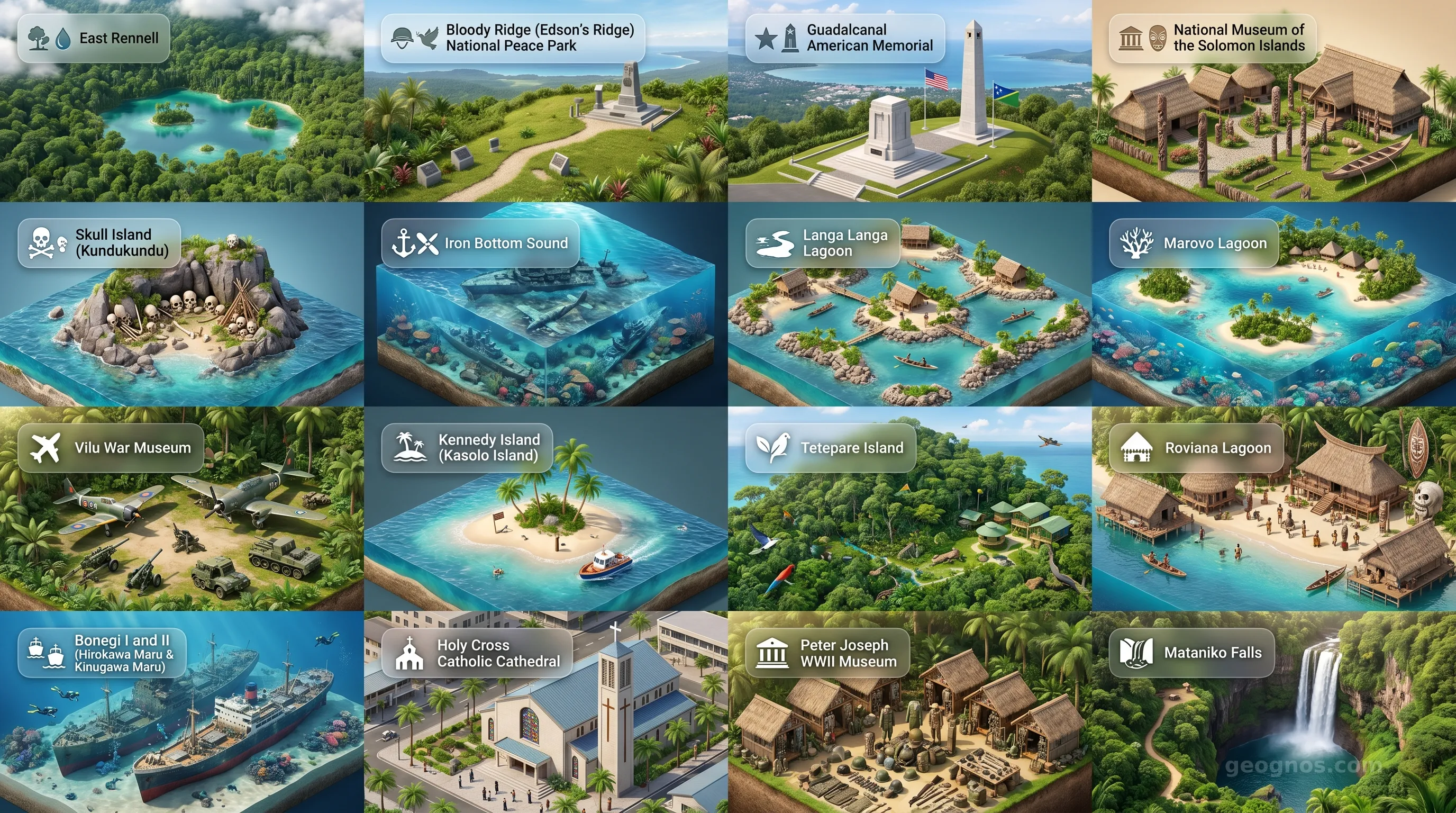
Solomon Islands - Panoramic Places of Interest Atlas including East Rennell, Bloody Ridge (Edson's Ridge) National Peace Park, Guadalcanal American Memorial, National Museum of the Solomon Islands, Skull Island (Kundukundu), Iron Bottom Sound, Langa Langa Lagoon, Marovo Lagoon, Vilu War Museum, Kennedy Island (Kasolo Island), Tetepare Island, Roviana Lagoon, Bonegi I and II (Hirokawa Maru & Kinugawa Maru), Holy Cross Catholic Cathedral, Peter Joseph WWII Museum, Mataniko Falls

Top Sights & Landmarks

01

East Rennell

World's Largest Raised Coral Atoll

02

Bloody Ridge (Edson's Ridge) National Peace Park

Pivotal WWII Battlefield

03

Guadalcanal American Memorial

Tribute to the Fallen

04

National Museum of the Solomon Islands

Guardian of Solomon Culture

05

Skull Island (Kundukundu)

Ancient Headhunting Shrine

06

Iron Bottom Sound

Massive Submarine Graveyard

07

Langa Langa Lagoon

Home of the Shell Money

08

Marovo Lagoon

World's Largest Double Barrier Lagoon

09

Vilu War Museum

Open-Air WWII Relics

10

Kennedy Island (Kasolo Island)

JFK's Survival Island

11

Tetepare Island

The Last Wild Island

12

Roviana Lagoon

Historic Lagoon and Pristine Waters

13

Bonegi I and II (Hirokawa Maru & Kinugawa Maru)

Accessible WWII Shipwrecks

14

Holy Cross Catholic Cathedral

Spiritual Heart of Honiara

15

Peter Joseph WWII Museum

A Personal Look at the Pacific War

16

Mataniko Falls

Cascades and Caves

The Double Canoe of Destiny: An Archipelago of Living Tradition

To view the Solomon Islands from the vantage of the heavens is to witness a masterpiece of oceanic geology. It is not merely a cluster of six major islands and nearly one thousand smaller islets scattered across the South Pacific. It is a fragmented, emerald mosaic, a vibrant archipelago that acts as a physical bridge between the deep past and a modern, maritime future. Here, the tectonic forces of the Pacific and Australian plates have collided for millennia to birth soaring volcanic peaks, verdant rainforests that hide secrets of lost botanical worlds, and coral-fringed lagoons so pristine they seem to glow from beneath the surface.

Yet, to define the Solomon Islands solely by its dramatic topography is to miss its heart. This is a land where geography has long dictated a philosophy of interconnectedness. Because the sea does not separate the islander; it unites them. The ocean is their highway, their grocery, and their repository of myth. To step onto these shores is to enter a place where time slows, dictated by the rhythm of the tides and the long, oral traditions of the diverse Melanesian groups that have called these islands home for thousands of years. It is a nation of resilience, of intense beauty, and of an ancient identity that survives in every song, every carving, and every fishing net cast into the surf.

Echoes of the Past: Navigating the Waves of Change

The story of the Solomon Islands is woven from complex layers of human migration, colonial encounter, and hard-won sovereignty. For generations, the archipelago was a collection of independent coastal and interior kingdoms, each with distinct languages and customs. When European explorers first glimpsed these shores in the 16th century, they brought with them not just iron and religion, but a catalyst that would fundamentally alter the archipelago’s internal balance. The colonial era transformed these islands into a strategic theater, eventually forcing a coalescence of diverse, semi-autonomous tribal societies into the modern political entity we recognize today.

For students and researchers seeking to untangle these complex shifts, we invite you to explore the history of Solomon Islands. Our dedicated archives provide a scholarly gateway into the socioeconomic evolution of the islands, including comprehensive educational resources for classroom use. As you begin to study the pivotal moments—from early Austronesian expansion to the geopolitical upheavals of the 20th century—you may wish to test your chronological fluency. Challenge your peers or yourself by engaging with our history puzzle, an interactive data exercise where you arrange major historical events in their proper order to earn digital badges of expertise.

If you prefer a more sensory immersion into these historical chapters, our history cinematic showcase offers a beautifully curated carousel. This visual narrative pairs evocative illustrations with detailed synopses, allowing you to walk through the corridors of the past and witness the moments that defined the soul of the Solomon Islands.

The Modern Horizon: Nature as the Ultimate Landmark

Modern Solomon Islands faces a unique paradox. It possesses some of the most biodiverse environments left on Earth, featuring sprawling coral reefs that act as a primary sanctuary for marine life and dense, untouched forests that breathe life into the humid equatorial air. These ecosystems are not mere "points of interest" for the traveler; they are the heritage of the people. From the shimmering, turquoise clarity of the Marovo Lagoon—the largest double-barrier lagoon in the world—to the formidable, volcanic heights of Guadalcanal, the natural world here remains largely untamed.

For those looking to map their future journey or visualize the sheer scope of this tropical geography, we highly recommend our POI cinematic showcase. This interactive gallery brings you face to face with the most striking wonders of the archipelago. Whether you are mesmerized by the quiet serenity of the inland waterfalls or the haunting, silent majesty of rusted shipwrecks resting in sheltered harbors, this showcase serves as the perfect companion to our site's 3d diorama maps and street-level geographic data.

Cultural Resilience and the Spirit of Melanesia

There is an intangible energy to the Solomon Islands that resonates with every visitor. It is found in the "wantok" system, a social contract based on shared language and kinship that ensures support and communal care. It is an expression of deep, collective resilience. Despite the pressures of globalization and the changing climate, the people of the Solomon Islands remain staunch protectors of their traditions. Their art, dominated by intricate wood carvings that depict the creatures of the sea and the ancestral spirits of the land, is a living, breathing language in its own right.

As we navigate the various facets of this nation on GeoGnos, we encourage you to view the Solomon Islands not as a distant corner of the map, but as a crucial participant in the human experience. Their contribution to the global dialogue—a lesson in sustainability, deep heritage, and communal living—is a treasure. We invite you to continue your discovery through our upcoming detailed pages on the national economy, environment, and social governance, each designed to provide the clarity and depth that the beautiful, complicated story of the Solomon Islands truly deserves.
Location

Latitude
-8° N
Longitude
159° E
N S W E
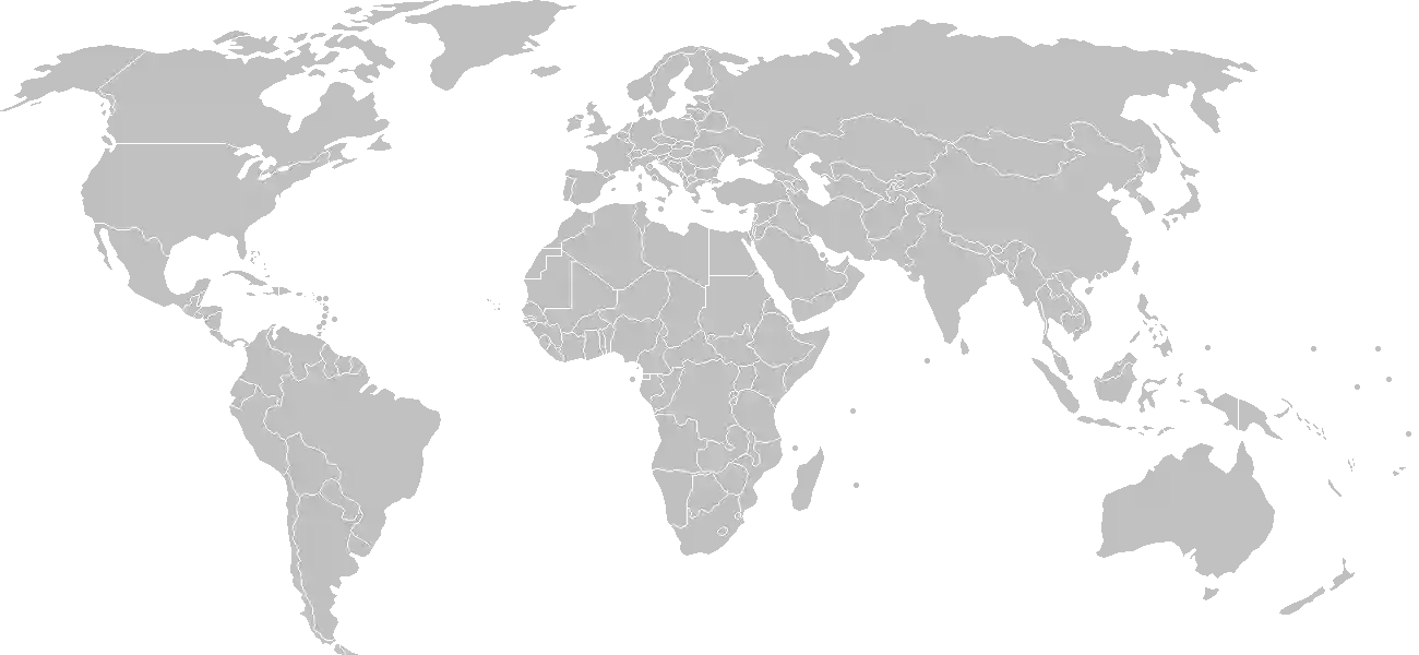
World Map Location
Geographic Location

Oceania, group of islands in the South Pacific Ocean, east of Papua New Guinea

Map Reference
Oceania

Area

Total Area
28,896 sq km
Land (97%)
Land: 27,986 sq km
Water: 910 sq km

Elevation

Highest Point
Mount Popomanaseu
Mount Popomanaseu 2,335 m
Lowest Point
Pacific Ocean
Pacific Ocean 0 m

Detailed Geography Information

Coastline

5,313 km

Geography - note

strategic location on sea routes between the South Pacific Ocean, the Solomon Sea, and the Coral Sea; Rennell Island, the southernmost in the Solomon Islands chain, is one of the world’s largest raised coral atolls; the island’s Lake Tegano, formerly a lagoon on the atoll, is the largest lake in the insular Pacific (15,500 hectares; 38,300 acres)

Irrigated land

0 sq km (2022)

Land boundaries

total: 0 km

Maritime claims

territorial sea: 12 nm exclusive economic zone: 200 nm continental shelf: 200 nm note: measured from claimed archipelagic baselines

Natural hazards

tropical cyclones, but rarely destructive; geologically active region with frequent earthquakes, tremors, and volcanic activity; tsunamis volcanism: Tinakula (851 m) has frequent eruption activity, and an eruption of Savo (485 m) could affect the capital Honiara on nearby Guadalcanal

Natural resources

fishforestsgoldbauxitephosphatesleadzincnickel

Terrain

mostly rugged mountains with some low coral atolls

Population & Growth

+1.60% Growth
738,774
Total inhabitants (2025 est.)
Male: 51.0% (377,067) Female: 49.0% (361,707)

Age Distribution

0-14 years
30.6%
~226,065
15-64 years
64.2%
~474,293
65 years
5.3%
~39,155
Note: 2024 est.

Demographic Longevity

Median Age
25.5 years
Male
25 yrs
Female
25.4 yrs
Life Expectancy
77.2 years
Male
74.6 yrs
Female
80 yrs

Vital Dynamics

Birth Rate
21.57
births per 1,000 people
Death Rate
3.94
deaths per 1,000 people
Net Migration
-1.47
migrants per 1,000 people
Fertility Rate
2.72
children born per woman

Detailed People & Society Information

Alcohol consumption per capita

1.19 liters of pure alcohol (2019 est.)

Currently married women (ages 15-49)

64.5% (2019 est.)

Dependency ratios

total dependency ratio: 55.1 (2025 est.) youth dependency ratio: 46.7 (2025 est.) elderly dependency ratio: 8.4 (2025 est.) potential support ratio: 12 (2025 est.)

Education expenditure

8.3%

8.3% of GDP (2023 est.) 25.2% national budget (2024 est.)

Ethnic groups

Melanesian
95.3%
Polynesian
3.1%
Micronesian
1.2%
other
0.3%

Gross reproduction rate

1.33 (2025 est.)

Health expenditure

4.8%

4.8% of GDP (2021) 9.7% of national budget (2022 est.)

Infant mortality rate

total: 18.6 deaths/1,000 live births (2025 est.) male: 22.7 deaths/1,000 live births female: 15.2 deaths/1,000 live births

Languages

English
1%

Major urban areas - population

82,000 HONIARA (capital) (2018)

Maternal mortality ratio

123 deaths/100,000 live births (2023 est.)

Mother's mean age at first birth

22.6 years (2015 est.) note: data represents median age at first birth among women 25-29

Nationality

noun: Solomon Islander(s) adjective: Solomon Islander

Obesity - adult prevalence rate

22.5% (2016)

Physician density

0.24 physicians/1,000 population (2023)

Population distribution

most of the population lives along the coastal regions; about one in five live in urban areas, and of these about two thirds reside in Honiara, the largest town and chief port

Refugees and internally displaced persons

Total Displaced & Vulnerable Persons
1,638 individuals
Internally Displaced Persons (IDPs)
100.0%
1,638
1,638 (2023 est.)

Religions

Protestant (Church of Melanesia
73.4%
South Sea Evangelical
17.1%
Seventh Day Adventist
11.7%
United Church
10.1%
Christian Fellowship Church
2.5%
Roman Catholic
19.6%
other Christian
2.9%
other
4%
unspecified
0.1%

Sex ratio

at birth: 1.05 male(s)/female 0-14 years: 1.06 male(s)/female 15-64 years: 1.05 male(s)/female 65 years and over: 0.89 male(s)/female total population: 1.04 male(s)/female (2024 est.)

Tobacco use

total: 36.8% (2025 est.) male: 54.5% (2025 est.) female: 18.8% (2025 est.)

Climate & Issues

Climate Profile

tropical monsoon; few temperature and weather extremes

Key Environmental Issues
deforestation soil erosion damage to coral reefs

Land Cover

Coverage Distribution
Forest (90%)
Arable: 0.8%
Crops: 2.8%
Pasture: 0.3%
Forest: 89.9%

Air & Carbon Emissions

Annual CO2 Output 2023 est.
318,000
Coal (0%) Oil (100%) Gas (0%)
PM2.5 Exposure 8.8 µg/m³
0 5 (WHO Limit) 15 25 35+

Water Resources & Use

Renewable Water Resources 44.7 billion cubic meters (2022 est.)

Detailed Environmental Information

International environmental agreements

BiodiversityClimate ChangeClimate Change-Kyoto ProtocolClimate Change-Paris AgreementDesertificationEndangered SpeciesEnvironmental ModificationLaw of the SeaMarine Dumping-London ConventionMarine Life ConservationOzone Layer ProtectionShip PollutionWhaling

Urbanization

urban population: 26% of total population (2023) rate of urbanization: 3.57% annual rate of change (2020-25 est.)

Waste and recycling

municipal solid waste generated annually: 180,000 tons (2024 est.) percent of municipal solid waste recycled: 6.1% (2022 est.)

Capital & State Profile

Capital City
Honiara
-9.4333° N, 159.95° E
Timezone UTC+11
Government Type
parliamentary democracy under a constitutional monarchy; a Commonwealth realm
Independence 1978-07-07
National Holiday 07-07

Executive Branch

Chief of State
King CHARLES III (since 8 September 2022); represented by Governor General David Tiva KAPU
Head of Government
Prime Minister Jeremiah MANELE (since 2 May 2024)
Cabinet Cabinet appointed by the governor general on the advice of the prime minister

Legislative Branch

unicameral
Legislature Name National Parliament
Seats & Term
50 (all directly elected) seats / 4 years
Women in Chamber
6% Representation
Electoral System plurality/majority
Parties Composition
Ownership Unity and Responsibility (OUR Party) 15Solomon Islands Democratic Party (SIDP) 11Solomon Islands United Party (UP) 6Solomon Islands People First Party (SIPFP) 3Independents 11Other 4

National Identity & Symbols

National Flag Description

divided diagonally by a yellow stripe from the lower-left corner; the upper triangle (left side) is blue with five five-pointed white stars in an "X" pattern; the lower triangle is green

Symbolic Meaning blue stands for the ocean, green for the land, and yellow for sunshine; the five stars stand for the main island groups
National Colors blue, yellow, green, white
National Anthem God Save Our Solomon Islands

Detailed Government Information

Administrative divisions

9 provinces and 1 city*; Central, Choiseul, Guadalcanal, Honiara*, Isabel, Makira and Ulawa, Malaita, Rennell and Bellona, Temotu, Western

Citizenship

citizenship by birth: no citizenship by descent only: at least one parent must be a citizen of the Solomon Islands dual citizenship recognized: no residency requirement for naturalization: 7 years

Constitution

history: adopted 31 May 1978, effective 7 July 1978 amendment process: proposed by the National Parliament; passage of constitutional sections, including those on fundamental rights and freedoms, the legal system, Parliament, alteration of the constitution and the ombudsman, requires three-fourths majority vote by Parliament and assent of the governor general; passage of other amendments requires two-thirds majority vote and assent of the governor general

Country name

conventional long form: none conventional short form: Solomon Islands local long form: none local short form: Solomon Islands former: British Solomon Islands etymology: Spanish explorer Alvaro de MENDANA named the isles in 1568 after the wealthy biblical King SOLOMON in the mistaken belief that the islands contained great riches

International law organization participation

has not submitted an ICJ jurisdiction declaration; non-party state to the ICCt

International organization participation

Judicial branch

highest court(s): Court of Appeal (consists of the court president and ex officio members including the High Court chief justice and puisne judges); High Court (consists of the chief justice and puisne judges) judge selection and term of office: Court of Appeal and High Court president, chief justices, and puisne judges appointed by the governor general on recommendation of the Judicial and Legal Service Commission, chaired by the chief justice and includes 5 members, mostly judicial officials and legal professionals; all judges serve until retirement at age 60 subordinate courts: Magistrates' Courts; Customary Land Appeal Court; local courts

Legal system

mixed system of English common law and customary law

National heritage

total World Heritage Sites: 1 (natural) selected World Heritage Site locales: East Rennell

Political parties

Democratic Alliance Party or DAP Kadere Party of Solomon Islands or KAD Ownership, Unity, and Responsibility Party (OUR Party) Solomon Islands People First Party or SIPFP Solomon Islands Democratic Party or SIDP Solomon Islands Party for Rural Advancement or SIPRA Solomon Islands United Party or UP United for Change Party or U4C Coalition for Accountability Reform and Empowerment (CARE) (includes DAP, SIDP, and U4C) note: the Solomon Islands political party system is characterized by fluid coalitions

Suffrage

21 years of age; universal

Economic Overview

lower middle-income Pacific island economy; natural resource rich but environmentally fragile; key agrarian sector; growing Chinese economic relationship; infrastructure damage due to social unrest; metal mining operations

Size & Performance

Real GDP (PPP)
$2.07 billion
Latest available estimate (2024)
2023: $2.019 billion2022: $1.967 billion
Real GDP Growth
2.5% (2024 est.)
+2.5%
GDP Per Capita (PPP)
$2,500
2023: $2,5002022: $2,500

GDP Sector Breakdown

Agriculture: 33.8%Industry: 18.7%Services: 47.3%
Origin GDP %
Agriculture 33.8%
Industry 18.7%
Services 47.3%

Trade Balance

Trade Position
Trade Deficit
$214.25 million
Total Exports
$642.877 million (2024 est.)
Total Imports
$857.128 million (2024 est.)
Exports (43%) Imports (57%)

Budget Balance

Budget Position
Budget Deficit
-$46.07 million
Revenues
$436.174 million (2022 est.)
Expenditures
$482.24 million (2022 est.)
Revenues (47%) Expenditures (53%)

Export Profile

Top Export Partners

Note: 2023; top five export partners based on percentage share of exports

Major Export Commodities

woodfishgoldprecious metal orepalm oil

Import Profile

Top Import Partners

Note: 2023; top five import partners based on percentage share of imports

Major Import Commodities

refined petroleumplastic productsfishbroadcasting equipmentiron structures

Labor & Employment

Total Labor Force 435,600 (2024 est.)
General Unemployment Rate 1.5%
Youth Unemployment (Ages 15-24) 3.0%

Income Inequality

Detailed Economic Data

Agricultural products

oil palm fruitcoconutssweet potatoesyamstarofruitspulsesvegetablescocoa beanscassava

Current account balance

-$66.231 million (2024 est.) -$178.197 million (2023 est.) -$218.534 million (2022 est.) note: balance of payments - net trade and primary/secondary income in current dollars

Debt - external

$184.191 million (2023 est.) note: present value of external debt in current US dollars

Exchange rates

Solomon Islands dollars (SBD) per US dollar - Exchange rates: 8.455 (2024 est.) 8.376 (2023 est.) 8.156 (2022 est.) 8.03 (2021 est.) 8.213 (2020 est.)

GDP - composition, by end use

Industrial production growth rate

4.7% (2022 est.) note: annual % change in industrial value added based on constant local currency

Industries

fish (tuna)miningtimber

Inflation rate (consumer prices)

5.9% (2023 est.) 5.5% (2022 est.) -0.1% (2021 est.) note: annual % change based on consumer prices

Public debt

15.4% of GDP (2022 est.) note: central government debt as a % of GDP

Remittances

5.4% of GDP (2024 est.) 5.1% of GDP (2023 est.) 5.2% of GDP (2022 est.) note: personal transfers and compensation between resident and non-resident individuals/households/entities

Reserves of foreign exchange and gold

$688.22 million (2023 est.) $661.604 million (2022 est.) $694.515 million (2021 est.) note: holdings of gold (year-end prices)/foreign exchange/special drawing rights in current dollars

Taxes and other revenues

20.7% (of GDP) (2022 est.) note: central government tax revenue as a % of GDP

Grid Infrastructure

Electricity Access 76%
Urban: 79% Rural: 75.4%
Capacity 37,000 kW (2023 est.)
Consumption 91.031 million kWh (2023 est.)
Grid Losses: 19.969 million kWh (2023 est.)

Generation Mix

Percentage Share of Production
fossil fuels 90.1%
solar 5.4%
biomass and waste 3.6%
hydroelectricity 0.9%

Fossil Fuels Production

Petroleum
Consumption 2,000 bbl/day (2023 est.)

Intensity & Nuclear

Energy Consumption Per Capita 5.655 million Btu/person (2023 est.)
No nuclear energy infrastructure or reactor operations reported in this country dossier.

Digital Access

.sb
Internet Usage 43%

Active internet users as a percentage of the total population.

Fixed Broadband

Penetration Rate 0 / 100
Total Subscriptions 1,000 (2022 est.)

Mobile Cellular

Penetration Rate 62 / 100
Total Subscriptions 485,000 (2022 est.)

Broadcast Media

multi-channel pay-TV is available; Solomon Islands Broadcasting Corporation (SIBC) operates 2 national radio stations and 2 provincial stations; 2 local commercial radio stations; Radio Australia is available via satellite (2019)

Aviation

H4
Airports
36
As of 2025
Heliports
2
As of 2025

Ports & Harbors

Ports Count 6
Hover for breakdown & key ports As of 2024

Merchant Marine

Commercial Fleet
25 ships
Hover for vessel types breakdown As of 2023

Service & Defense Details

Military and security forces

Ministry of Police, National Security and Correctional Services (MPNSCS): the Royal Solomon Islands Police Force (RSIPF) (2025)

Military - note

in 2017, the Solomon Islands and Australia signed a security treaty allowing Australian police, defense, and associated civilian personnel to deploy rapidly to Solomon Islands should the need arise and where both countries consent; the treaty was activated for the first time in November 2021 following civil unrest in Honiara; Australia was the first country Solomon Islands called upon for support, and from November 2021, Australia deployed police and defense personnel to work alongside partners from Fiji, Papua New Guinea, and New Zealand to restore law and order in Honiara in 2022, the Solomon Islands Government has also signed a police and security agreement with China (2025)