🇿🇼

Zimbabwe

Africa • Countries
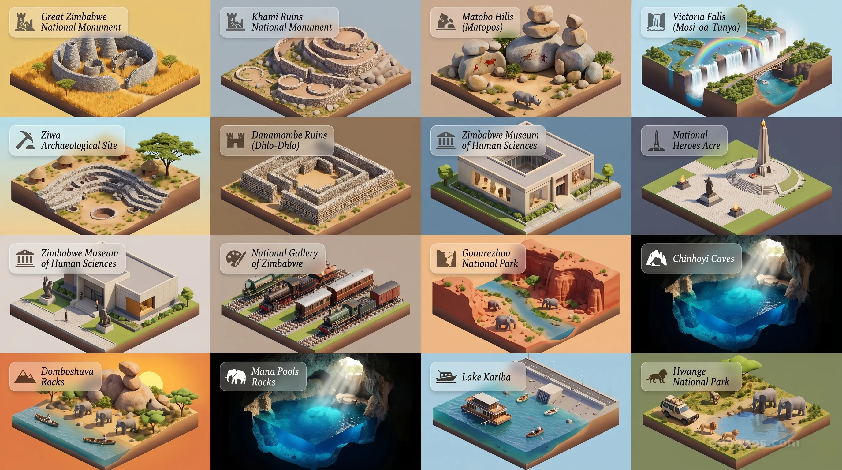
Zimbabwe - Panoramic Places of Interest Atlas including Great Zimbabwe National Monument, Khami Ruins National Monument, Matobo Hills (Matopos), Victoria Falls (Mosi-oa-Tunya), Ziwa Archaeological Site, Danamombe Ruins (Dhlo-Dhlo), Zimbabwe Museum of Human Sciences, National Heroes Acre, National Gallery of Zimbabwe, Bulawayo Railway Museum, Mana Pools National Park, Chinhoyi Caves, Domboshava Rocks, Hwange National Park, Lake Kariba, Gonarezhou National Park

Top Sights & Landmarks

01

Great Zimbabwe National Monument

Ancient Capital of the Shona Ancestors

02

Khami Ruins National Monument

Capital of the Torwa Dynasty

03

Matobo Hills (Matopos)

Sacred Granite Domes and Ancient Rock Art

04

Victoria Falls (Mosi-oa-Tunya)

The Smoke That Thunders

05

Ziwa Archaeological Site

Ancient Agricultural Terraces of Nyanga

06

Danamombe Ruins (Dhlo-Dhlo)

Fortress of the Rozvi Empire

07

Zimbabwe Museum of Human Sciences

Custodian of the Ngoma Lungundu

08

National Heroes Acre

Monument to the Liberation Struggle

09

National Gallery of Zimbabwe

The Heart of Contemporary Zimbabwean Art

10

Bulawayo Railway Museum

A Journey Through the Age of Steam

11

Mana Pools National Park

Untamed Wilderness on the Lower Zambezi

12

Chinhoyi Caves

The Mystical Sleeping Pool

13

Domboshava Rocks

Granite Monoliths and Ancient Art

14

Hwange National Park

The Kingdom of the Elephant

15

Lake Kariba

The Ocean of Zimbabwe

16

Gonarezhou National Park

The Place of Elephants and Red Cliffs

The Heart of the Highveld: Understanding the Soul of Zimbabwe

To stand upon the soil of Zimbabwe is to place your feet at the very center of Southern Africa, both geographically and culturally. It is a landlocked tapestry woven with the rugged threads of the granite-strewn Highveld, the lush greenery of the Eastern Highlands, and the thundering, mist-shrouded power of one of the world's greatest natural wonders. Unlike many nations defined by the sea, Zimbabwe looks inward, drawing its character from its ancient river systems, its dramatic escarpments, and a storied human legacy that spans from the earliest hunter-gatherer societies to the architectural marvels of the medieval era. It is a nation of resilience, deep-rooted traditions, and a spirit as enduring as the stone structures for which it is named.

The name Zimbabwe itself derives from the Shona term "dzimba-dza-mabwe," meaning "houses of stone." This etymology serves as a perfect lens through which to view the nation. Stone here is not merely a geological component, but a narrative vessel. It holds the echoes of empires that mastered transcontinental trade long before the maps of the modern world were finalized. For those looking to understand how these early civilizations rose, thrived, and transformed, it is essential to explore the history of Zimbabwe, which chronicles the rise of the Great Zimbabwe kingdom and its influence over the Southern African interior.

Stone, River, and Civilization: The Geographic Foundation

Geographically, Zimbabwe is dominated by a high plateau that stretches across the center of the country. This elevation grants the land a moderate climate that defied the stereotypical heat of the tropics. The landscape is a paradoxical mix of soft, rolling grasslands and harsh, craggy granite kopjes—isolated rock hills that look as if a giant scattered them across the veld. These landscapes are more than just scenery; they are habitats for diverse wildlife and the primary inspiration for the artistic output of the Shona people, whose stone carving traditions are celebrated globally.

To grasp the timeline of these regional transitions, educators and students alike should engage with our interactive data chronology puzzle. This activity challenges the mind to order major historical events accurately, bridging the gap between archaic migrations and the formation of the modern state. Mastering this sequence not only yields digital recognition but provides a spatial understanding of how power and populations migrated along the Zambezi and Limpopo river systems.

A Landscape of Living History

Water acts as the lifeblood of Zimbabwe, defining its borders and its biodiversity. In the north, the Zambezi River carves a dramatic path, acting as the border with Zambia and culminating in the majestic Victoria Falls, known locally as Mosi-oa-Tunya, or "The Smoke That Thunders." The sheer scale of this geographic feature reminds travelers and scholars that the environment has always dictated the pace of human life here. Beyond the falls, the rivers have carved valleys that foster incredible National Parks, such as Mana Pools and Hwange, where the rhythm of the seasons determines the survival of the African elephant, lion, and rhino.

For those eager to visualize the breathtaking topography and the cultural heritage sites that punctuate these plains, our history cinematic showcase provides a meticulously curated digital journey. It serves as a pedagogical bridge, illustrating key historical milestones through evocative imagery that brings the dusty chronicles of the past to vivid life.

The Cultural Tapestry

The social landscape of Zimbabwe is as vibrant as its topography. The population is characterized by a deep reverence for community, artistic expression, and historical continuity. From the traditional music that features the meditative, hypnotic melodies of the mbira—the thumb piano that is considered the national instrument—to the vibrant contemporary visual arts scene in Harare, culture here is an active, living experience. Hospitality is central to the Zimbabwean identity, and visitors often remark on the warmth that accompanies the country's profound historical awareness.

Whether you are a student planning a report, an educator drafting a syllabus, or a traveler looking to trace the footsteps of explorers and indigenous royalty, the country invites discovery on every horizon. If you wish to immerse yourself in the grandeur of the landscape and the artistry of its architecture, spend time in our POI cinematic showcase. This carousel is designed to guide you through the hidden gems and the iconic vistas of the nation, from the sprawling, ancient stone complexes of Masvingo to the misted precipices of the Eastern Highlands.

Moving Forward: The Legacy of Zimbabwe

Zimbabwe stands today at an interesting crossroads, balancing its profound ancestral heritage with the aspirations of a dynamic, younger generation. It remains a classroom for historians and a sanctuary for ecologists. The spirit of the nation lies in its adaptability, a trait carved into the landscape itself, where water shapes the stone and stone holds the memory of the water. As you delve deeper into the specific sections of this site, consider how the interplay of environmental factors and human determination continues to craft a unique identity for this landlocked jewel of Southern Africa.

Whether your interest lies in the geological formation of the Highveld, the linguistic evolution of the Bantu-speaking populations, or the intricate economic strategies of a nation rich in minerals and agricultural potential, this guide serves as your foundation. Zimbabwe invites you to move beyond the surface and engage with the layers of history and geography that have, for centuries, built a story as durable and significant as the very stone for which the nation is named.
Location

Latitude
-20° N
Longitude
30° E
N S W E
World Map Location
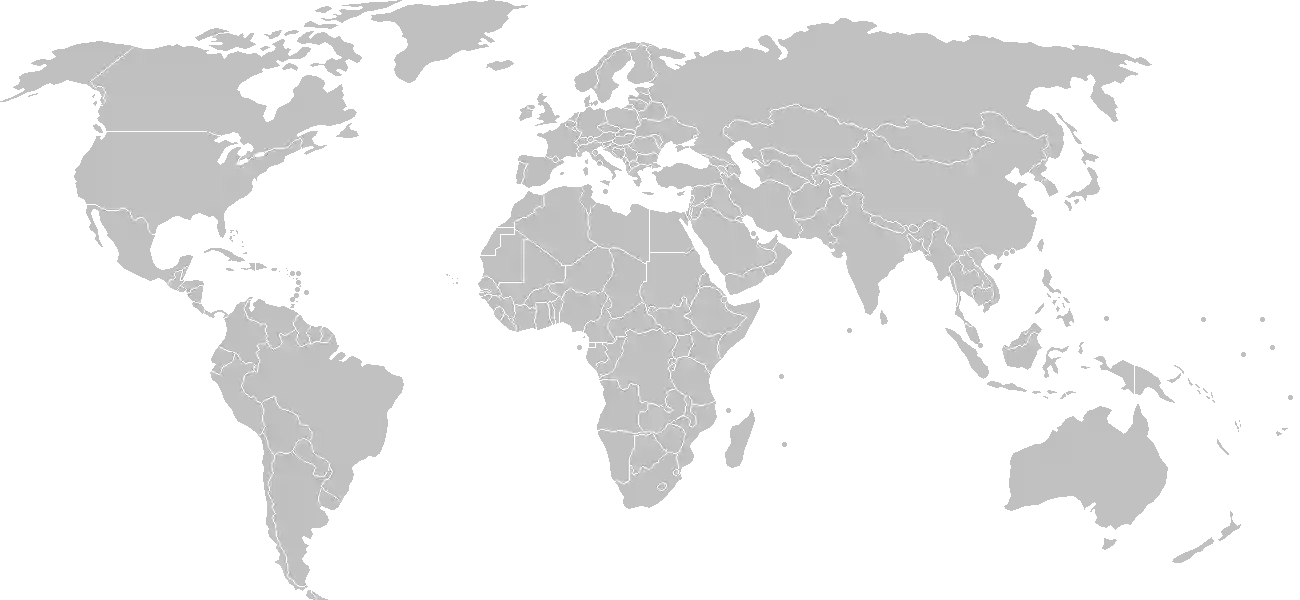
Geographic Location

Southern Africa, between South Africa and Zambia

Map Reference
Africa

Area

Total Area
390,757 sq km
Land (99%)
Land: 386,847 sq km
Water: 3,910 sq km

Elevation

Highest Point
Inyangani
Inyangani 2,592 m
Lowest Point
junction of the Runde and Save Rivers
junction of the Runde and Save Rivers 162 m
Mean Elevation
961 m

Detailed Geography Information

Coastline

0 km (landlocked)

Geography - note

landlocked; the Zambezi forms a natural river boundary with Zambia; in full flood (February-April), the massive Victoria Falls on the river forms the world's largest curtain of falling water; Lake Kariba on the Zambia-Zimbabwe border forms the world's largest reservoir by volume (180 cu km; 43 cu mi)

Irrigated land

1,740 sq km (2012)

Land boundaries

Total boundary: 3,229 km
Botswana 834 km
Mozambique 1402 km
Zambia 763 km

Major aquifers

Upper Kalahari-Cuvelai-Upper Zambezi Basin

Major rivers (by length in km)

Zambezi (shared with Zambia [s]), Angola, Namibia, Botswana, and Mozambique [m]) - 2,740 km; Limpopo (shared with South Africa [s], Botswana, and Mozambique [m]) - 1,800 km note: [s] after country name indicates river source; [m] after country name indicates river mouth

Major watersheds (area sq km)

Indian Ocean drainage: Zambezi (1,332,412 sq km) Internal (endorheic basin) drainage: Okavango Basin (863,866 sq km)

Maritime claims

none (landlocked)

Natural hazards

recurring droughts; floods and severe storms are rare

Natural resources

coalchromium oreasbestosgoldnickelcopperiron orevanadiumlithiumtinplatinum group metals

Terrain

mostly high plateau with higher central plateau (high veld); mountains in east

Population & Growth

+1.80% Growth
17,472,752
Total inhabitants (2025 est.)
Male: 48.7% (8,503,108) Female: 51.3% (8,969,644)

Age Distribution

0-14 years
38.3%
~6,692,064
15-64 years
57.8%
~10,099,251
65 years
3.9%
~681,437
Note: 2024 est.

Demographic Longevity

Median Age
21.3 years
Male
20.3 yrs
Female
22 yrs
Life Expectancy
67.2 years
Male
65.6 yrs
Female
68.8 yrs

Vital Dynamics

Birth Rate
28.18
births per 1,000 people
Death Rate
6.4
deaths per 1,000 people
Net Migration
-3.58
migrants per 1,000 people
Fertility Rate
3.42
children born per woman

Detailed People & Society Information

Alcohol consumption per capita

3.11 liters of pure alcohol (2019 est.)

Children under the age of 5 years underweight

9.6% (2024 est.)

Currently married women (ages 15-49)

62.2% (2022 est.)

Dependency ratios

total dependency ratio: 72.3 (2025 est.) youth dependency ratio: 65.5 (2025 est.) elderly dependency ratio: 6.8 (2025 est.) potential support ratio: 14.7 (2025 est.)

Education expenditure

0.4%

0.4% of GDP (2023 est.) 17.9% national budget (2025 est.)

Ethnic groups

African
99.6%
mixed race
0.4%

Gross reproduction rate

1.68 (2025 est.)

Health expenditure

2.8%

2.8% of GDP (2021) 5.2% of national budget (2022 est.)

Infant mortality rate

total: 32.8 deaths/1,000 live births (2025 est.) male: 37 deaths/1,000 live births female: 29.6 deaths/1,000 live births

Languages

most widely spoken
80.9%
second most widely spoken
11.5%
traditionally used for business
0.3%
and Xhosa
7%
other
0.3%

Literacy

total population: 93.2% (2019 est.) male: 93.1% (2019 est.) female: 93.4% (2019 est.)

Major urban areas - population

1.578 million HARARE (capital) (2023)

Maternal mortality ratio

358 deaths/100,000 live births (2023 est.)

Mother's mean age at first birth

20.3 years (2015 est.) note: data represents median age at first birth among women 25-49

Nationality

noun: Zimbabwean(s) adjective: Zimbabwean

Obesity - adult prevalence rate

15.5% (2016)

Physician density

0.14 physicians/1,000 population (2023)

Population distribution

aside from major urban agglomerations in Harare and Bulawayo, population distribution is fairly even, with slightly greater overall numbers in the eastern half, as shown in this population distribution map

Refugees and internally displaced persons

Total Displaced & Vulnerable Persons
55,107 individuals
Refugees
40.7%
22,432
22,432 (2024 est.)
Internally Displaced Persons (IDPs)
59.3%
32,675
32,675 (2024 est.)

Religions

Apostolic Sect
40.3%
Pentecostal
17%
Protestant
13.8%
other Christian
7.8%
Roman Catholic
6.4%
African traditionalist
5%
other (includes Muslim
1.5%
none
8.3%

Sex ratio

at birth: 1.03 male(s)/female 0-14 years: 1.02 male(s)/female 15-64 years: 0.92 male(s)/female 65 years and over: 0.68 male(s)/female total population: 0.95 male(s)/female (2024 est.)

Tobacco use

total: 8.4% (2025 est.) male: 17.6% (2025 est.) female: 0.7% (2025 est.)

Climate & Issues

Climate Profile

tropical; moderated by altitude; rainy season (November to March)

Key Environmental Issues
deforestation soil erosion land degradation air and water pollution poaching toxic waste and heavy metal pollution from mining

Land Cover

Coverage Distribution
Agri (42%)
Forest (36%)
Other (22%)
Arable: 10.4%
Crops: 0.1%
Pasture: 31.3%
Forest: 35.9%

Air & Carbon Emissions

Annual CO2 Output 2023 est.
12.578 million
Coal (61%) Oil (39%) Gas (0%)
PM2.5 Exposure 14.5 µg/m³
0 5 (WHO Limit) 15 25 35+

Water Resources & Use

Renewable Water Resources 20 billion cubic meters (2022 est.)
Annual Water Withdrawal
municipal: 547.078 million cubic meters (2022 est.)
Municipal (11%) Ind (2%) Agri (87%)

Detailed Environmental Information

International environmental agreements

BiodiversityClimate ChangeClimate Change-Kyoto ProtocolClimate Change-Paris AgreementComprehensive Nuclear Test BanDesertificationEndangered SpeciesHazardous WastesLaw of the SeaOzone Layer ProtectionWetlands

Urbanization

urban population: 32.5% of total population (2023) rate of urbanization: 2.41% annual rate of change (2020-25 est.)

Waste and recycling

municipal solid waste generated annually: 1.45 million tons (2024 est.) percent of municipal solid waste recycled: 21.8% (2022 est.)

Capital & State Profile

Capital City
Harare
-17.8167° N, 31.0333° E
Timezone UTC+2
Government Type
presidential republic
Independence 1980-04-18
National Holiday 04-18

Executive Branch

Chief of State
President Emmerson Dambudzo MNANGAGWA (since 4 September 2023)
Head of Government
Vice President Constantino CHIWENGA (since 11 September 2023)
Last Election 23 August 2023
Next Election 2028
Cabinet Cabinet appointed by president, responsible to National Assembly

Legislative Branch

bicameral
Legislature Name Parliament
Lower Chamber National Assembly
Seats 280 (all directly elected)
Term 5 years
% Women 30.1%
Parties Composition
ZANU-PF 175Citizens Coalition for Change (CCC) 104
Upper Chamber Senate
Seats 80 (60 directly elected; 20 indirectly elected)
Term 5 years
% Women 44.3%
Parties Composition
ZANU-PF 33Citizens Coalition for Change (CCC) 27

National Identity & Symbols

National Flag Description

seven equal horizontal bands of green (top), yellow, red, black, red, yellow, and green, with a white isosceles triangle edged in black based on the left side; in the middle of the triangle, a yellow bird is on top of a five-pointed red star

Symbolic Meaning the bird represents the long history of the country; white stands for peace, green for agriculture, yellow for mineral wealth, red for the blood shed to achieve independence, and black for the people
National Symbol Zimbabwe bird symbol, African fish eagle, flame lily
National Colors green, yellow, red, black, white
National Anthem Kalibusiswe Ilizwe leZimbabwe [Ndebele] Simudzai Mureza WeZimbabwe [Shona] (Blessed Be the Land of Zimbabwe)

Detailed Government Information

Administrative divisions

8 provinces and 2 cities* with provincial status; Bulawayo*, Harare*, Manicaland, Mashonaland Central, Mashonaland East, Mashonaland West, Masvingo, Matabeleland North, Matabeleland South, Midlands

Citizenship

citizenship by birth: no citizenship by descent only: the father must be a citizen of Zimbabwe; in the case of a child born out of wedlock, the mother must be a citizen dual citizenship recognized: no residency requirement for naturalization: 5 years

Constitution

history: previous 1965 (at Rhodesian independence), 1979 (Lancaster House Agreement), 1980 (at Zimbabwean independence); latest final draft completed January 2013, approved by referendum 16 March 2013, approved by Parliament 9 May 2013, effective 22 May 2013 amendment process: proposed by the Senate or by the National Assembly; passage requires two-thirds majority vote by the membership of both houses of Parliament and assent of the president of the republic; amendments to constitutional chapters on fundamental human rights and freedoms and on agricultural lands also require approval by a majority of votes cast in a referendum

Country name

conventional long form: Republic of Zimbabwe conventional short form: Zimbabwe former: Southern Rhodesia, Rhodesia, Zimbabwe-Rhodesia etymology: takes its name from the Kingdom of Zimbabwe (13th-15th century) and its capital of Great Zimbabwe, which was built of stone; the name Zimbabwe comes from the Bantu phrase zimba we bahwe, meaning "houses of stones;" the former name, Rhodesia, was derived from the name of British colonial administrator Cecil RHODES

International law organization participation

has not submitted an ICJ jurisdiction declaration; non-party state to the ICCt

International organization participation

Judicial branch

highest court(s): Supreme Court (consists of the chief justice and 4 judges); Constitutional Court (consists of the chief and deputy chief justices and 9 judges) judge selection and term of office: Supreme Court judges appointed by the president on recommendation of the Judicial Service Commission, an independent body consisting of the chief justice, Public Service Commission chairman, attorney general, and 2-3 members appointed by the president; judges normally serve until age 65 but can elect to serve until age 70; Constitutional Court judge appointment NA; judges serve nonrenewable 15-year terms subordinate courts: High Court; Labor Court; Administrative Court; regional magistrate courts; customary law courts; special courts

Legal system

mixed system of English common law, Roman-Dutch civil law, and customary law

National heritage

total World Heritage Sites: 5 (3 cultural, 2 natural) selected World Heritage Site locales: Mana Pools National Park, Sapi, and Chewore Safari Areas (n); Great Zimbabwe National Monument (c); Khami Ruins National Monument (c); Mosi-oa-Tunya/Victoria Falls (n); Matobo Hills (c)

Political parties

Citizens Coalition for Change Movement for Democratic Change or MDC-T National People's Congress or NPC Zimbabwe African National Union-Patriotic Front or ZANU-PF Zimbabwe African Peoples Union or ZAPU

Suffrage

18 years of age; universal

Economic Overview

low income Sub-Saharan economy; political instability and endemic corruption have prevented reforms and stalled debt restructuring; new Zimbabwe Gold (ZiG) currency latest effort to combat ongoing hyperinflation; reliant on natural resource extraction, agriculture and remittances

Size & Performance

Real GDP (PPP)
$57.391 billion
Latest available estimate (2024)
2023: $56.249 billion2022: $53.399 billion
Real GDP Growth
2% (2024 est.)
+2%
GDP Per Capita (PPP)
$3,500
2023: $3,4002022: $3,300

GDP Sector Breakdown

Agriculture: 5.4%Industry: 31.8%Services: 55.8%
Origin GDP %
Agriculture 5.4%
Industry 31.8%
Services 55.8%

Trade Balance

Trade Position
Trade Deficit
$2.69 billion
Total Exports
$7.603 billion (2023 est.)
Total Imports
$10.293 billion (2023 est.)
Exports (42%) Imports (58%)

Budget Balance

Budget Position
Budget Deficit
-$6.00 million
Revenues
$17 million (2018 est.)
Expenditures
$23 million (2018 est.)
Revenues (43%) Expenditures (57%)

Export Profile

Top Export Partners

Note: 2023; top five export partners based on percentage share of exports

Major Export Commodities

goldtobacconickelmineralsdiamonds

Import Profile

Top Import Partners

15.0%
The
5.0%
4.0%
Note: 2023; top five import partners based on percentage share of imports

Major Import Commodities

refined petroleumfertilizerstruckssoybean oilstone processing machines

Labor & Employment

Total Labor Force 6.386 million (2024 est.)
General Unemployment Rate 8.6%
Youth Unemployment (Ages 15-24) 14.0%
Population Below Poverty Line 38.3% (2019 est.)

Income Inequality

Gini Coefficient (Family Income) 50.3
0 (Perfect Equality) High Inequality 100 (Perfect Inequality)

Family Income / Consumption Share

Lowest 10%: 2.5% (2017 est.) Highest 10%: 34.8% (2017 est.)
Inequality Gap: Top 10% holds 13.9x the share of the bottom 10%.

Detailed Economic Data

Agricultural products

sugarcanebeefmaizecabbagespotatoestomatoesmilkonionsbananaswheat

Current account balance

$133.877 million (2023 est.) $304.966 million (2022 est.) $348.215 million (2021 est.) note: balance of payments - net trade and primary/secondary income in current dollars

Debt - external

$6.671 billion (2023 est.) note: present value of external debt in current US dollars

Exchange rates

Zimbabwean dollars (ZWD) per US dollar - Exchange rates: 3,266.332 (2024 est.) 3,509.172 (2023 est.) 374.954 (2022 est.) 88.552 (2021 est.) 51.329 (2020 est.) note: ongoing hyperinflation rendered Zimbabwean dollar essentially worthless; introduction of Zimbabwe Gold (ZiG) as new currency effective April 2024

GDP - composition, by end use

Industrial production growth rate

2.7% (2024 est.) note: annual % change in industrial value added based on constant local currency

Industries

mining (coalgoldplatinumcoppernickeltindiamondsclaynumerous metallic and nonmetallic ores)steelwood productscementchemicalsfertilizerclothing and footwearfoodstuffsbeverages

Inflation rate (consumer prices)

104.7% (2022 est.) 98.5% (2021 est.) 557.2% (2020 est.) note: annual % change based on consumer prices

Remittances

9.4% of GDP (2023 est.) 9.4% of GDP (2022 est.) 9.4% of GDP (2021 est.) note: personal transfers and compensation between resident and non-resident individuals/households/entities

Reserves of foreign exchange and gold

$484.973 million (2024 est.) $115.53 million (2023 est.) $598.622 million (2022 est.) note: holdings of gold (year-end prices)/foreign exchange/special drawing rights in current dollars

Taxes and other revenues

7.2% (of GDP) (2018 est.) note: central government tax revenue as a % of GDP

Grid Infrastructure

Electricity Access 50.1%
Urban: 89% Rural: 33.7%
Capacity 2.491 million kW (2023 est.)
Consumption 8.346 billion kWh (2023 est.)
Exports 395 million kWh (2023 est.)
Imports 2.297 billion kWh (2023 est.)
Grid Losses: 1.864 billion kWh (2023 est.)

Generation Mix

Percentage Share of Production
hydroelectricity 65.7%
fossil fuels 32.5%
biomass and waste 1.5%
solar 0.4%

Fossil Fuels Production

Petroleum
Production 800 bbl/day (2023 est.)
Consumption 34,000 bbl/day (2023 est.)
Coal
Production 7.968 million metric tons (2023 est.)
Consumption 6.705 million metric tons (2023 est.)
Exports 984,000 metric tons (2023 est.)
Imports 71,000 metric tons (2023 est.)
Proven Reserves 502 million metric tons (2023 est.)

Intensity & Nuclear

Energy Consumption Per Capita 10.855 million Btu/person (2023 est.)
No nuclear energy infrastructure or reactor operations reported in this country dossier.

Digital Access

.zw
Internet Usage 38%

Active internet users as a percentage of the total population.

Fixed Broadband

Penetration Rate 2 / 100
Total Subscriptions 269,000 (2023 est.)

Mobile Cellular

Penetration Rate 94 / 100
Total Subscriptions 15.7 million (2024 est.)

Broadcast Media

government owns all local radio and TV stations; foreign shortwave broadcasts and satellite TV available; in rural areas, access to TV broadcasts is extremely limited; analog TV only, no digital service (2017)

Aviation

Z
Airports
144
As of 2025
Heliports
5
As of 2025

Railways

Total Track Length
3,427 km
National Network Data from 2014

Military Expenditures

GDP Allocation 0.4%
0.4% of GDP (2024 est.) 0.3% of GDP (2023 est.) 0.9% of GDP (2022 est.) 1.4% of GDP (2021 est.) 1% of GDP (2020 est.)

Active Duty Strengths

approximately 30,000 active Zimbabwe Defense Forces (2025)

Refers to active military personnel.

Service & Defense Details

Military and security forces

Zimbabwe Defense Forces (ZDF): Zimbabwe National Army (ZNA), Air Force of Zimbabwe (AFZ) Ministry of Home Affairs: Zimbabwe Republic Police (2025)

Military equipment inventories and acquisitions

the ZDF inventory is comprised mostly of Russian/Soviet-era and Chinese armaments with smaller quantities of older or obsolescent material from countries such as Brazil, France, Italy, South Africa, the UK, and the US (2025) note: since the early 2010s, Zimbabwe has been under an arms embargo from the EU, as well as targeted sanctions from Australia, Canada, New Zealand, the UK, and the US

Military - note

the primary responsibilities of the Zimbabwe Defense Forces (ZDF) are protecting the country’s sovereignty and territory and securing its borders; it also has a role in domestic security and socio-economic development projects and has continued to be active in the country’s politics since the 2017 military-assisted political transition; the ZDF is part of the Southern Africa Development Community (SADC) Standby Force and provided troops for the SADC military deployment to Mozambique from 2021-2024; Zimbabwe has defense ties with China and Russia the ZDF was formed after independence from the former Rhodesian Army and the two guerrilla forces that opposed it during the Rhodesian Civil War (aka "Bush War") of the 1970s, the Zimbabwe African National Liberation Army (ZANLA) and the Zimbabwe People's Revolutionary Army (ZIPRA); the ZDF intervened in the Mozambique Civil War (1983-1992), the Democratic Republic of Congo during the Second Congo War (1998-2003), and the Angolan Civil War (1975-2002) during the late 1990s (2025)

Military service age and obligation

18-22 years of age for voluntary military service for men and women (enlisted personnel); 18-24 for officer cadets; 18-30 for technical/specialist personnel; no conscription (2025)

Space Agency

Zimbabwe National Geospatial and Space Agency (ZINGSA; established in 2019 and officially launched in 2021) (2025) note: ZINGSA is under the Ministry of Higher and Tertiary Education, Science, and Technology Development

Program Overview

has a nascent program with the goal of using space technologies in economic development, including remote sensing capabilities to assist with monitoring or managing agriculture, food security, climate change, disease outbreaks, environmental hazards and disasters, and natural resources, as well as weather forecasting; has cooperated with Japan and Russia (2025)

Program Milestones

2020 began a program (BIRDS-5) sponsored by Japan to promote the development of a domestic space program by designing, building, testing, launching, and operating the first satellites for participating countries
2021 established satellite ground communications station and completed national wetlands mapping project
2022 first nano-sized remote sensing/educational satellite (ZIMSAT-1) built with Japan’s assistance and launched by Japan under the BIRDs-5 program
2024 second RS satellite (ZIMSAT-2) built with Russian assistance and launched by Russia