🇲🇺

Mauritius

Africa • Countries
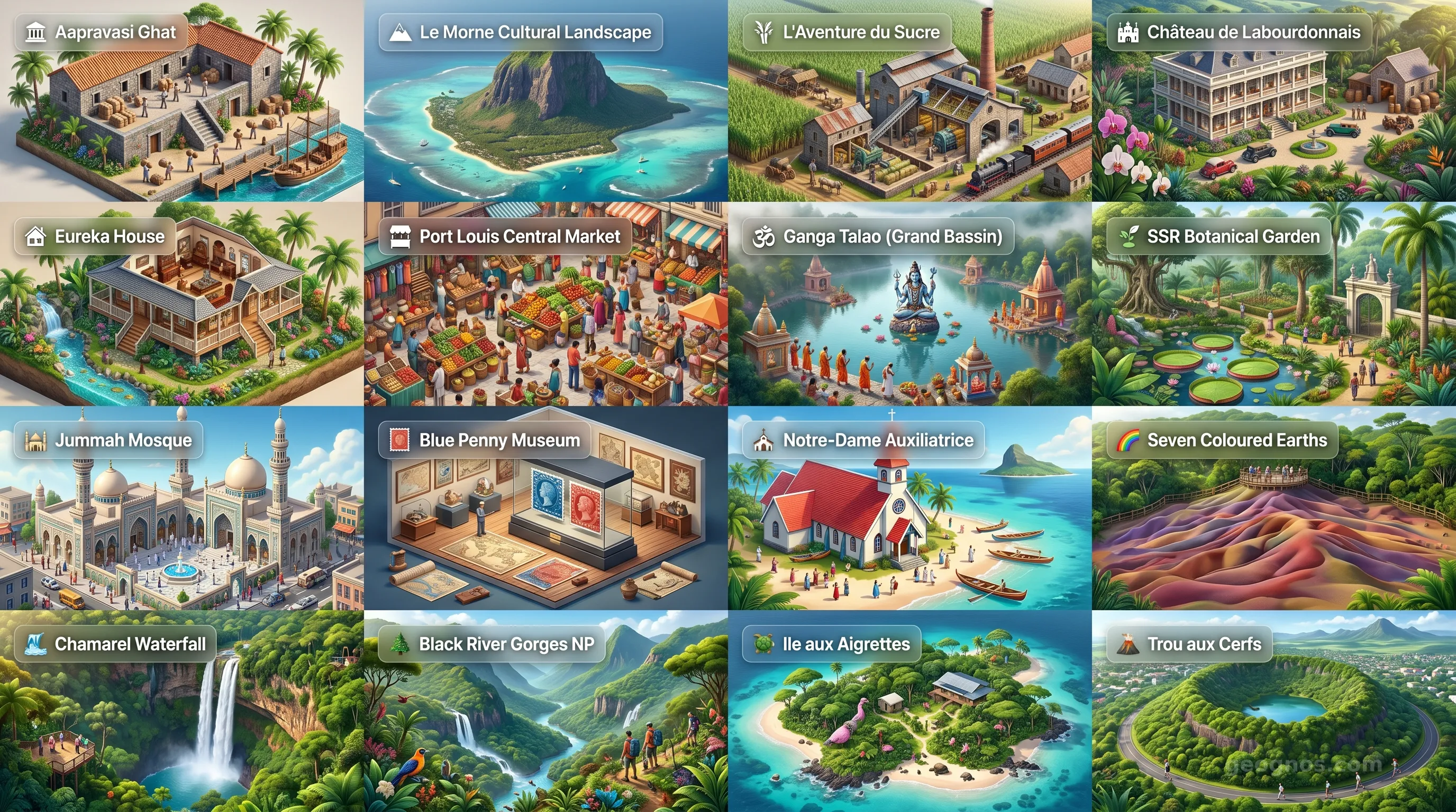
Mauritius - Panoramic Places of Interest Atlas including Aapravasi Ghat, Le Morne Cultural Landscape, L'Aventure du Sucre, Château de Labourdonnais, Eureka House, Port Louis Central Market, Ganga Talao (Grand Bassin), Sir Seewoosagur Ramgoolam Botanical Garden, Jummah Mosque, Blue Penny Museum, Notre-Dame Auxiliatrice (Cap Malheureux), Seven Coloured Earths of Chamarel, Chamarel Waterfall, Black River Gorges National Park, Ile aux Aigrettes, Trou aux Cerfs

Top Sights & Landmarks

01

Aapravasi Ghat

Birthplace of the Great Experiment

02

Le Morne Cultural Landscape

Symbol of Freedom and Resistance

03

L'Aventure du Sucre

The Sweet History of Mauritius

04

Château de Labourdonnais

Grand 19th-Century Colonial Estate

05

Eureka House

Creole Mansion of 109 Doors

06

Port Louis Central Market

The Vibrant Heartbeat of Port Louis

07

Ganga Talao (Grand Bassin)

Sacred Crater Lake of Shiva

08

Sir Seewoosagur Ramgoolam Botanical Garden

Historic Pamplemousses Gardens

09

Jummah Mosque

Architectural Jewel of Islam in Mauritius

10

Blue Penny Museum

Home of the World's Rarest Stamps

11

Notre-Dame Auxiliatrice (Cap Malheureux)

The Iconic Red-Roofed Church

12

Seven Coloured Earths of Chamarel

A Rainbow of Volcanic Sands

13

Chamarel Waterfall

The Tallest Waterfall in Mauritius

14

Black River Gorges National Park

Sanctuary of Endemic Biodiversity

15

Ile aux Aigrettes

Coral Island Eco-Reserve

16

Trou aux Cerfs

Dormant Volcano Crater in Curepipe

The Pearl of the Indian Ocean: A Crossroads of Spirit and Sea

Far from the continental shelves that dictate the lives of most nations, Mauritius rises from the volcanic floor of the Indian Ocean like a jagged, verdant emerald set against an endless sapphire expanse. To understand Mauritius is to understand the concept of a "world in one island." It is a land where the sheer geological violence of volcanic eruption softened over eons into lush tropical forests, dramatic coastal cliffs, and a turquoise lagoon that hums with the vitality of the coral reefs beneath. Yet, the geography of this place serves merely as the stage for a much grander human performance.

Mauritius was not a home for humans until relatively recently in the span of planetary time. Without an indigenous population, every culture that now defines the island—the Dutch, the French, the British, the enslaved Africans, and the indentured laborers from India and China—arrived as voyagers. This unique origin story has forged a society that does not merely tolerate diversity but flourishes because of it. Here, the aroma of simmering Creole rougail blends with the scent of Indian spice and French pâtisserie, creating a cultural alchemy that makes the island feel both impossibly remote and universally familiar.

A History Forged in the Wake of Ships

The story of Mauritius is a fascinating study of resilience and metamorphosis. It begins with the silence of the dodo, the flightless icon of the island that serves as a somber reminder of our environmental responsibility, and progresses through centuries of maritime ambition and colonial transformation. If you wish to understand how this small volcanic dot became a lighthouse for cultural integration, you should delve into our detailed history of Mauritius, where we break down the major waves of migration and the socioeconomic shifts that defined the colonial era.

This history is not just a series of dates on a dusty timeline. It is an active, living memory that informs the Mauritian identity today. We invite students and scholars alike to sharpen their grasp of these transformative events by participating in our interactive chronological puzzle. By arranging the defining moments of the nation in the correct order, you gain more than just a badge; you gain a structural understanding of how each chapter of Mauritian history built the foundation for its modern stability and democracy.

Visualizing the Mauritian Journey

Because the physical and historical evolution of Mauritius is so vividly colored by its landscapes—from the colonial mansions of Eureka to the bustling harbor of Port Louis—it deserves a sensory approach to education. We encourage you to engage with the visual storytelling of this island by accessing our cinematic history showcase. This curated journey through the annals of the past allows you to view rare historical illustrations and context summaries that bring the struggle and ultimate triumph of the Mauritian people into sharp focus.

Beyond the pages of history, the geography of the island provides a breathtaking gallery of natural wonder. Whether it is the shifting sand dunes of Chamarel, the towering massifs of the Black River Gorges, or the serene, reflective waters of the Grand Bassin, the topography tells a tale of fire and water. You can explore these topographical and man-made landmarks in detail through our cinematic points of interest tour. This experience is designed to help educators visualize the diversity of the terrain for their students, providing a vivid look at the island's most essential landmarks before they visit the physical site.

The Mauritian Spirit: A Modern Synthesis

What truly sets Mauritius apart is its internal social harmony. In an age where societies often fracture under the pressure of globalization, Mauritius serves as a compelling model of coexistence. The interplay of religious festivals, which might see the quiet devotion of Diwali lanterns floating on a lake or the solemn, rhythmic music of the Sega dance performed under the evening stars, reflects a population that has learned the value of the 'we' over the 'I.' The Sega dance itself, born from the pain of enslavement and transformed into a joyful expression of freedom, is perhaps the most accurate metaphor for the Mauritian soul.

As you progress through the further sections of this profile, you will find that our commitment to documenting this nation is as rigorous as our admiration for it. From the technical aspects of the government and the economic metrics that track the island’s transition into a high-income service and tourism economy, to the nuanced environmental reports that address the preservation of our endemic species, GeoGnos aims to provide a comprehensive digital encyclopedia of this island paradise. We do this not only for the sake of data, but to ensure that the unique character of Mauritius remains known and respected by those who inhabit the mainland worlds thousands of miles away.

Whether you are a researcher looking for precise data on energy infrastructure or a student dreaming of walking the golden sands of Belle Mare, remember that Mauritius is more than a location on a map. It is a lesson in potential, a study in multicultural success, and a vivid testament to the beauty of our world when it is nurtured with care and respected for its fragility.
Location

Latitude
-20.2833° N
Longitude
57.55° E
N S W E
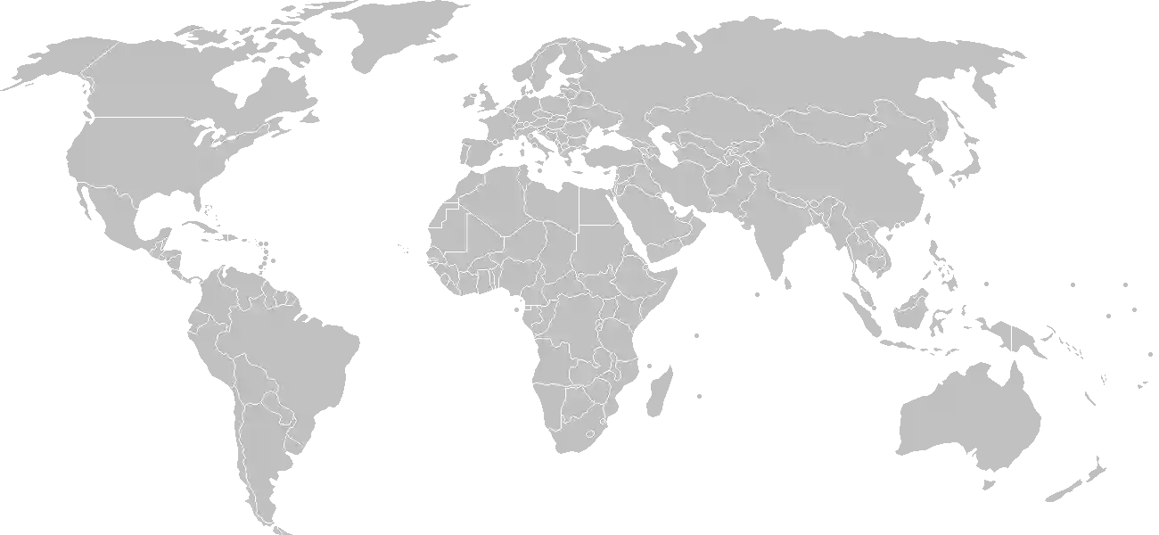
World Map Location
Geographic Location

Southern Africa, island in the Indian Ocean, about 800 km (500 mi) east of Madagascar

Map Reference
Africa

Area

Total Area
2,040 sq km
Land (100%)
Land: 2,030 sq km
Water: 10 sq km

Elevation

Highest Point
Mont Piton
Mont Piton 828 m
Lowest Point
Indian Ocean
Indian Ocean 0 m

Detailed Geography Information

Coastline

177 km

Geography - note

the main island, from which the country derives its name, is of volcanic origin and is almost entirely surrounded by coral reefs; former home of the extinct dodo, a large flightless bird related to pigeons

Irrigated land

143 sq km (2022)

Land boundaries

total: 0 km

Maritime claims

territorial sea: 12 nm exclusive economic zone: 200 nm continental shelf: 200 nm or to the edge of the continental margin note: measured from claimed archipelagic straight baselines

Natural hazards

cyclones (November to April); almost completely surrounded by reefs that may pose maritime hazards

Natural resources

arable landfish

Terrain

small coastal plain rising to discontinuous mountains encircling central plateau

Population & Growth

+0.10% Growth
1,311,375
Total inhabitants (2025 est.)
Male: 48.8% (639,707) Female: 51.2% (671,668)

Age Distribution

0-14 years
15.1%
~198,018
15-64 years
71.0%
~931,076
65 years
13.9%
~182,281
Note: 2024 est.

Demographic Longevity

Median Age
40 years
Male
38.1 yrs
Female
41 yrs
Life Expectancy
75.4 years
Male
72.6 yrs
Female
78.4 yrs

Vital Dynamics

Birth Rate
9.73
births per 1,000 people
Death Rate
9.14
deaths per 1,000 people
Net Migration
0
migrants per 1,000 people
Fertility Rate
1.36
children born per woman

Detailed People & Society Information

Alcohol consumption per capita

3.39 liters of pure alcohol (2019 est.)

Currently married women (ages 15-49)

51.6% (2022 est.)

Dependency ratios

total dependency ratio: 41.7 (2025 est.) youth dependency ratio: 21.1 (2025 est.) elderly dependency ratio: 20.5 (2025 est.) potential support ratio: 4.9 (2025 est.)

Education expenditure

4.1%

4.1% of GDP (2024 est.) 14.2% national budget (2024 est.)

Ethnic groups

Gross reproduction rate

0.66 (2025 est.)

Health expenditure

6.4%

6.4% of GDP (2021) 9.4% of national budget (2022 est.)

Hospital bed density

3.7 beds/1,000 population (2021 est.)

Infant mortality rate

total: 11.4 deaths/1,000 live births (2025 est.) male: 13.1 deaths/1,000 live births female: 10 deaths/1,000 live births

Languages

Creole
86.5%
Bhojpuri
5.3%
French
4.1%
two languages
1.4%
other (includes English
2.6%
which is spoken by less than of the population
1%
unspecified
0.1%

Literacy

total population: 94.3% (2023 est.) male: 96.3% (2023 est.) female: 92.8% (2023 est.)

Major urban areas - population

149,000 PORT LOUIS (capital) (2018)

Maternal mortality ratio

66 deaths/100,000 live births (2023 est.)

Nationality

noun: Mauritian(s) adjective: Mauritian

Obesity - adult prevalence rate

10.8% (2016)

Physician density

1.44 physicians/1,000 population (2022)

Population distribution

population density is one of the highest in the world; urban clusters are found throughout the main island, with a greater density in and around Port Luis; the population on Rodrigues Island is fairly evenly spread, with a slightly denser cluster on the north coast, as shown in this population distribution map

Refugees and internally displaced persons

Total Displaced & Vulnerable Persons
121 individuals
Refugees
67.8%
82
82 (2024 est.)
Internally Displaced Persons (IDPs)
32.2%
39
39 (2024 est.)

Religions

Hindu
48.5%
Roman Catholic
26.3%
Muslim
17.3%
other Christian
6.4%
other
0.6%
none
0.7%
unspecified
0.1%

School life expectancy (primary to tertiary education)

total: 14 years (2020 est.) male: 14 years (2020 est.) female: 15 years (2020 est.)

Sex ratio

at birth: 1.07 male(s)/female 0-14 years: 1.04 male(s)/female 15-64 years: 0.99 male(s)/female 65 years and over: 0.71 male(s)/female total population: 0.95 male(s)/female (2024 est.)

Tobacco use

total: 19.6% (2025 est.) male: 37.4% (2025 est.) female: 2.6% (2025 est.)

Climate & Issues

Climate Profile

tropical, modified by southeast trade winds; warm, dry winter (May to November); hot, wet, humid summer (November to May)

Key Environmental Issues
water pollution, degradation of coral reefs soil erosion wildlife preservation solid-waste disposal

Land Cover

Coverage Distribution
Agri (43%)
Forest (19%)
Other (38%)
Arable: 37.6%
Crops: 2.0%
Pasture: 3.5%
Forest: 19.2%

Air & Carbon Emissions

Annual CO2 Output 2023 est.
5.551 million
Coal (27%) Oil (73%) Gas (0%)
PM2.5 Exposure 10.5 µg/m³
0 5 (WHO Limit) 15 25 35+

Water Resources & Use

Renewable Water Resources 2.751 billion cubic meters (2022 est.)
Annual Water Withdrawal
municipal: 320 million cubic meters (2022)
Municipal (51%) Ind (2%) Agri (48%)

Detailed Environmental Information

International environmental agreements

Antarctic-Marine Living ResourcesBiodiversityClimate ChangeClimate Change-Kyoto ProtocolClimate Change-Paris AgreementDesertificationEndangered SpeciesEnvironmental ModificationHazardous WastesLaw of the SeaMarine Life ConservationNuclear Test BanOzone Layer ProtectionShip PollutionWetlands

Urbanization

urban population: 40.9% of total population (2023) rate of urbanization: 0.28% annual rate of change (2020-25 est.)

Waste and recycling

municipal solid waste generated annually: 438,000 tons (2024 est.) percent of municipal solid waste recycled: 15.9% (2022 est.)

Capital & State Profile

Capital City
Port Louis
-20.15° N, 57.4833° E
Timezone UTC+4
Government Type
parliamentary republic
Independence 1968-03-12
National Holiday 03-12

Executive Branch

Chief of State
President Dharam GOKHOOL (since 7 December 2024)
Head of Government
Prime Minister Navin RAMGOOLAM (since 13 November 2024)
Last Election 6 December 2024
Next Election 2029
Cabinet Cabinet of Ministers (Council of Ministers) appointed by the president on the recommendation of the prime minister

Legislative Branch

unicameral
Legislature Name National Assembly - Assemblée nationale
Seats & Term
67 (62 directly elected; 4 appointed) seats / 5 years
Women in Chamber
17.9% Representation
Electoral System plurality/majority
Parties Composition
Alliance Du Changement (Alliance for Change, AdC) 60Other 2

National Identity & Symbols

National Flag Description

four equal horizontal bands of red (top), blue, yellow, and green

Symbolic Meaning red stands for self-determination and independence; blue for the Indian Ocean; yellow for the new light of independence, golden sunshine, or the bright future; and green for agriculture or the island's lush vegetation
National Symbol dodo bird, earring tree flower (Trochetia boutoniana)
National Colors red, blue, yellow, green
National Anthem Motherland

Detailed Government Information

Administrative divisions

9 districts and 3 dependencies*; Agalega Islands*, Black River, Cargados Carajos Shoals*, Flacq, Grand Port, Moka, Pamplemousses, Plaines Wilhems, Port Louis, Riviere du Rempart, Rodrigues*, Savanne

Citizenship

citizenship by birth: yes citizenship by descent only: yes dual citizenship recognized: yes residency requirement for naturalization: 5 out of the previous 7 years including the last 12 months

Constitution

history: several previous; latest adopted 12 March 1968 amendment process: proposed by the National Assembly; passage of amendments affecting constitutional articles, including the sovereignty of the state, fundamental rights and freedoms, citizenship, or the branches of government, requires approval in a referendum by at least three-fourths majority of voters followed by a unanimous vote by the Assembly; passage of other amendments requires only two-thirds majority vote by the Assembly

Country name

conventional long form: Republic of Mauritius conventional short form: Mauritius local long form: Republic of Mauritius local short form: Mauritius etymology: named after Prince Maurice VAN NASSAU, stadtholder (governor) of the Dutch Republic, in 1598 note: pronounced mahr-ish-us

International law organization participation

accepts compulsory ICJ jurisdiction with reservations; accepts ICCt jurisdiction

International organization participation

Judicial branch

highest court(s): Supreme Court of Mauritius (consists of the chief justice, a senior puisne judge, and 24 puisne judges) judge selection and term of office: chief justice appointed by the president after consultation with the prime minister; senior puisne judge appointed by the president with the advice of the chief justice; other puisne judges appointed by the president with the advice of the Judicial and Legal Commission, a 4-member body of judicial officials including the chief justice; all judges serve until retirement at age 67 subordinate courts: lower regional courts known as District Courts, Court of Civil Appeal; Court of Criminal Appeal; Public Bodies Appeal Tribunal note: the Judicial Committee of the Privy Council (in London) serves as the final court of appeal

Legal system

civil system based on French civil law with some elements of English common law

National heritage

total World Heritage Sites: 2 (both cultural) selected World Heritage Site locales: Aapravasi Ghat; Le Morne Cultural Landscape

Political parties

Alliance Morisien (Mauritian Alliance) Jean-Claude Barbier Movement (Mouvement Jean-Claude Barbier) or MJCB Mauritian Militant Movement (Mouvement Militant Mauricien) or MMM Mauritian Social Democratic Party (Parti Mauricien Social Democrate) or PMSD Mauritius Labor Party (Parti Travailliste) or PTR or MLP Militant Platform (Plateforme Militante) or PM Militant Socialist Movement (Mouvement Socialist Mauricien) or MSM Muvman Liberater or ML National Alliance Patriotic Movement (Mouvement Patriotique) or MAG Rodrigues Peoples Organization (Organisation du Peuple Rodriguais) or OPR

Suffrage

18 years of age; universal

Economic Overview

upper middle-income Indian Ocean island economy; diversified portfolio; investing in maritime security; strong tourism sector decimated by COVID-19; expanding in information and financial services; environmentally fragile

Size & Performance

Real GDP (PPP)
$34.406 billion
Latest available estimate (2024)
2023: $32.864 billion2022: $31.296 billion
Real GDP Growth
4.7% (2024 est.)
+4.7%
GDP Per Capita (PPP)
$27,300
2023: $26,1002022: $24,800

GDP Sector Breakdown

Agriculture: 4.3%Industry: 17.8%Services: 64.4%
Origin GDP %
Agriculture 4.3%
Industry 17.8%
Services 64.4%

Trade Balance

Trade Position
Trade Deficit
$1.65 billion
Total Exports
$6.381 billion (2023 est.)
Total Imports
$8.027 billion (2023 est.)
Exports (44%) Imports (56%)

Budget Balance

Budget Position
Budget Deficit
-$1.24 billion
Revenues
$3.801 billion (2024 est.)
Expenditures
$5.042 billion (2024 est.)
Revenues (43%) Expenditures (57%)

Export Profile

Top Export Partners

Note: 2023; top five export partners based on percentage share of exports

Major Export Commodities

fishgarmentsraw sugarfertilizersdiamonds

Import Profile

Top Import Partners

Note: 2023; top five import partners based on percentage share of imports

Major Import Commodities

refined petroleumcarsfishcoalpackaged medicine

Labor & Employment

Total Labor Force 594,900 (2024 est.)
General Unemployment Rate 5.5%
Youth Unemployment (Ages 15-24) 16.6%
Population Below Poverty Line 10.3% (2017 est.)

Income Inequality

Gini Coefficient (Family Income) 36.8
0 (Perfect Equality) Moderate Inequality 100 (Perfect Inequality)

Family Income / Consumption Share

Lowest 10%: 2.9% (2017 est.) Highest 10%: 29.9% (2017 est.)
Inequality Gap: Top 10% holds 10.3x the share of the bottom 10%.

Detailed Economic Data

Agricultural products

sugarcanechickenpumpkinstomatoeseggspotatoescabbagesbananasonionscucumbers

Current account balance

-$647.743 million (2023 est.) -$1.437 billion (2022 est.) -$1.497 billion (2021 est.) note: balance of payments - net trade and primary/secondary income in current dollars

Debt - external

$3.632 billion (2023 est.) note: present value of external debt in current US dollars

Exchange rates

Mauritian rupees (MUR) per US dollar - Exchange rates: 46.415 (2024 est.) 45.267 (2023 est.) 44.183 (2022 est.) 41.692 (2021 est.) 39.347 (2020 est.)

GDP - composition, by end use

Industrial production growth rate

4.7% (2024 est.) note: annual % change in industrial value added based on constant local currency

Industries

food processing (largely sugar milling)textilesclothingminingchemicalsmetal productstransport equipmentnonelectrical machinerytourism

Inflation rate (consumer prices)

3.6% (2024 est.) 7.1% (2023 est.) 10.8% (2022 est.) note: annual % change based on consumer prices

Public debt

58% of GDP (2019 est.) note: central government debt as a % of GDP

Remittances

2.2% of GDP (2023 est.) 2.1% of GDP (2022 est.) 2.4% of GDP (2021 est.) note: personal transfers and compensation between resident and non-resident individuals/households/entities

Reserves of foreign exchange and gold

$8.506 billion (2024 est.) $7.248 billion (2023 est.) $7.793 billion (2022 est.) note: holdings of gold (year-end prices)/foreign exchange/special drawing rights in current dollars

Taxes and other revenues

20.5% (of GDP) (2023 est.) note: central government tax revenue as a % of GDP

Grid Infrastructure

Electricity Access 100%
Urban: 99% Rural: 100%
Capacity 955,000 kW (2023 est.)
Consumption 3.084 billion kWh (2023 est.)
Grid Losses: 179.996 million kWh (2023 est.)

Generation Mix

Percentage Share of Production
fossil fuels 82.4%
biomass and waste 9.9%
solar 4.6%
hydroelectricity 2.9%
wind 0.3%

Fossil Fuels Production

Petroleum
Consumption 28,000 bbl/day (2023 est.)
Coal
Consumption 651,000 metric tons (2023 est.)
Imports 610,000 metric tons (2023 est.)

Intensity & Nuclear

Energy Consumption Per Capita 60.188 million Btu/person (2023 est.)
No nuclear energy infrastructure or reactor operations reported in this country dossier.

Digital Access

.mu
Internet Usage 80%

Active internet users as a percentage of the total population.

Fixed Broadband

Penetration Rate 27 / 100
Total Subscriptions 343,000 (2023 est.)

Mobile Cellular

Penetration Rate 173 / 100
Total Subscriptions 2.2 million (2024 est.)

Broadcast Media

the Mauritius Broadcasting Corporation (MBC) is the national public TV and radio broadcaster, with programming in French, English, Hindi, Creole, and Chinese; MBC provides 17 television channels in Mauritius; 9 FM radio stations and 2 AM radio stations (2022)

Aviation

3B
Airports
5
As of 2025
Heliports
1
As of 2025

Ports & Harbors

Ports Count 2
Hover for breakdown & key ports As of 2024

Merchant Marine

Commercial Fleet
32 ships
Hover for vessel types breakdown As of 2023

Service & Defense Details

Military and security forces

no regular military forces; the Mauritius Police Force (MPF) under the Ministry of Defense is responsible for the country's security; it includes a paramilitary unit known as the Special Mobile Force, which includes some motorized infantry and light armored units; the MPF also has a Police Helicopter Squadron, a Special Support Unit (riot police), and the National Coast Guard (2025)

Military - note

key security priorities for the Maritius Police Force (MPF) include combating narcotics trafficking, ensuring public order, fighting cybercrime, improving maritime security, and responding to natural disasters; the MPF's primary security partner is India, which provides training and other support to the National Coast Guard, while Indian naval vessels often patrol the country's waters; the MPF has also received assistance and training from France, the UK, and the US the Special Mobile Force was created in 1960 following the withdrawal of the British garrison (2025)