🇳🇦

Namibia

Africa • Countries
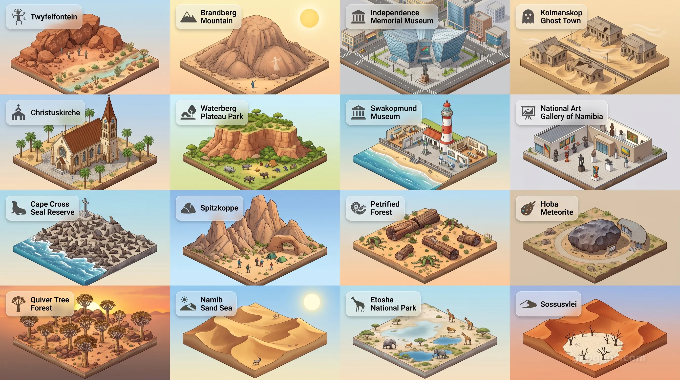
Namibia - Panoramic Places of Interest Atlas including Twyfelfontein, Brandberg Mountain, Independence Memorial Museum, Kolmanskop Ghost Town, Christuskirche, Waterberg Plateau Park, Swakopmund Museum, National Art Gallery of Namibia, Cape Cross Seal Reserve, Spitzkoppe, Petrified Forest, Hoba Meteorite, Quiver Tree Forest, Namib Sand Sea, Etosha National Park, Sossusvlei

Top Sights & Landmarks

01

Twyfelfontein

Ancient Rock Engravings

02

Brandberg Mountain

Home of the White Lady

03

Independence Memorial Museum

Monument to Freedom

04

Kolmanskop Ghost Town

The Sand-Swallowed Diamond Town

05

Christuskirche

Windhoek's Iconic Lutheran Church

06

Waterberg Plateau Park

Ecological Stronghold & Historical Battlefield

07

Swakopmund Museum

Window into the Coastal Past

08

National Art Gallery of Namibia

Heart of Namibian Creativity

09

Cape Cross Seal Reserve

Historic Cross and Barking Seals

10

Spitzkoppe

The Matterhorn of Namibia

11

Petrified Forest

Frozen in Time

12

Hoba Meteorite

The Largest Meteorite on Earth

13

Quiver Tree Forest

Ancient Botanical Wonder

14

Namib Sand Sea

The Oldest Desert on Earth

15

Etosha National Park

The Great White Place

16

Sossusvlei

Towering Red Dunes

Namibia: The Timeless Canvas of the Ancient Earth

There are places on this planet that feel as though they were crafted before the dawn of time, landscapes so vast and uncompromising that they demand a quiet reverence from all who traverse them. Namibia is precisely such a place. Located along the southwestern coast of Africa, this nation is defined not by the bustling clamor of modern urban density, but by the profound, silent majesty of its geography. To look upon Namibia is to witness the Earth in its most raw and elemental form, where the restless Atlantic Ocean meets the shifting, apricot-colored dunes of the Namib, arguably the oldest desert in existence.

Namibia is a masterpiece of light and shadow, a territory where the geological clock slows to a near standstill. For those who seek to understand the profound interaction between climate, topography, and the human spirit, this country offers an unrivaled classroom. The narrative of Namibia is not one of hurried change, but of resilience, adaptability, and the enduring beauty of spaces that defy categorization.

The Anatomy of a Wilderness

The sheer physical presence of Namibia serves as the primary architect of its identity. Its territory stretches across 824,292 square kilometers, flanked by the harsh currents of the Atlantic to the west and the expansive interior plateaus that transition into the Kalahari Basin in the east. This is a land of sharp contrasts. In the north, the Etosha Pan creates a salt-encrusted mirror that briefly shimmers with life during the rains, drawing herds of game from across the savannah. To the south, the Fish River Canyon cuts a jagged, titanic wound into the earth, echoing the tectonic forces that shaped the continent millions of years ago.

Understanding this landscape is the first step toward appreciating its people and its complex past. We invite you to explore the most iconic locations in the country through our POI Cinematic Showcase, which captures the visual splendor of sites ranging from the skeletal trees of Deadvlei to the colonial whispers of Swakopmund. These landmarks provide a visual foundation for understanding how the environment has dictated human settlement and migratory patterns throughout the millennia.

Threads of Time: Unraveling the Namibian Narrative

The human history of Namibia is etched into the very soil, a tapestry woven from the traditions of the San people, the migrations of the Bantu, and the complex entanglements of the colonial era. To grasp the fullness of the nation, one must venture beneath the surface of the landscapes and delve into the human chronicle. Because history in Namibia is so closely tethered to the harshness of the environment, each era reveals a new facet of survival and societal organization.

For those interested in a structured academic journey, you can examine our comprehensive history essay on Namibia, which traces the nation's progression from ancient rock art engravings in Twyfelfontein to its emergence as a sovereign state. We believe that history should be as immersive as the land itself. You can also engage with our interactive approach by visiting our Namibia History Puzzle, a digital chronology exercise designed to test your mastery of these events. By aligning the sequence of shifts in power, struggle, and peace, students and researchers can gain a tangible sense of how the modern nation took its shape.

A Perspective Through the Lens of History

Education at GeoGnos is about connecting dots between the past and the present. When we observe the architectural style of a Namibian town, we are seeing the echo of a century ago. When we study the traditional land-management techniques of the local communities, we are learning from knowledge systems that have flourished in arid conditions for generations. This synthesis of knowledge allows for a holistic view of the nation.

To help illustrate these transformative moments, we have curated a multimedia experience for our readers. You can view our History Cinematic Showcase, where high-definition illustrations breathe life into the foundational moments of Namibian development. This curated display serves as a bridge for students and educators, connecting abstract historical data to vivid, unforgettable imagery. It is our goal that this perspective encourages a deeper, more empathetic appreciation for the complexities that Namibians have navigated as they built their modern identity.

An Invitation to Discovery

Namibia remains a beacon for those who value the preservation of wild spaces and the documentation of profound historical cycles. Whether you are a student piecing together a geography presentation, a professor researching ecological adaptation, or a traveler preparing to stand atop the crimson sands of Sossusvlei, you will find that this nation offers much more than mere sight-seeing. It offers a lesson in perspective.

In the following sections of our portal, we explore the mechanical realities of the state. We analyze the intricate governmental structures that navigate the country's diverse demographic landscape, the economic performance that balances resource extraction with environmental conservation, and the cultural bonds that define the people. Namibia is a living, breathing testament to the fact that when we learn from the earth, we learn how to endure. We invite you to move forward through our data modules with a clear mind and an open heart, as you delve deeper into the unique, vibrant, and timeless story of Namibia.
Location

Latitude
-22° N
Longitude
17° E
N S W E
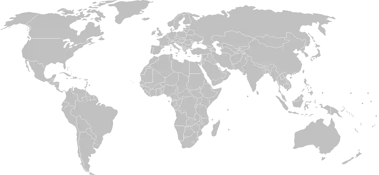
World Map Location
Geographic Location

Southern Africa, bordering the South Atlantic Ocean, between Angola and South Africa

Map Reference
Africa

Area

Total Area
824,292 sq km
Land (100%)
Land: 823,290 sq km
Water: 1,002 sq km

Elevation

Highest Point
Konigstein on Brandberg
Konigstein on Brandberg 2,573 m
Lowest Point
Atlantic Ocean
Atlantic Ocean 0 m
Mean Elevation
1,141 m

Detailed Geography Information

Coastline

1,572 km

Geography - note

the Namib Desert, after which the country is named, is considered to be the oldest desert in the world; some 14% of the land is protected, including virtually the entire Namib Desert coastal strip

Irrigated land

80 sq km (2012)

Land boundaries

Total boundary: 4,220 km
Angola 1427 km
Botswana 1544 km
South Africa 1005 km
Zambia 244 km

Major aquifers

Lower Kalahari-Stampriet Basin, Upper Kalahari-Cuvelai-Upper Zambezi Basin

Major rivers (by length in km)

Zambezi (shared with Zambia [s]), Angola, Botswana, Zimbabwe, and Mozambique [m]) - 2,740 km; Orange river mouth (shared with Lesotho [s], and South Africa) - 2,092 km; Okavango (shared with Angola [s], and Botswana [m]) - 1,600 km note: [s] after country name indicates river source; [m] after country name indicates river mouth

Major watersheds (area sq km)

Atlantic Ocean drainage: Orange (941,351 sq km) Indian Ocean drainage: Zambezi (1,332,412 sq km) Internal (endorheic basin) drainage: Okavango Basin (863,866 sq km)

Maritime claims

territorial sea: 12 nm contiguous zone: 24 nm exclusive economic zone: 200 nm

Natural hazards

prolonged periods of drought

Natural resources

diamondscopperuraniumgoldsilverleadtinlithiumcadmiumtungstenzincsalthydropowerfish

Terrain

mostly high plateau; Namib Desert along coast; Kalahari Desert in east

Population & Growth

+1.80% Growth
2,852,777
Total inhabitants (2025 est.)
Male: 49.1% (1,402,136) Female: 50.9% (1,450,641)

Age Distribution

0-14 years
34.1%
~972,797
15-64 years
62.0%
~1,768,722
65 years
3.9%
~111,258
Note: 2024 est.

Demographic Longevity

Median Age
23.1 years
Male
22.1 yrs
Female
23.5 yrs
Life Expectancy
65.9 years
Male
64.2 yrs
Female
67.6 yrs

Vital Dynamics

Birth Rate
23.93
births per 1,000 people
Death Rate
6.36
deaths per 1,000 people
Net Migration
0
migrants per 1,000 people
Fertility Rate
2.85
children born per woman

Detailed People & Society Information

Alcohol consumption per capita

2.38 liters of pure alcohol (2019 est.)

Currently married women (ages 15-49)

33.7% (2018 est.)

Dependency ratios

total dependency ratio: 60.5 (2025 est.) youth dependency ratio: 54 (2025 est.) elderly dependency ratio: 6.5 (2025 est.) potential support ratio: 15.5 (2025 est.)

Education expenditure

9.1%

9.1% of GDP (2024 est.) 24.6% national budget (2025 est.)

Ethnic groups

Ovambo
50%
Kavangos
9%
Herero
7%
Damara
7%
mixed European and African ancestry
6.5%
European
6%
Nama
5%
Caprivian
4%
San
3%
Baster
2%
Tswana
0.5%

Gross reproduction rate

1.4 (2025 est.)

Health expenditure

9.4%

9.4% of GDP (2021) 11.7% of national budget (2022 est.)

Infant mortality rate

total: 27.1 deaths/1,000 live births (2025 est.) male: 31 deaths/1,000 live births female: 24.7 deaths/1,000 live births

Languages

Oshiwambo languages
49.7%
Nama/Damara
11%
Kavango languages
10.4%
Afrikaans
9.4%
Herero languages
9.2%
Zambezi languages
4.9%
English
2.3%
other African languages
1.5%
other European languages
0.7%
other
1%

Literacy

total population: 87.6% (2023 est.) male: 87.9% (2023 est.) female: 87.4% (2023 est.)

Major urban areas - population

477,000 WINDHOEK (capital) (2023)

Maternal mortality ratio

139 deaths/100,000 live births (2023 est.)

Mother's mean age at first birth

21.6 years (2013 est.) note: data represents median age at first birth among women 25-49

Nationality

noun: Namibian(s) adjective: Namibian

Obesity - adult prevalence rate

17.2% (2016)

Physician density

0.55 physicians/1,000 population (2022)

Population distribution

population density is very low, with the largest clusters found in the extreme north-central area along the border with Angola, as shown in this population distribution map

Refugees and internally displaced persons

Total Displaced & Vulnerable Persons
22,770 individuals
Refugees
28.9%
6,575
6,575 (2024 est.)
Internally Displaced Persons (IDPs)
6.1%
1,399
1,399 (2024 est.)
Stateless Persons
65.0%
14,796
14,796 (2024 est.)

Religions

Christian
97.5%
other (includes Muslim
0.6%
unaffiliated
1.9%

Sex ratio

at birth: 1.03 male(s)/female 0-14 years: 1.02 male(s)/female 15-64 years: 0.95 male(s)/female 65 years and over: 0.76 male(s)/female total population: 0.97 male(s)/female (2024 est.)

Tobacco use

total: 11.8% (2025 est.) male: 20.5% (2025 est.) female: 3.9% (2025 est.)

Climate & Issues

Climate Profile

desert; hot, dry; rainfall sparse and erratic

Key Environmental Issues
depletion and degradation of water and aquatic resources desertification land degradation loss of biodiversity wildlife poaching

Land Cover

Coverage Distribution
Agri (47%)
Other (43%)
Arable: 1.0%
Crops: 0.0%
Pasture: 46.2%
Forest: 9.8%

Air & Carbon Emissions

Annual CO2 Output 2023 est.
3.46 million
Coal (100%) Oil (0%) Gas (0%)
PM2.5 Exposure 11.8 µg/m³
0 5 (WHO Limit) 15 25 35+
Methane Emissions
energy: 2.1 kt (2022-2024 est.)

Water Resources & Use

Renewable Water Resources 39.91 billion cubic meters (2022 est.)
Annual Water Withdrawal
municipal: 61.568 million cubic meters (2022 est.)
Municipal (22%) Ind (7%) Agri (71%)

Detailed Environmental Information

International environmental agreements

Antarctic-Marine Living ResourcesBiodiversityClimate ChangeClimate Change-Kyoto ProtocolClimate Change-Paris AgreementComprehensive Nuclear Test BanDesertificationEndangered SpeciesHazardous WastesLaw of the SeaOzone Layer ProtectionShip PollutionWetlands

Urbanization

urban population: 54.9% of total population (2023) rate of urbanization: 3.64% annual rate of change (2020-25 est.)

Waste and recycling

municipal solid waste generated annually: 256,700 tons (2024 est.) percent of municipal solid waste recycled: 19.6% (2022 est.)

Capital & State Profile

Capital City
Windhoek
-22.5667° N, 17.0833° E
Timezone UTC+2
Government Type
presidential republic
Independence 1990-03-21
National Holiday 03-21

Executive Branch

Chief of State
President Netumbo NANDI-NDAITWAH (since 21 March 2025)
Head of Government
President Netumbo NANDI-NDAITWAH (since 21 March 2025)
Last Election 27 November 2024
Next Election November 2029
Cabinet Cabinet appointed by the president from among members of the National Assembly

Legislative Branch

bicameral
Legislature Name Parliament
Lower Chamber National Assembly
Seats 104 (96 directly elected; 8 appointed)
Term 5 years
% Women 42.3%
Parties Composition
SWAPO Party 51Independent Patriots of Change (IPC) 20Affirmative Repositioning (AR) 6Landless People's Movement (LPM) 5Popular Democratic Movement (PDM) 5Other 9
Upper Chamber National Council
Seats 42 (all indirectly elected)
Term 5 years
% Women 14.3%

National Identity & Symbols

National Flag Description

a wide red stripe edged with narrow white stripes divides the flag diagonally from lower-left corner to upper-right corner; the upper triangle is blue and has a golden-yellow, 12-ray sunburst, and the lower triangle is green

Symbolic Meaning red stands for the heroism of the people and their determination to build a future of equal opportunity; white stands for peace, unity, tranquility, and harmony; blue stands for the sky and the Atlantic Ocean, the sun for power and existence, and green for vegetation and agricultural resources
National Symbol oryx (antelope)
National Colors blue, red, green, white, yellow
National Anthem Namibia, Land of the Brave

Detailed Government Information

Administrative divisions

14 regions; Erongo, Hardap, //Karas, Kavango East, Kavango West, Khomas, Kunene, Ohangwena, Omaheke, Omusati, Oshana, Oshikoto, Otjozondjupa, Zambezi note: the Karas region was renamed //Karas in 2013 to include the alveolar lateral click of the Khoekhoegowab language

Citizenship

citizenship by birth: no citizenship by descent only: at least one parent must be a citizen of Namibia dual citizenship recognized: no residency requirement for naturalization: 5 years

Constitution

history: adopted 9 February 1990, entered into force 21 March 1990 amendment process: passage requires majority vote of the National Assembly membership and of the National Council of Parliament and assent of the president of the republic; if the National Council fails to pass an amendment, the president can call for a referendum; passage by referendum requires two-thirds majority of votes cast; amendments that detract from or repeal constitutional articles on fundamental rights and freedoms cannot be amended, and the requisite majorities needed by Parliament to amend the constitution cannot be changed

Country name

conventional long form: Republic of Namibia conventional short form: Namibia local long form: Republic of Namibia local short form: Namibia former: German South-West Africa (Deutsch-Suedwestafrika), South-West Africa etymology: named for the coastal Namib Desert; the word namib comes from the local Nama language and means "an area where there is nothing"

International law organization participation

has not submitted an ICJ jurisdiction declaration; accepts ICCt jurisdiction

International organization participation

Judicial branch

highest court(s): Supreme Court (consists of the chief justice and at least 3 judges in quorum sessions) judge selection and term of office: judges appointed by the president of Namibia on the recommendation of the Judicial Service Commission; judges serve until age 65, but terms can be extended by the president until age 70 subordinate courts: High Court; Electoral Court, Labor Court; regional and district magistrates' courts; community courts

Legal system

mixed system of uncodified civil law based on Roman-Dutch law and customary law

National heritage

total World Heritage Sites: 2 (1 cultural, 1 natural) selected World Heritage Site locales: Twyfelfontein or /Ui-//aes (c); Namib Sand Sea (n)

Political parties

All People's Party or APP Christian Democratic Voice or CDV Landless People's Movement or LPM National Unity Democratic Organization or NUDO Namibian Economic Freedom Fighters or NEFF Popular Democratic Movement or PDM (formerly Democratic Turnhalle Alliance or DTA) Rally for Democracy and Progress or RDP Republican Party or RP South West Africa National Union or SWANU South West Africa People's Organization or SWAPO United Democratic Front or UDF United People's Movement or UPM

Suffrage

18 years of age; universal

Economic Overview

upper middle-income, export-driven Sub-Saharan economy; natural resource rich; Walvis Bay port expansion for trade; high potential for renewable power generation and energy independence; major nature-based tourist locale; natural resource rich; shortage of skilled labor

Size & Performance

Real GDP (PPP)
$31.154 billion
Latest available estimate (2024)
2023: $30.039 billion2022: $28.761 billion
Real GDP Growth
3.7% (2024 est.)
+3.7%
GDP Per Capita (PPP)
$10,300
2023: $10,1002022: $10,000

GDP Sector Breakdown

Agriculture: 7.3%Industry: 28.9%Services: 54.5%
Origin GDP %
Agriculture 7.3%
Industry 28.9%
Services 54.5%

Trade Balance

Trade Position
Trade Deficit
$3.31 billion
Total Exports
$5.887 billion (2024 est.)
Total Imports
$9.199 billion (2024 est.)
Exports (39%) Imports (61%)

Budget Balance

Budget Position
Budget Deficit
-$364.00 million
Revenues
$4.415 billion (2023 est.)
Expenditures
$4.779 billion (2023 est.)
Revenues (48%) Expenditures (52%)

Export Profile

Top Export Partners

Note: 2023; top five export partners based on percentage share of exports

Major Export Commodities

golddiamondsradioactive chemicalsfishrefined petroleum

Import Profile

Top Import Partners

Note: 2023; top five import partners based on percentage share of imports

Major Import Commodities

refined petroleumcopper oreshipselectricitytrucks

Labor & Employment

Total Labor Force 1.131 million (2024 est.)
General Unemployment Rate 19.2%
Youth Unemployment (Ages 15-24) 37.3%
Population Below Poverty Line 17.4% (2015 est.)

Income Inequality

Gini Coefficient (Family Income) 59.1
0 (Perfect Equality) High Inequality 100 (Perfect Inequality)

Family Income / Consumption Share

Lowest 10%: 1% (2015 est.) Highest 10%: 47.2% (2015 est.)
Inequality Gap: Top 10% holds 47.2x the share of the bottom 10%.

Detailed Economic Data

Agricultural products

root vegetablesmilkmaizebeefgrapesonionswheatfruitspulsesvegetables

Current account balance

-$2.055 billion (2024 est.) -$1.893 billion (2023 est.) -$1.605 billion (2022 est.) note: balance of payments - net trade and primary/secondary income in current dollars

Exchange rates

Namibian dollars (NAD) per US dollar - Exchange rates: 18.329 (2024 est.) 18.446 (2023 est.) 16.356 (2022 est.) 14.779 (2021 est.) 16.463 (2020 est.)

GDP - composition, by end use

Industrial production growth rate

1% (2024 est.) note: annual % change in industrial value added based on constant local currency

Industries

miningtourismfishingagriculture

Inflation rate (consumer prices)

4.2% (2024 est.) 5.9% (2023 est.) 6.1% (2022 est.) note: annual % change based on consumer prices

Public debt

4.64% of GDP (2019 est.) note: central government debt as a % of GDP

Remittances

1.1% of GDP (2024 est.) 1% of GDP (2023 est.) 0.7% of GDP (2022 est.) note: personal transfers and compensation between resident and non-resident individuals/households/entities

Reserves of foreign exchange and gold

$3.356 billion (2024 est.) $2.956 billion (2023 est.) $2.803 billion (2022 est.) note: holdings of gold (year-end prices)/foreign exchange/special drawing rights in current dollars

Taxes and other revenues

33% (of GDP) (2023 est.) note: central government tax revenue as a % of GDP

Grid Infrastructure

Electricity Access 56.2%
Urban: 74.8% Rural: 33.2%
Capacity 646,000 kW (2023 est.)
Consumption 3.891 billion kWh (2023 est.)
Exports 169 million kWh (2023 est.)
Imports 2.917 billion kWh (2023 est.)
Grid Losses: 747.409 million kWh (2023 est.)

Generation Mix

Percentage Share of Production
hydroelectricity 70%
solar 26.9%
fossil fuels 1.9%
wind 1.2%

Fossil Fuels Production

Petroleum
Consumption 23,000 bbl/day (2023 est.)
Natural Gas
Proven Reserves 62.297 billion cubic meters (2021 est.)
Coal
Consumption 24,000 metric tons (2023 est.)
Exports 900 metric tons (2023 est.)
Imports 26,000 metric tons (2023 est.)
Proven Reserves 350 million metric tons (2023 est.)

Intensity & Nuclear

Energy Consumption Per Capita 21.734 million Btu/person (2023 est.)
No nuclear energy infrastructure or reactor operations reported in this country dossier.

Digital Access

.na
Internet Usage 64%

Active internet users as a percentage of the total population.

Fixed Broadband

Penetration Rate 4 / 100
Total Subscriptions 104,000 (2023 est.)

Mobile Cellular

Penetration Rate 85 / 100
Total Subscriptions 2.58 million (2024 est.)

Broadcast Media

1 private and 1 state-run TV station; satellite and cable TV service available; state-run radio broadcasts in multiple languages; about a dozen private radio stations; transmissions of multiple international broadcasters available

Aviation

V5
Airports
259
As of 2025
Heliports
1
As of 2025

Railways

Total Track Length
2,628 km
National Network Data from 2014

Ports & Harbors

Ports Count 2
Hover for breakdown & key ports As of 2024

Merchant Marine

Commercial Fleet
15 ships
Hover for vessel types breakdown As of 2023

Military Expenditures

GDP Allocation 2.8%
2.8% of GDP (2024 est.) 2.8% of GDP (2023 est.) 3% of GDP (2022 est.) 3% of GDP (2021 est.) 3.4% of GDP (2020 est.)

Active Duty Strengths

estimated 12,000 active Namibian Defense Forces (2025)

Refers to active military personnel.

Service & Defense Details

Military and security forces

Namibian Defense Force (NDF): Namibian Army, Namibian Navy, Namibian Air Force (2025) note: the Namibian Police Force is under the Ministry of Home Affairs, Immigration, Safety, and Security; it has a paramilitary Special Field Force responsible for protecting borders and government installations

Military equipment inventories and acquisitions

the NDF's inventory consists mostly of Soviet-era weapons and equipment; over the past decade, it has received a limited number of newer weapons systems from China and South Africa; Namibia has a small defense industry that produces items such as armored personnel carriers (2025)

Military - note

the NDF’s primary responsibility is defending Namibia's territorial integrity and national interests; other responsibilities include support to civil authorities and participating in peace and stability missions under the African Union, Southern African Development Community, and the UN; Namibia has bilateral defense ties with several countries, including Botswana, India, South Africa, Tanzania, and Zambia the NDF was created in 1990, largely from demobilized former members of the People's Liberation Army of Namibia (PLAN) and the South West Africa Territorial Force (SWATF); the PLAN was the armed wing of the South West Africa People’s Organization (SWAPO), while SWATF was an auxiliary of the South African Defense Force and comprised the armed forces of the former South West Africa, 1977-1989; from 1990-1995, the British military assisted with the forming and training the NDF (2025)

Military service age and obligation

18-25 years of age for men and women for voluntary military service; no conscription (2026)